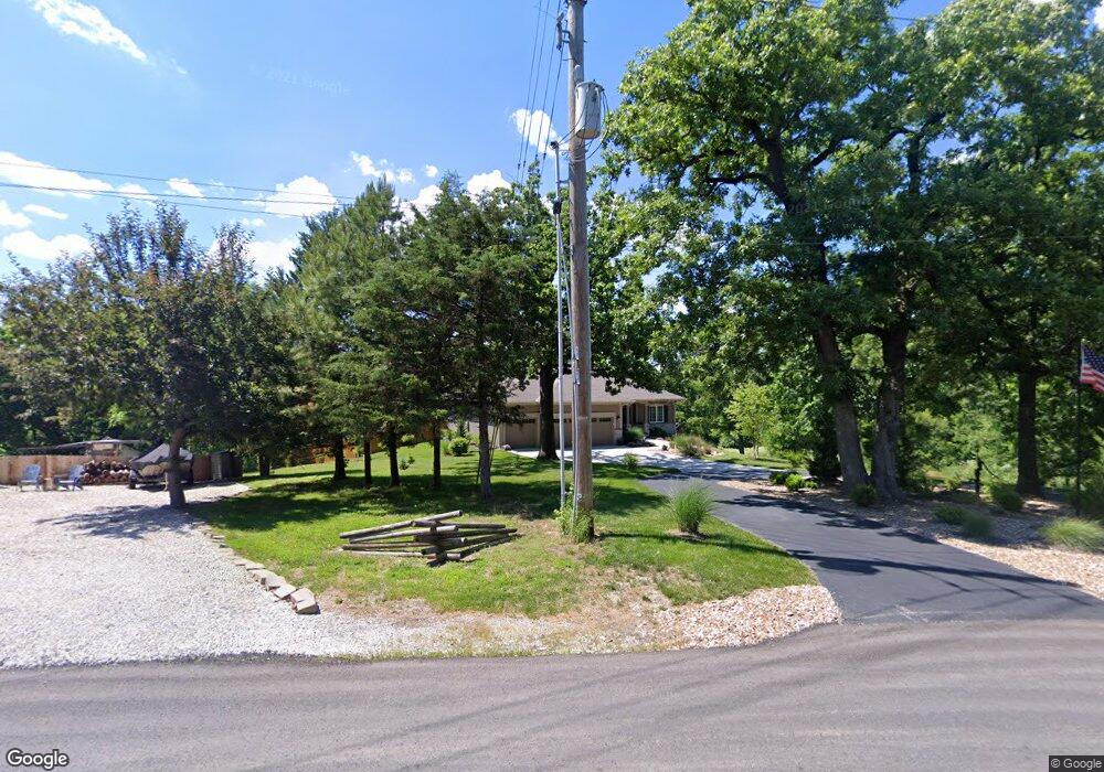
6260 Barker Rd Shawnee, KS 66218
Estimated Value: $489,000 - $652,909
3
Beds
2
Baths
1,719
Sq Ft
$325/Sq Ft
Est. Value
About This Home
This home is located at 6260 Barker Rd, Shawnee, KS 66218 and is currently estimated at $559,227, approximately $325 per square foot. 6260 Barker Rd is a home located in Johnson County with nearby schools including Horizon Elementary School, Monticello Trails Middle School, and Mill Valley High School.
Ownership History
Date
Name
Owned For
Owner Type
Purchase Details
Closed on
Mar 13, 2018
Sold by
Thompason Chad and Thompson Donna E
Bought by
Chris George Homes Llc
Current Estimated Value
Purchase Details
Closed on
Jan 31, 2018
Sold by
Thompson Linda L
Bought by
Thompson Chad and Thompson Donna E
Purchase Details
Closed on
Apr 20, 2015
Sold by
Painter Carl Franklin and Painter Inalie Kay
Bought by
Thompson Linda Louise
Home Financials for this Owner
Home Financials are based on the most recent Mortgage that was taken out on this home.
Original Mortgage
$68,000
Interest Rate
3.84%
Mortgage Type
Future Advance Clause Open End Mortgage
Create a Home Valuation Report for This Property
The Home Valuation Report is an in-depth analysis detailing your home's value as well as a comparison with similar homes in the area
Home Values in the Area
Average Home Value in this Area
Purchase History
| Date | Buyer | Sale Price | Title Company |
|---|---|---|---|
| Chris George Homes Llc | -- | None Available | |
| Thompson Chad | -- | None Available | |
| Thompson Linda Louise | -- | First American Title |
Source: Public Records
Mortgage History
| Date | Status | Borrower | Loan Amount |
|---|---|---|---|
| Previous Owner | Thompson Linda Louise | $68,000 |
Source: Public Records
Tax History Compared to Growth
Tax History
| Year | Tax Paid | Tax Assessment Tax Assessment Total Assessment is a certain percentage of the fair market value that is determined by local assessors to be the total taxable value of land and additions on the property. | Land | Improvement |
|---|---|---|---|---|
| 2024 | $6,647 | $57,006 | $15,952 | $41,054 |
| 2023 | $6,267 | $53,268 | $13,080 | $40,188 |
| 2022 | $5,504 | $45,850 | $11,907 | $33,943 |
| 2021 | $5,608 | $44,953 | $11,907 | $33,046 |
| 2020 | $5,535 | $44,540 | $15,254 | $29,286 |
| 2019 | $4,082 | $32,464 | $15,619 | $16,845 |
| 2018 | $2,091 | $16,298 | $16,298 | $0 |
| 2017 | $2,143 | $16,298 | $16,298 | $0 |
| 2016 | $1,861 | $13,985 | $13,985 | $0 |
| 2015 | $1,097 | $7,770 | $7,770 | $0 |
| 2013 | -- | $19,366 | $16,309 | $3,057 |
Source: Public Records
Map
Nearby Homes
- 19403 W 64th Terrace
- 31.24 Acres of Woodland Dr
- 58.14 acres Woodland Dr
- 46.13 Acres of Woodland Dr
- 6246 Woodland Dr
- 5810 Locust St
- 5750 Locust St
- 5817 Millbrook St
- 5833 Longview Rd
- 6805 Millbrook St
- 6046 Redbud St
- 6744 Longview Rd
- 20805 W 68th Terrace
- 6753 Longview Rd
- 6764 Longview Rd
- 6905 Longview Rd
- 21617 W 61st St
- 7312 Martindale St
- 7939 Noble St
- 7943 Noble St
- 6302 Barker Rd
- 6306 Barker Rd
- 6305 Barker Rd
- 6310 Barker Rd
- 19706 W 63rd Terrace
- 19343 W 63rd Terrace
- 19710 W 63rd Terrace
- 19707 W 63rd Terrace
- 19714 W 63rd Terrace
- 19339 W 63rd Terrace
- 6255 Barker Rd
- 6325 Stevenson St
- 19715 W 63rd Terrace
- 19718 W 63rd Terrace
- 0 Johnson & Woodland Dr Unit 1979073
- 6322 Stevenson St
- 6329 Stevenson St
- 6351 Walker St
- 19722 W 63rd Terrace
- 19335 W 63rd Terrace