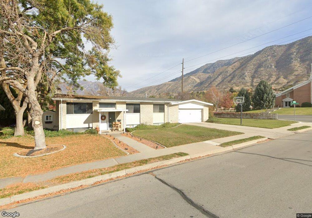
629 E 2875 N Provo, UT 84604
Rock Canyon NeighborhoodEstimated Value: $498,000 - $578,000
5
Beds
2
Baths
2,300
Sq Ft
$236/Sq Ft
Est. Value
About This Home
This home is located at 629 E 2875 N, Provo, UT 84604 and is currently estimated at $541,807, approximately $235 per square foot. 629 E 2875 N is a home located in Utah County with nearby schools including Rock Canyon Elementary School, Centennial Middle School, and Timpview High School.
Ownership History
Date
Name
Owned For
Owner Type
Purchase Details
Closed on
Dec 5, 2011
Sold by
Gibson Reed K and Gibson Lindsay M
Bought by
Gibson Reed K and Gibson Lindsay D
Current Estimated Value
Home Financials for this Owner
Home Financials are based on the most recent Mortgage that was taken out on this home.
Original Mortgage
$169,000
Outstanding Balance
$115,885
Interest Rate
4.06%
Mortgage Type
New Conventional
Estimated Equity
$425,922
Purchase Details
Closed on
Apr 7, 2005
Sold by
Washburn Jerry C
Bought by
Gibson Reed K and Gibson Lindsay M
Purchase Details
Closed on
Aug 19, 2004
Sold by
Ahlstrom Jeffrey L and Ahlstrom Lynn M
Bought by
Washburn Jerry C
Create a Home Valuation Report for This Property
The Home Valuation Report is an in-depth analysis detailing your home's value as well as a comparison with similar homes in the area
Home Values in the Area
Average Home Value in this Area
Purchase History
| Date | Buyer | Sale Price | Title Company |
|---|---|---|---|
| Gibson Reed K | -- | Keystone Title Insurance Age | |
| Gibson Reed K | -- | Pro Title & Escrow Inc | |
| Washburn Jerry C | $130,500 | -- |
Source: Public Records
Mortgage History
| Date | Status | Borrower | Loan Amount |
|---|---|---|---|
| Open | Gibson Reed K | $169,000 |
Source: Public Records
Tax History
| Year | Tax Paid | Tax Assessment Tax Assessment Total Assessment is a certain percentage of the fair market value that is determined by local assessors to be the total taxable value of land and additions on the property. | Land | Improvement |
|---|---|---|---|---|
| 2025 | $4,564 | $488,400 | $237,100 | $251,300 |
| 2024 | $4,564 | $449,300 | $0 | $0 |
| 2023 | $4,391 | $426,100 | $0 | $0 |
| 2022 | $4,986 | $487,900 | $240,800 | $247,100 |
| 2021 | $2,152 | $367,300 | $172,000 | $195,300 |
| 2020 | $2,093 | $334,800 | $143,300 | $191,500 |
| 2019 | $1,862 | $309,800 | $143,300 | $166,500 |
| 2018 | $1,644 | $277,400 | $132,600 | $144,800 |
| 2017 | $1,524 | $141,295 | $0 | $0 |
| 2016 | $1,425 | $123,145 | $0 | $0 |
| 2015 | $1,291 | $112,750 | $0 | $0 |
| 2014 | $1,177 | $107,140 | $0 | $0 |
Source: Public Records
Map
Nearby Homes
- 758 E 3030 N
- 2774 N 370 E
- 788 E 2680 N
- 3129 Cherokee Ln
- 3025 N 250 E
- 1108 E 2620 N
- 2735 N Country Club Dr
- 5600 N Canyon Rd
- 3250 Mohawk Ln
- 3013 N 100 W
- 3057 N 100 W
- 3221 Shadowbrook Cir
- 2999 N Marrcrest West Dr
- 2939 N Marrcrest Dr W
- 3305 N Shadowbrook Cir
- 111 Candlewood Place
- 3240 Shadowbrook Dr
- 240 E 2230 N Unit 7
- 2848 Foothill Dr
- 3711 N Canyon Rd
Your Personal Tour Guide
Ask me questions while you tour the home.