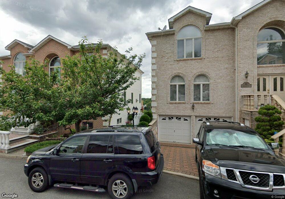
63 Nicole Loop Staten Island, NY 10301
Emerson Hill NeighborhoodEstimated Value: $1,159,264 - $1,667,000
Studio
4
Baths
2,800
Sq Ft
$531/Sq Ft
Est. Value
About This Home
This home is located at 63 Nicole Loop, Staten Island, NY 10301 and is currently estimated at $1,485,566, approximately $530 per square foot. 63 Nicole Loop is a home located in Richmond County with nearby schools including P.S. 48 - William C. Wilcox, I.S. 49 Berta A Dreyfus, and New Dorp High School.
Ownership History
Date
Name
Owned For
Owner Type
Purchase Details
Closed on
Oct 16, 2017
Sold by
Butala Gitaben A
Bought by
Butala Ankur and The Butala Preservation Trust
Current Estimated Value
Purchase Details
Closed on
Feb 22, 1999
Sold by
Silvergate At Emerson Llc
Bought by
Butala Gitaben A
Home Financials for this Owner
Home Financials are based on the most recent Mortgage that was taken out on this home.
Original Mortgage
$324,000
Interest Rate
7.02%
Mortgage Type
Purchase Money Mortgage
Create a Home Valuation Report for This Property
The Home Valuation Report is an in-depth analysis detailing your home's value as well as a comparison with similar homes in the area
Home Values in the Area
Average Home Value in this Area
Purchase History
| Date | Buyer | Sale Price | Title Company |
|---|---|---|---|
| Butala Ankur | -- | None Available | |
| Butala Gitaben A | $411,000 | -- |
Source: Public Records
Mortgage History
| Date | Status | Borrower | Loan Amount |
|---|---|---|---|
| Previous Owner | Butala Gitaben A | $324,000 |
Source: Public Records
Tax History
| Year | Tax Paid | Tax Assessment Tax Assessment Total Assessment is a certain percentage of the fair market value that is determined by local assessors to be the total taxable value of land and additions on the property. | Land | Improvement |
|---|---|---|---|---|
| 2025 | $14,085 | $74,280 | $13,808 | $60,472 |
| 2024 | $14,097 | $78,120 | $12,801 | $65,319 |
| 2023 | $13,420 | $67,480 | $13,091 | $54,389 |
| 2022 | $12,421 | $63,660 | $13,980 | $49,680 |
| 2021 | $13,061 | $66,300 | $13,980 | $52,320 |
| 2020 | $12,646 | $61,140 | $13,980 | $47,160 |
| 2019 | $12,846 | $64,380 | $13,980 | $50,400 |
| 2018 | $11,782 | $59,256 | $13,603 | $45,653 |
| 2017 | $11,135 | $56,095 | $11,475 | $44,620 |
| 2016 | $10,269 | $52,920 | $13,402 | $39,518 |
| 2015 | $9,740 | $52,920 | $10,391 | $42,529 |
| 2014 | $9,740 | $52,342 | $10,278 | $42,064 |
Source: Public Records
Map
Nearby Homes
- 55 Nicole Loop
- 16 Diana Trail
- 260 Douglas Rd
- 35 Milden Ave
- 74 Longfellow Ave
- 201 Milford Ave
- 79 Endor Ave
- 47 Longfellow Ave
- 174 Douglas Rd
- 27 Witteman Place
- 755 Narrows Rd N Unit 602
- 755 Narrows Rd N Unit 513A
- 755 Narrows Rd N Unit 305
- 197 Seneca Ave
- 1 Douglas Ct
- 25 Beebe St
- 86 Tioga St
- 830 Howard Ave Unit 4H
- 830 Howard Ave Unit 3H
- 1430 Clove Rd
- 59 Nicole Loop
- 67 Nicole Loop
- 66 Michael Loop
- 70 Michael Loop
- 62 Michael Loop
- 71 Nicole Loop
- 64 Nicole Loop
- 68 Nicole Loop
- 74 Michael Loop
- 75 Nicole Loop
- 72 Nicole Loop
- 58 Michael Loop
- 51 Nicole Loop
- 78 Michael Loop
- 30 Nicole Loop
- 34 Nicole Loop
- 76 Nicole Loop
- 65 Michael Loop
- 79 Nicole Loop
- 69 Michael Loop
Your Personal Tour Guide
Ask me questions while you tour the home.