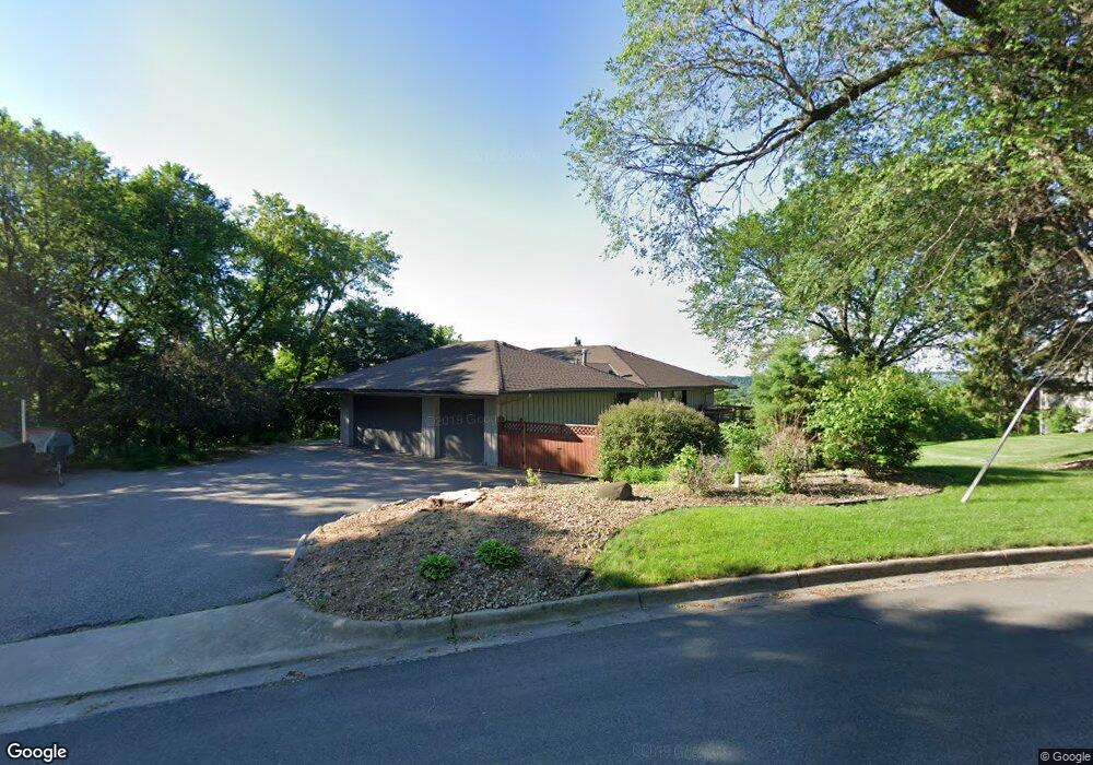
6301 Bluff Dr Bloomington, MN 55438
West Bloomington NeighborhoodEstimated Value: $782,000 - $893,000
4
Beds
4
Baths
3,778
Sq Ft
$221/Sq Ft
Est. Value
About This Home
This home is located at 6301 Bluff Dr, Bloomington, MN 55438 and is currently estimated at $833,406, approximately $220 per square foot. 6301 Bluff Dr is a home located in Hennepin County with nearby schools including Westwood Elementary School, Oak Grove Middle School, and Jefferson Senior High School.
Ownership History
Date
Name
Owned For
Owner Type
Purchase Details
Closed on
Oct 5, 2022
Sold by
David L Stark Individual Revocable Trust
Bought by
Xiaofang Angel Stark Intervivos Revocable Tru
Current Estimated Value
Purchase Details
Closed on
Nov 11, 2021
Sold by
Stark David L
Bought by
Stark David L and Stark David L
Purchase Details
Closed on
Jun 9, 2021
Sold by
Garborg Betty L and Garborg Kent R
Bought by
Stark David L
Home Financials for this Owner
Home Financials are based on the most recent Mortgage that was taken out on this home.
Original Mortgage
$548,250
Interest Rate
2.9%
Mortgage Type
New Conventional
Purchase Details
Closed on
Aug 31, 1998
Sold by
Wisdorf Bernard J
Bought by
Garborg Kent R and Garborg Betty L
Create a Home Valuation Report for This Property
The Home Valuation Report is an in-depth analysis detailing your home's value as well as a comparison with similar homes in the area
Home Values in the Area
Average Home Value in this Area
Purchase History
| Date | Buyer | Sale Price | Title Company |
|---|---|---|---|
| Xiaofang Angel Stark Intervivos Revocable Tru | $3,000 | -- | |
| Stark David L | -- | None Available | |
| Stark David L | $760,000 | Results Title | |
| Garborg Kent R | $340,000 | -- |
Source: Public Records
Mortgage History
| Date | Status | Borrower | Loan Amount |
|---|---|---|---|
| Previous Owner | Stark David L | $548,250 |
Source: Public Records
Tax History
| Year | Tax Paid | Tax Assessment Tax Assessment Total Assessment is a certain percentage of the fair market value that is determined by local assessors to be the total taxable value of land and additions on the property. | Land | Improvement |
|---|---|---|---|---|
| 2024 | $9,666 | $702,500 | $253,800 | $448,700 |
| 2023 | $9,535 | $741,600 | $289,600 | $452,000 |
| 2022 | $6,820 | $668,300 | $224,100 | $444,200 |
| 2021 | $6,300 | $526,700 | $209,800 | $316,900 |
| 2020 | $6,881 | $496,800 | $203,900 | $292,900 |
| 2019 | $6,310 | $522,700 | $215,500 | $307,200 |
| 2018 | $6,004 | $474,700 | $203,700 | $271,000 |
| 2017 | $5,869 | $432,100 | $204,900 | $227,200 |
| 2016 | $6,623 | $461,700 | $209,800 | $251,900 |
| 2015 | $6,357 | $425,700 | $204,400 | $221,300 |
| 2014 | -- | $398,600 | $190,000 | $208,600 |
Source: Public Records
Map
Nearby Homes
- 6100 Auto Club Rd Unit 211
- 6958 Kenmare Dr
- 11428 Zion Cir
- 11380 Louisiana Cir
- 7041 Kenmare Dr
- 11313 Xavier Rd
- 11208 Vessey Cir
- 11039 Oregon Cir Unit 60
- 7334 W 114th Street Cir
- 11115 Vessey Cir
- 11065 Oregon Curve
- 11137 Trail West Rd
- 10935 Oregon Ave S
- 11159 Sumter Ave S
- 11019 Stanley Rd
- 7525 W 110th St Unit 7
- 5100 W 110th St
- 7555 W 110th St
- 7229 Woodstock Curve Unit 6
- 5141 Balmoral Ln Unit 3
- 6311 Bluff Dr
- 6251 Auto Club Rd
- 6221 Auto Club Rd
- 6320 Bluff Dr
- 6211 Auto Club Rd
- 6401 Bluff Dr
- 6201 Auto Club Rd
- 6420 Bluff Dr
- 6131 Auto Club Rd
- 6411 Bluff Dr
- 6121 Auto Club Rd
- 6421 Bluff Dr
- 6431 Bluff Dr
- 6441 Auto Club Rd
- 6111 Auto Club Rd
- 6101 Auto Club Rd
- 6001 Auto Club Rd
- 6100 Auto Club Rd
- 6100 Auto Club Rd
- 6100 Auto Club Rd
Your Personal Tour Guide
Ask me questions while you tour the home.