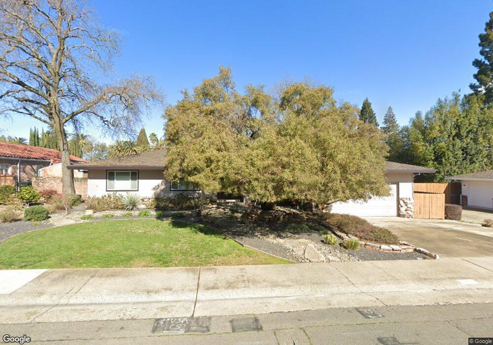
6313 Date Palm Way Carmichael, CA 95608
Carmichael Town Center NeighborhoodEstimated Value: $655,000 - $825,000
4
Beds
3
Baths
2,121
Sq Ft
$349/Sq Ft
Est. Value
About This Home
This home is located at 6313 Date Palm Way, Carmichael, CA 95608 and is currently estimated at $739,215, approximately $348 per square foot. 6313 Date Palm Way is a home located in Sacramento County with nearby schools including Mary Deterding Elementary School, John Barrett Middle School, and Del Campo High School.
Ownership History
Date
Name
Owned For
Owner Type
Purchase Details
Closed on
Jun 12, 2024
Sold by
Pearson-Brown Diane E
Bought by
Diane Pearson-Brown Revocable Trust and Pearson-Brown
Current Estimated Value
Purchase Details
Closed on
Jun 16, 1997
Sold by
Groeginger Leland B
Bought by
Brown Douglas E and Pearson Brown Diane E
Home Financials for this Owner
Home Financials are based on the most recent Mortgage that was taken out on this home.
Original Mortgage
$56,500
Interest Rate
7.94%
Mortgage Type
Seller Take Back
Create a Home Valuation Report for This Property
The Home Valuation Report is an in-depth analysis detailing your home's value as well as a comparison with similar homes in the area
Home Values in the Area
Average Home Value in this Area
Purchase History
We collect this data history from publicly available records. To have your information removed, we recommend requesting removal directly through your county’s website.
| Date | Buyer | Sale Price | Title Company |
|---|---|---|---|
| Diane Pearson-Brown Revocable Trust | -- | None Listed On Document | |
| Diane Pearson-Brown Revocable Trust | -- | None Listed On Document | |
| Brown Douglas E | $211,500 | Sacramento Title Company |
Source: Public Records
Mortgage History
We collect this data history from publicly available records. To have your information removed, we recommend requesting removal directly through your county’s website.
| Date | Status | Borrower | Loan Amount |
|---|---|---|---|
| Previous Owner | Brown Douglas E | $56,500 |
Source: Public Records
Tax History
| Year | Tax Paid | Tax Assessment Tax Assessment Total Assessment is a certain percentage of the fair market value that is determined by local assessors to be the total taxable value of land and additions on the property. | Land | Improvement |
|---|---|---|---|---|
| 2025 | $4,001 | $344,444 | $146,570 | $197,874 |
| 2024 | $4,001 | $337,692 | $143,697 | $193,995 |
| 2023 | $3,936 | $331,072 | $140,880 | $190,192 |
| 2022 | $3,856 | $324,581 | $138,118 | $186,463 |
| 2021 | $3,790 | $318,217 | $135,410 | $182,807 |
| 2020 | $3,719 | $314,955 | $134,022 | $180,933 |
| 2019 | $3,642 | $308,781 | $131,395 | $177,386 |
| 2018 | $3,595 | $302,727 | $128,819 | $173,908 |
| 2017 | $3,562 | $296,793 | $126,294 | $170,499 |
| 2016 | $3,325 | $290,974 | $123,818 | $167,156 |
| 2015 | $3,312 | $286,605 | $121,959 | $164,646 |
| 2014 | $3,243 | $280,991 | $119,570 | $161,421 |
Source: Public Records
Map
Nearby Homes
- 6401 Orange Hill Ln
- 2965 Marco Way
- 2804 California Ave
- 6201 Eastmont Ct
- 6120 Friendly Ct
- 3252 Panama Ave
- 6200 Mahala Dr
- 3244 Panama Ave
- 6512 Landis Ave
- 6516 Landis Ave
- 2818 Clark Ave
- 2300 California Ave
- 6042 Landis Ave
- 51 Covered Bridge Rd
- 6533 Landis Ave
- 3125 Colorado St
- 6049 Landis Ave
- 35 River Bluff Ln
- 80 Riverknoll Place
- 26 River Bluff Ln
- 6312 Date Palm Way
- 6306 Date Palm Way
- 2815 Hoffman Bluff Way
- 2746 Royal Palm Way
- 2801 Hoffman Bluff Way
- 2802 Royal Palm Way
- 6300 Date Palm Way
- 6321 Date Palm Way
- 2808 Royal Palm Way
- 2842 Royal Palm Way
- 2806 Hoffman Bluff Way
- 2747 Royal Palm Way
- 6326 Palm Dr
- 6316 Palm Dr
- 2803 Royal Palm Way
- 2800 Hoffman Bluff Way
- 2741 Royal Palm Way
- 2816 Hoffman Bluff Way
- 6330 Palm Dr
- 6329 Date Palm Way
Your Personal Tour Guide
Ask me questions while you tour the home.