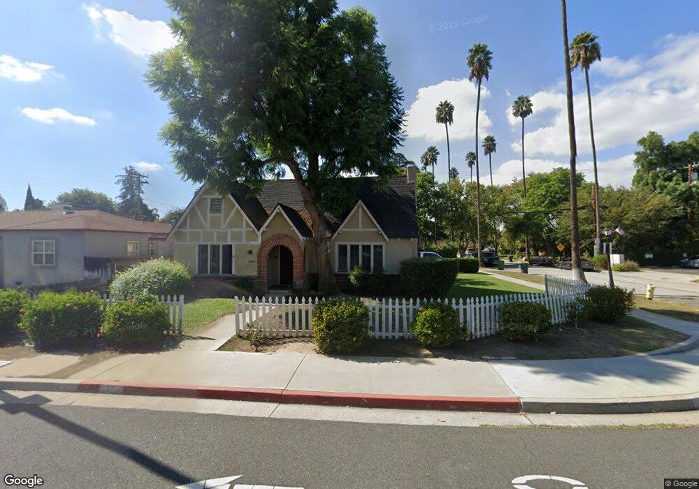
6361 Brockton Ave Riverside, CA 92506
Magnolia Center NeighborhoodEstimated Value: $611,000 - $678,000
4
Beds
2
Baths
1,636
Sq Ft
$385/Sq Ft
Est. Value
About This Home
This home is located at 6361 Brockton Ave, Riverside, CA 92506 and is currently estimated at $629,622, approximately $384 per square foot. 6361 Brockton Ave is a home located in Riverside County with nearby schools including Pachappa Elementary School, Sierra Middle School, and Ramona High School.
Ownership History
Date
Name
Owned For
Owner Type
Purchase Details
Closed on
May 7, 2019
Sold by
Celse Craig M
Bought by
Shipley Denise
Current Estimated Value
Home Financials for this Owner
Home Financials are based on the most recent Mortgage that was taken out on this home.
Original Mortgage
$196,000
Interest Rate
3.7%
Mortgage Type
New Conventional
Purchase Details
Closed on
Apr 11, 2019
Sold by
Mission Counties Development Llc
Bought by
Shipley Denise
Home Financials for this Owner
Home Financials are based on the most recent Mortgage that was taken out on this home.
Original Mortgage
$196,000
Interest Rate
3.7%
Mortgage Type
New Conventional
Purchase Details
Closed on
May 1, 2008
Sold by
Starnes Winifred
Bought by
Mission Counties Development Llc
Create a Home Valuation Report for This Property
The Home Valuation Report is an in-depth analysis detailing your home's value as well as a comparison with similar homes in the area
Home Values in the Area
Average Home Value in this Area
Purchase History
| Date | Buyer | Sale Price | Title Company |
|---|---|---|---|
| Shipley Denise | -- | Lawyers Title Company | |
| Shipley Denise | -- | None Available | |
| Mission Counties Development Llc | $185,000 | Commonwealth Land Title Co |
Source: Public Records
Mortgage History
| Date | Status | Borrower | Loan Amount |
|---|---|---|---|
| Previous Owner | Shipley Denise | $196,000 |
Source: Public Records
Tax History
| Year | Tax Paid | Tax Assessment Tax Assessment Total Assessment is a certain percentage of the fair market value that is determined by local assessors to be the total taxable value of land and additions on the property. | Land | Improvement |
|---|---|---|---|---|
| 2025 | $2,997 | $273,192 | $98,504 | $174,688 |
| 2023 | $2,997 | $262,585 | $94,680 | $167,905 |
| 2022 | $2,930 | $257,437 | $92,824 | $164,613 |
| 2021 | $2,900 | $252,390 | $91,004 | $161,386 |
| 2020 | $2,878 | $249,803 | $90,071 | $159,732 |
| 2019 | $2,824 | $244,905 | $88,305 | $156,600 |
| 2018 | $2,770 | $240,104 | $86,574 | $153,530 |
| 2017 | $2,721 | $235,397 | $84,877 | $150,520 |
| 2016 | $2,549 | $230,782 | $83,213 | $147,569 |
| 2015 | $2,512 | $227,317 | $81,964 | $145,353 |
| 2014 | $2,489 | $222,865 | $80,359 | $142,506 |
Source: Public Records
Map
Nearby Homes
- 6490 Palm Ave
- 4538 Merrill Ave
- 4545 Sunnyside Dr
- 3595 Timothy Way
- 4693 Central Ave
- 4660 Cover St
- 6044 Elenor St
- 6034 Elenor St
- 6735 De Anza Ave
- 6014 Elenor St
- 4061 Maplewood Place
- 6762 Rainier Ct
- 3678 Jurupa Ave
- 6795 Glacier Dr
- 6240 Wiehe Ave
- 4423 Maplewood Place
- 3495 Mono Dr
- 6964 Yellowstone Dr
- 6979 Palm Ct Unit 126
- 6979 Palm Ct
- 4148 Merrill Ave
- 6383 Brockton Ave
- 4170 Merrill Ave
- 4141 Beatty Dr
- 6329 Brockton Ave
- 4163 Merrill Ave
- 6395 Brockton Ave
- 4190 Merrill Ave
- 6346 Brockton Ave
- 4169 Beatty Dr
- 6338 Brockton Ave
- 6332 Brockton Ave Unit 6330
- 6332 Brockton Ave Unit 2
- 6332 Brockton Ave
- 4210 Merrill Ave
- 4191 Merrill Ave
- 6370 Brockton Ave
- 6317 Brockton Ave
- 4187 Beatty Dr
- 4036 Merrill Ave
Your Personal Tour Guide
Ask me questions while you tour the home.