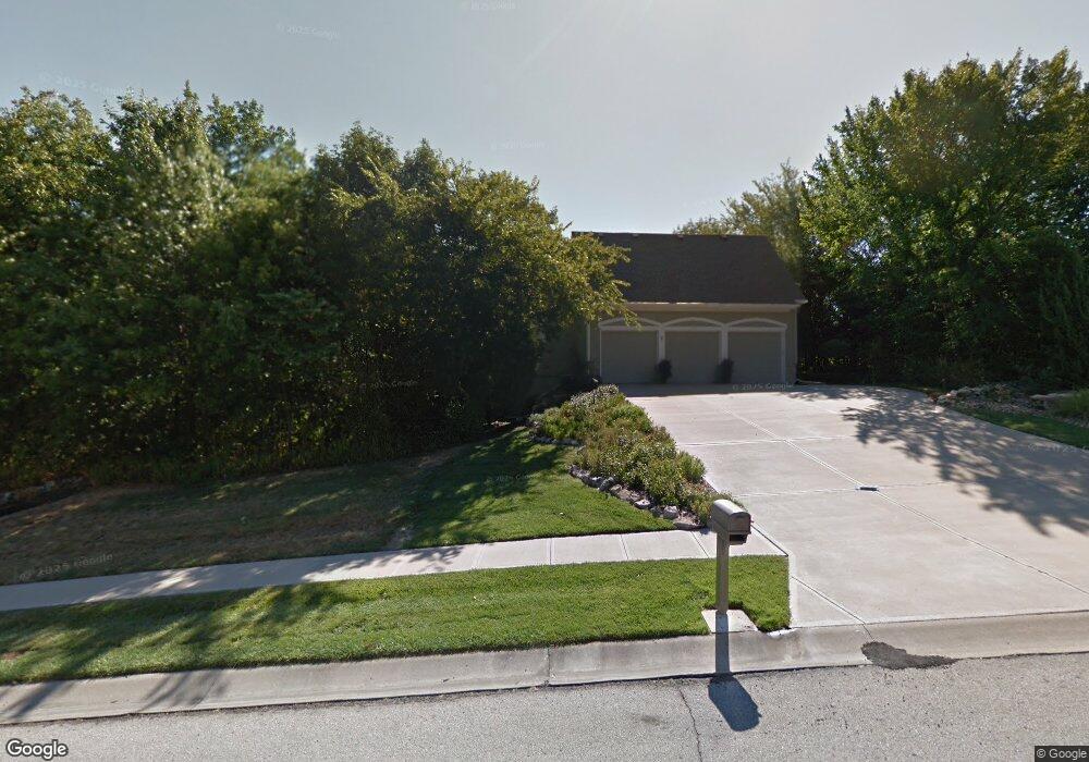
6361 Warwick St Shawnee, KS 66218
Estimated Value: $701,000 - $911,000
3
Beds
5
Baths
2,448
Sq Ft
$309/Sq Ft
Est. Value
About This Home
This home is located at 6361 Warwick St, Shawnee, KS 66218 and is currently estimated at $755,357, approximately $308 per square foot. 6361 Warwick St is a home located in Johnson County with nearby schools including Horizon Elementary School, Monticello Trails Middle School, and Mill Valley High School.
Ownership History
Date
Name
Owned For
Owner Type
Purchase Details
Closed on
Mar 23, 2011
Sold by
Stewart Lillian K and Stewart Daniel C
Bought by
Stewart Daniel C and Stewart Lillian K
Current Estimated Value
Home Financials for this Owner
Home Financials are based on the most recent Mortgage that was taken out on this home.
Original Mortgage
$385,000
Interest Rate
4.35%
Mortgage Type
New Conventional
Purchase Details
Closed on
Jan 24, 2002
Sold by
Stewart Daniel C and Stewart Lillian K
Bought by
Stewart Lillian K
Create a Home Valuation Report for This Property
The Home Valuation Report is an in-depth analysis detailing your home's value as well as a comparison with similar homes in the area
Home Values in the Area
Average Home Value in this Area
Purchase History
| Date | Buyer | Sale Price | Title Company |
|---|---|---|---|
| Stewart Daniel C | -- | Nations Title Agency Ks Inc | |
| Stewart Lillian K | -- | -- |
Source: Public Records
Mortgage History
| Date | Status | Borrower | Loan Amount |
|---|---|---|---|
| Closed | Stewart Daniel C | $385,000 |
Source: Public Records
Tax History Compared to Growth
Tax History
| Year | Tax Paid | Tax Assessment Tax Assessment Total Assessment is a certain percentage of the fair market value that is determined by local assessors to be the total taxable value of land and additions on the property. | Land | Improvement |
|---|---|---|---|---|
| 2024 | $9,354 | $79,879 | $15,497 | $64,382 |
| 2023 | $9,239 | $78,430 | $12,910 | $65,520 |
| 2022 | $9,184 | $76,395 | $12,910 | $63,485 |
| 2021 | $8,543 | $68,586 | $12,910 | $55,676 |
| 2020 | $8,656 | $68,874 | $12,910 | $55,964 |
| 2019 | $7,948 | $62,307 | $11,232 | $51,075 |
| 2018 | $7,939 | $61,686 | $11,108 | $50,578 |
| 2017 | $7,879 | $59,731 | $11,108 | $48,623 |
| 2016 | $7,754 | $58,064 | $11,108 | $46,956 |
| 2015 | $7,680 | $56,304 | $11,109 | $45,195 |
| 2013 | -- | $54,694 | $11,109 | $43,585 |
Source: Public Records
Map
Nearby Homes
- 19403 W 64th Terrace
- 5810 Locust St
- 5750 Locust St
- 17730 W 68th Terrace
- 31.24 Acres of Woodland Dr
- 58.14 acres Woodland Dr
- 46.13 Acres of Woodland Dr
- 6246 Woodland Dr
- 6805 Millbrook St
- 5817 Millbrook St
- 20805 W 68th Terrace
- 6040 Renner Rd
- 6744 Longview Rd
- 5833 Longview Rd
- 6753 Longview Rd
- 6764 Longview Rd
- 6046 Redbud St
- 6905 Longview Rd
- 7312 Martindale St
- 7939 Noble St
- 18714 W 64th St
- 18804 W 64th St
- 18721 W 64th St
- 18717 W 64th St
- 6356 Warwick St
- 6353 Warwick St
- 6352 Warwick St
- 6402 Hillside St
- 18702 W 64th St
- 6405 Warwick St
- 6359 Locust St
- 6410 Hillside St
- 6355 Locust St
- 6406 Warwick St
- 18907 W 64th St
- 18615 W 64th St
- 6420 Hillside St
- 18610 W 64th St
- 6409 Warwick St
- 6416 Hillside St