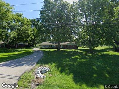
6365 Mcfarland Rd Indianapolis, IN 46227
Estimated Value: $267,000 - $294,000
4
Beds
3
Baths
2,196
Sq Ft
$127/Sq Ft
Est. Value
About This Home
This home is located at 6365 Mcfarland Rd, Indianapolis, IN 46227 and is currently estimated at $277,838, approximately $126 per square foot. 6365 Mcfarland Rd is a home located in Marion County with nearby schools including Southport Elementary School, Southport 6th Grade Academy, and Southport Middle School.
Ownership History
Date
Name
Owned For
Owner Type
Purchase Details
Closed on
Sep 12, 2017
Sold by
Patricia D
Bought by
Kevin Kevin P and Kevin Sr
Current Estimated Value
Home Financials for this Owner
Home Financials are based on the most recent Mortgage that was taken out on this home.
Original Mortgage
$148,980
Interest Rate
3.89%
Mortgage Type
VA
Purchase Details
Closed on
Aug 25, 2006
Sold by
Worley David L and Worley Beatrice M
Bought by
Mangus Paul C and Mangus Patricia D
Home Financials for this Owner
Home Financials are based on the most recent Mortgage that was taken out on this home.
Original Mortgage
$118,000
Interest Rate
6.7%
Mortgage Type
New Conventional
Create a Home Valuation Report for This Property
The Home Valuation Report is an in-depth analysis detailing your home's value as well as a comparison with similar homes in the area
Home Values in the Area
Average Home Value in this Area
Purchase History
| Date | Buyer | Sale Price | Title Company |
|---|---|---|---|
| Kevin Kevin P | $147,000 | -- | |
| Mangus Kevin P | $147,000 | Meridian Title Corporation | |
| Mangus Kevin P | $147,000 | Meridian Title Corporation | |
| Mangus Paul C | -- | None Available |
Source: Public Records
Mortgage History
| Date | Status | Borrower | Loan Amount |
|---|---|---|---|
| Open | Mangus Kevin P | $145,071 | |
| Closed | Mangus Kevin P | $148,980 | |
| Previous Owner | Mangus Paul C | $118,000 | |
| Previous Owner | Gemberling Elizabeth May | $29,500 |
Source: Public Records
Tax History Compared to Growth
Tax History
| Year | Tax Paid | Tax Assessment Tax Assessment Total Assessment is a certain percentage of the fair market value that is determined by local assessors to be the total taxable value of land and additions on the property. | Land | Improvement |
|---|---|---|---|---|
| 2024 | $2,864 | $214,100 | $35,500 | $178,600 |
| 2023 | $2,864 | $214,100 | $35,500 | $178,600 |
| 2022 | $2,689 | $197,600 | $35,500 | $162,100 |
| 2021 | $2,496 | $181,400 | $35,500 | $145,900 |
| 2020 | $2,287 | $165,800 | $35,500 | $130,300 |
| 2019 | $2,202 | $159,200 | $24,300 | $134,900 |
| 2018 | $2,016 | $147,600 | $24,300 | $123,300 |
| 2017 | $2,073 | $151,800 | $24,300 | $127,500 |
| 2016 | $1,927 | $141,500 | $24,300 | $117,200 |
| 2014 | $1,600 | $136,700 | $24,300 | $112,400 |
| 2013 | $3,312 | $136,700 | $24,300 | $112,400 |
Source: Public Records
Map
Nearby Homes
- 3303 Busy Bee Ln
- 6107 Rural Dr
- 5945 Mcfarland Rd
- 3136 E Edgewood Ave
- 2315 Cardinal Dr
- 3538 Whalen Ave
- 7108 Hearthstone Way
- 6471 Homestead Dr
- 3702 Candy Cane Dr
- 4316 Moss Ridge Cir
- 106 Walnut St
- 120 Walnut St
- 1942 E Edgewood Ave
- 3125 Anniston Dr
- 1709 E Loretta Dr
- 5420 Mcfarland Rd
- 700 E Werges Ave
- 7322 S Sherman Dr
- 7421 Broadview Ln
- 6628 Moss Cir
- 6365 Mcfarland Rd
- 6355 Mcfarland Rd
- 3010 E Banta Rd
- 6362 Marburn Dr
- 3030 E Banta Rd
- 6345 Mcfarland Rd
- 6352 Marburn Dr
- 6342 Marburn Dr
- 2974 E Banta Rd
- 6344 Mcfarland Rd
- 6329 Mcfarland Rd
- 6410 Mcfarland Rd
- 6424 Mcfarland Rd
- 6505 Mcfarland Rd
- 3101 E Banta Rd
- 6330 Mcfarland Rd
- 6332 Marburn Dr
- 6509 Mcfarland Rd
- 2950 E Banta Rd
- 6322 Mcfarland Rd