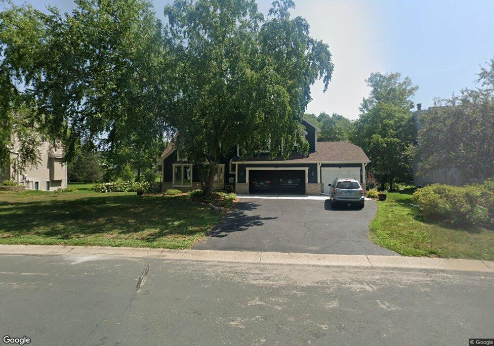
637 Hackmore Dr Saint Paul, MN 55123
Estimated Value: $515,732 - $630,000
4
Beds
3
Baths
2,208
Sq Ft
$257/Sq Ft
Est. Value
About This Home
This home is located at 637 Hackmore Dr, Saint Paul, MN 55123 and is currently estimated at $566,683, approximately $256 per square foot. 637 Hackmore Dr is a home located in Dakota County with nearby schools including Pinewood Elementary School, Dakota Hills Middle School, and Eagan Senior High School.
Ownership History
Date
Name
Owned For
Owner Type
Purchase Details
Closed on
Jan 31, 2019
Sold by
Bolke Jeanne M and Bolke Mark R
Bought by
Tuerk Michael and Runquist Hannah
Current Estimated Value
Home Financials for this Owner
Home Financials are based on the most recent Mortgage that was taken out on this home.
Original Mortgage
$303,360
Interest Rate
4.4%
Mortgage Type
New Conventional
Create a Home Valuation Report for This Property
The Home Valuation Report is an in-depth analysis detailing your home's value as well as a comparison with similar homes in the area
Home Values in the Area
Average Home Value in this Area
Purchase History
| Date | Buyer | Sale Price | Title Company |
|---|---|---|---|
| Tuerk Michael | $379,200 | Liberty Title Inc |
Source: Public Records
Mortgage History
| Date | Status | Borrower | Loan Amount |
|---|---|---|---|
| Previous Owner | Tuerk Michael | $303,360 |
Source: Public Records
Tax History
| Year | Tax Paid | Tax Assessment Tax Assessment Total Assessment is a certain percentage of the fair market value that is determined by local assessors to be the total taxable value of land and additions on the property. | Land | Improvement |
|---|---|---|---|---|
| 2024 | $5,002 | $462,900 | $117,400 | $345,500 |
| 2023 | $5,002 | $460,500 | $117,800 | $342,700 |
| 2022 | $4,308 | $452,500 | $117,500 | $335,000 |
| 2021 | $4,370 | $385,100 | $102,100 | $283,000 |
| 2020 | $4,318 | $381,200 | $97,300 | $283,900 |
| 2019 | $3,863 | $367,600 | $89,700 | $277,900 |
| 2018 | $3,724 | $343,500 | $85,500 | $258,000 |
| 2017 | $4,025 | $320,300 | $81,400 | $238,900 |
| 2016 | $3,985 | $317,400 | $77,500 | $239,900 |
| 2015 | $3,670 | $308,944 | $75,388 | $233,556 |
| 2014 | -- | $287,362 | $72,757 | $214,605 |
| 2013 | -- | $259,131 | $65,188 | $193,943 |
Source: Public Records
Map
Nearby Homes
- 578 Prairie Cir E
- 4136 Prairie Ridge Rd
- 752 Summerbrooke Cir
- 4222 Yorktown Dr
- 4133 Countryview Dr
- 648 Welland Ct
- 4105 Countryview Dr
- 4639 Manor Dr
- 4001 Haven Woods Ct
- 3998 Haven Woods Ct
- 625 McFaddens Trail
- 4190 Braddock Trail
- 4401 Braddock Trail
- 10445 Akron Ave
- 10064 Adam Ave
- 935 Lakewood Hills Rd
- 617 Remington Ct
- 925 Cliff Rd
- 11125 Alameda Ave
- 4832 Avery Ct
- 641 Hackmore Dr
- 633 Hackmore Dr
- 4333 Dorchester Ct
- 4337 Dorchester Ct
- 629 Hackmore Dr
- 636 Hackmore Dr
- 645 Hackmore Dr
- 4329 Dorchester Ct
- 644 Hackmore Dr
- 632 Hackmore Dr
- 625 Hackmore Dr
- 4341 Dorchester Ct
- 649 Hackmore Dr
- 619 Crimson Leaf Ct
- 4325 Dorchester Ct
- 588 Hawthorne Woods Dr
- 621 Hackmore Dr
- 615 Crimson Leaf Ct
- 4340 Dorchester Ct
- 4345 Dorchester Ct
Your Personal Tour Guide
Ask me questions while you tour the home.