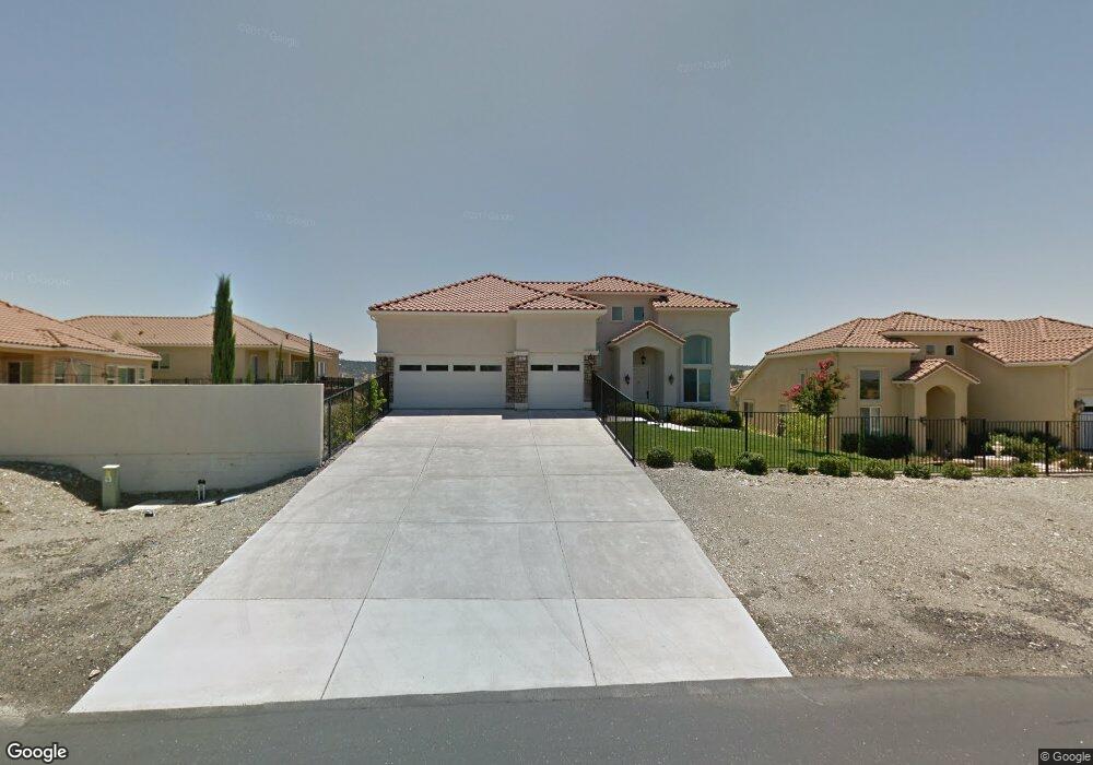
6371 Conner Estates Dr Copperopolis, CA 95228
Estimated Value: $625,000 - $850,000
4
Beds
4
Baths
3,043
Sq Ft
$238/Sq Ft
Est. Value
About This Home
This home is located at 6371 Conner Estates Dr, Copperopolis, CA 95228 and is currently estimated at $722,808, approximately $237 per square foot. 6371 Conner Estates Dr is a home located in Calaveras County with nearby schools including Bret Harte Union High School.
Ownership History
Date
Name
Owned For
Owner Type
Purchase Details
Closed on
May 13, 2020
Sold by
Delisle Frank
Bought by
Delisle Frank Roger and Delisle Barbara Ann
Current Estimated Value
Purchase Details
Closed on
Mar 29, 2006
Sold by
Delisle Barbara
Bought by
Delisle Frank
Home Financials for this Owner
Home Financials are based on the most recent Mortgage that was taken out on this home.
Original Mortgage
$130,108
Interest Rate
6.2%
Mortgage Type
Stand Alone Second
Purchase Details
Closed on
Mar 21, 2006
Sold by
Marina Ridge Llc
Bought by
Delisle Frank
Home Financials for this Owner
Home Financials are based on the most recent Mortgage that was taken out on this home.
Original Mortgage
$130,108
Interest Rate
6.2%
Mortgage Type
Stand Alone Second
Purchase Details
Closed on
Dec 6, 2005
Sold by
Marina Ridge Llc
Bought by
Herzing Adam
Create a Home Valuation Report for This Property
The Home Valuation Report is an in-depth analysis detailing your home's value as well as a comparison with similar homes in the area
Home Values in the Area
Average Home Value in this Area
Purchase History
| Date | Buyer | Sale Price | Title Company |
|---|---|---|---|
| Delisle Frank Roger | -- | None Available | |
| Delisle Frank | -- | Calaveras Title Company | |
| Delisle Frank | $651,000 | Calaveras Title Company | |
| Herzing Adam | $502,500 | Calaveras Title Company |
Source: Public Records
Mortgage History
| Date | Status | Borrower | Loan Amount |
|---|---|---|---|
| Previous Owner | Delisle Frank | $130,108 | |
| Previous Owner | Delisle Frank | $520,432 |
Source: Public Records
Tax History
| Year | Tax Paid | Tax Assessment Tax Assessment Total Assessment is a certain percentage of the fair market value that is determined by local assessors to be the total taxable value of land and additions on the property. | Land | Improvement |
|---|---|---|---|---|
| 2025 | $8,347 | $746,000 | $60,000 | $686,000 |
| 2023 | $7,572 | $669,000 | $60,000 | $609,000 |
| 2022 | $6,521 | $578,000 | $50,000 | $528,000 |
| 2021 | $5,537 | $487,000 | $50,000 | $437,000 |
| 2020 | $4,881 | $426,000 | $50,000 | $376,000 |
| 2019 | $4,906 | $426,000 | $50,000 | $376,000 |
| 2018 | $4,903 | $426,000 | $50,000 | $376,000 |
| 2017 | $4,552 | $396,000 | $50,000 | $346,000 |
| 2016 | $4,618 | $396,000 | $50,000 | $346,000 |
| 2015 | $4,629 | $396,000 | $50,000 | $346,000 |
| 2014 | -- | $396,000 | $40,000 | $356,000 |
Source: Public Records
Map
Nearby Homes
- 6311 Conner Estates Dr
- 121 Athena Dr
- 33 Aurora Ln
- 78 Aphrodite Ct
- 66 Argonaut Dr
- 1046 Shoreline Dr
- 21 Poseidon Way
- 1057 Shoreline Dr
- 450 Lakeview Rd
- 257 Thomson Ln
- 6250 Bluff View Rd
- 6286 Ricky Rd
- 65 Poker Flat Rd
- 359 Thomson Ln
- 5105 Lakeshore Dr
- 466 Thomson Ln
- 464 Thomson Ln
- 6256 Ricky Rd
- 3 Paseo Delago
- 5 Paseo Delago
- 6389 Conner Estates Dr
- 5 Aphrodite Ct
- 11 Aphrodite Ct
- 167 Athena Dr
- 6403 Conner Estates Dr Unit 56
- 21 Aphrodite Ct
- 175 Athena Dr
- 6 Ambrosia Ct
- 161 Athena Dr
- 175 Hilltop Estates Dr
- 33 Aphrodite Ct
- 18 Aphrodite Ct Unit 73
- 18 Aphrodite Ct
- 0 Conner Estates Dr
- 20 Ambrosia Ct
- 185 Athena Dr
- 36 Aphrodite Ct
- 47 Aphrodite Ct
- 25 Ambrosia Ct
- 7 Aurora Ln
Your Personal Tour Guide
Ask me questions while you tour the home.