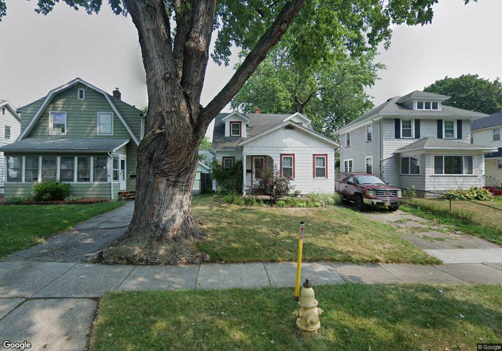
64 Maynard St Rochester, NY 14615
Estimated Value: $134,000 - $192,000
3
Beds
1
Bath
1,092
Sq Ft
$146/Sq Ft
Est. Value
About This Home
This home is located at 64 Maynard St, Rochester, NY 14615 and is currently estimated at $159,595, approximately $146 per square foot. 64 Maynard St is a home located in Monroe County with nearby schools including Virgil Grissom School No. 7, Dr. Louis A. Cerulli School No. 34, and John Williams School No. 5.
Ownership History
Date
Name
Owned For
Owner Type
Purchase Details
Closed on
Jul 21, 1997
Current Estimated Value
Create a Home Valuation Report for This Property
The Home Valuation Report is an in-depth analysis detailing your home's value as well as a comparison with similar homes in the area
Home Values in the Area
Average Home Value in this Area
Purchase History
| Date | Buyer | Sale Price | Title Company |
|---|---|---|---|
| -- | $56,000 | -- |
Source: Public Records
Tax History
| Year | Tax Paid | Tax Assessment Tax Assessment Total Assessment is a certain percentage of the fair market value that is determined by local assessors to be the total taxable value of land and additions on the property. | Land | Improvement |
|---|---|---|---|---|
| 2024 | $1,022 | $110,600 | $3,300 | $107,300 |
| 2023 | $846 | $66,500 | $4,000 | $62,500 |
| 2022 | $860 | $66,500 | $4,000 | $62,500 |
| 2021 | $899 | $66,500 | $4,000 | $62,500 |
| 2020 | $830 | $66,500 | $4,000 | $62,500 |
| 2019 | $790 | $58,000 | $4,000 | $54,000 |
| 2018 | $1,341 | $58,000 | $4,000 | $54,000 |
| 2017 | $2,221 | $58,000 | $4,000 | $54,000 |
| 2016 | $790 | $58,000 | $4,000 | $54,000 |
| 2015 | -- | $58,000 | $4,000 | $54,000 |
| 2014 | -- | $58,000 | $4,000 | $54,000 |
Source: Public Records
Map
Nearby Homes
- 46 Maynard St
- 41 Maynard St
- 19 Mac Arthur Rd
- 153 Carlisle St
- 219 Carlisle St
- 216 Mac Arthur Rd
- 87 Christian Ave
- 16 Devitt Rd
- 63 Dorothy Ave
- 84 Mayflower St
- 40 Chad Cir
- 57 Ross St
- 8 Velox St
- 394 Knickerbocker Ave
- 208 Mount Ridge Cir
- 147 Perinton St
- 297 Knickerbocker Ave
- 62 Ayer St
- 258 Avis St
- 968 Ridgeway Ave
Your Personal Tour Guide
Ask me questions while you tour the home.