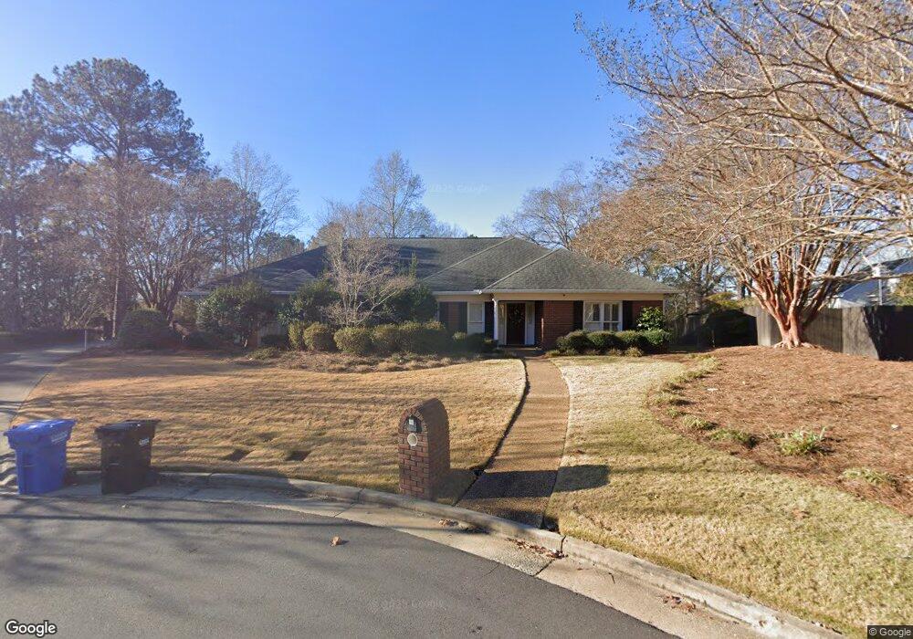
6405 Spring Water Dr Columbus, GA 31904
North Columbus NeighborhoodEstimated Value: $412,000 - $459,000
4
Beds
4
Baths
3,203
Sq Ft
$138/Sq Ft
Est. Value
About This Home
This home is located at 6405 Spring Water Dr, Columbus, GA 31904 and is currently estimated at $443,367, approximately $138 per square foot. 6405 Spring Water Dr is a home located in Muscogee County with nearby schools including River Road Elementary School, Double Churches Middle School, and Northside High School.
Ownership History
Date
Name
Owned For
Owner Type
Purchase Details
Closed on
Mar 10, 2014
Sold by
Sewell Leslie P
Bought by
Attaway Leslie P and Attaway Frank
Current Estimated Value
Home Financials for this Owner
Home Financials are based on the most recent Mortgage that was taken out on this home.
Original Mortgage
$150,000
Outstanding Balance
$42,200
Interest Rate
3.44%
Mortgage Type
New Conventional
Estimated Equity
$401,167
Create a Home Valuation Report for This Property
The Home Valuation Report is an in-depth analysis detailing your home's value as well as a comparison with similar homes in the area
Home Values in the Area
Average Home Value in this Area
Purchase History
| Date | Buyer | Sale Price | Title Company |
|---|---|---|---|
| Attaway Leslie P | -- | -- |
Source: Public Records
Mortgage History
| Date | Status | Borrower | Loan Amount |
|---|---|---|---|
| Open | Attaway Leslie P | $150,000 |
Source: Public Records
Tax History Compared to Growth
Tax History
| Year | Tax Paid | Tax Assessment Tax Assessment Total Assessment is a certain percentage of the fair market value that is determined by local assessors to be the total taxable value of land and additions on the property. | Land | Improvement |
|---|---|---|---|---|
| 2025 | $2,743 | $165,608 | $27,020 | $138,588 |
| 2024 | $2,742 | $165,608 | $27,020 | $138,588 |
| 2023 | $2,065 | $165,608 | $27,020 | $138,588 |
| 2022 | $2,859 | $126,672 | $27,020 | $99,652 |
| 2021 | $2,852 | $131,772 | $27,020 | $104,752 |
| 2020 | $2,853 | $131,772 | $27,020 | $104,752 |
| 2019 | $2,864 | $131,772 | $27,020 | $104,752 |
| 2018 | $2,864 | $131,772 | $27,020 | $104,752 |
| 2017 | $2,875 | $131,772 | $27,020 | $104,752 |
| 2016 | $2,887 | $92,889 | $12,560 | $80,329 |
| 2015 | $2,891 | $92,889 | $12,560 | $80,329 |
| 2014 | $2,896 | $92,889 | $12,560 | $80,329 |
| 2013 | -- | $92,889 | $12,560 | $80,329 |
Source: Public Records
Map
Nearby Homes
- 6390 Cape Cod Dr
- 6333 Cape Cod Dr
- 5 Bridgecreek Ct
- 16 Kylemore Ct
- 6130 Brookstone Blvd
- 6130 Bristol Blvd
- 235 Pebblebrook Ln
- 7233 Mobley Walk Dr
- 5908 Brookstone Blvd
- 616 Newport Place
- 6101 River Rd Unit 2
- 280 Zachary Ct
- 7015 Spring Walk Dr
- 7044 Spring Walk Dr
- 6969 Mobley Rd
- 6836 Sharmel Ln
- 252 Woodstream Dr
- 308 Woodstream Dr
- 264 Woodstream Dr
- 315 Woodstream Dr
- 6310 Brookstone Blvd
- 6296 Brookstone Blvd
- 6401 Spring Water Dr
- 6374 Cape Cod Dr
- 6288 Brookstone Blvd
- 6404 Springwater Dr
- 6370 Cape Cod Dr
- 6404 Spring Water Dr
- 6378 Cape Cod Dr
- 6320 Brookstone Blvd
- 6421 Spring Water Dr
- 6301 Brookstone Blvd
- 6366 Cape Cod Dr
- 6295 Brookstone Blvd
- 6328 Brookstone Blvd
- 6420 Spring Water Dr
- 6367 Cape Cod Dr
- 6272 Brookstone Blvd
- 6427 Spring Water Dr
- 6382 Cape Cod Dr