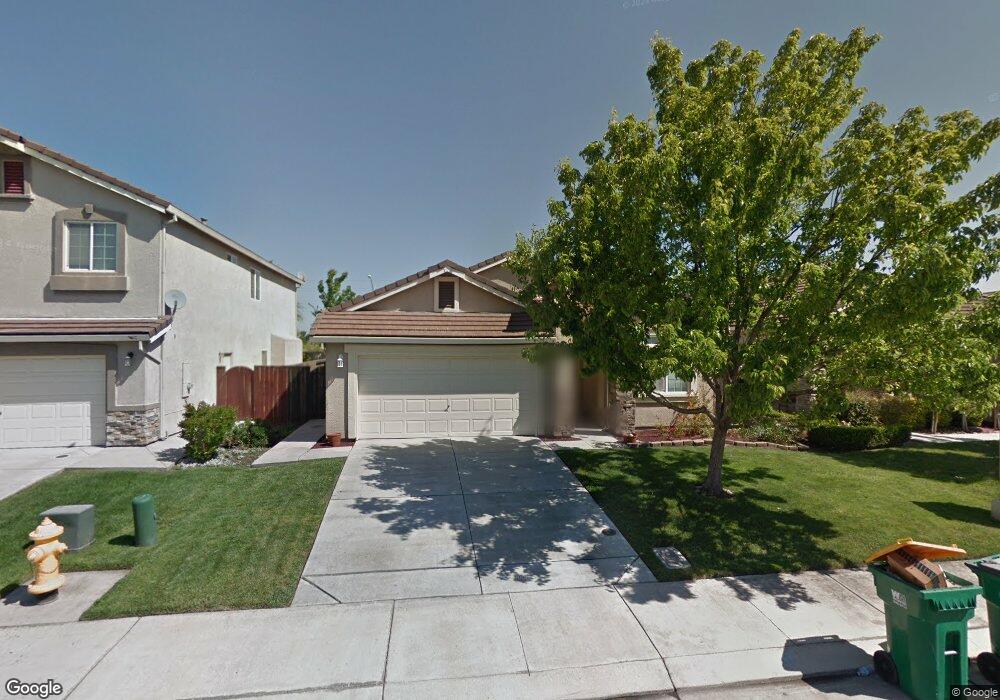
6435 Crestview Cir Stockton, CA 95219
Spanos Park West NeighborhoodEstimated Value: $405,000 - $525,000
3
Beds
2
Baths
1,706
Sq Ft
$282/Sq Ft
Est. Value
About This Home
This home is located at 6435 Crestview Cir, Stockton, CA 95219 and is currently estimated at $480,469, approximately $281 per square foot. 6435 Crestview Cir is a home located in San Joaquin County with nearby schools including Manlio Silva Elementary School, Christa McAuliffe Middle School, and Bear Creek High School.
Ownership History
Date
Name
Owned For
Owner Type
Purchase Details
Closed on
Oct 1, 2004
Sold by
Normandin Michele T
Bought by
Pichardo Paul and Pichardo Julie
Current Estimated Value
Home Financials for this Owner
Home Financials are based on the most recent Mortgage that was taken out on this home.
Original Mortgage
$288,000
Outstanding Balance
$129,098
Interest Rate
4.37%
Mortgage Type
Purchase Money Mortgage
Estimated Equity
$351,371
Purchase Details
Closed on
Feb 25, 2004
Sold by
Kimball Hill Homes California Inc
Bought by
Normandin Michele T
Home Financials for this Owner
Home Financials are based on the most recent Mortgage that was taken out on this home.
Original Mortgage
$238,950
Interest Rate
5.62%
Mortgage Type
Purchase Money Mortgage
Create a Home Valuation Report for This Property
The Home Valuation Report is an in-depth analysis detailing your home's value as well as a comparison with similar homes in the area
Home Values in the Area
Average Home Value in this Area
Purchase History
| Date | Buyer | Sale Price | Title Company |
|---|---|---|---|
| Pichardo Paul | $360,000 | First Amer Title Co | |
| Normandin Michele T | $252,000 | First Amer Title Co |
Source: Public Records
Mortgage History
| Date | Status | Borrower | Loan Amount |
|---|---|---|---|
| Open | Pichardo Paul | $288,000 | |
| Previous Owner | Normandin Michele T | $238,950 |
Source: Public Records
Tax History
| Year | Tax Paid | Tax Assessment Tax Assessment Total Assessment is a certain percentage of the fair market value that is determined by local assessors to be the total taxable value of land and additions on the property. | Land | Improvement |
|---|---|---|---|---|
| 2025 | $6,736 | $485,400 | $145,000 | $340,400 |
| 2024 | $6,438 | $465,300 | $135,000 | $330,300 |
| 2023 | $6,434 | $460,000 | $135,000 | $325,000 |
| 2022 | $6,410 | $460,000 | $135,000 | $325,000 |
| 2021 | $6,135 | $418,500 | $120,000 | $298,500 |
| 2020 | $5,420 | $363,500 | $120,000 | $243,500 |
| 2019 | $5,393 | $363,500 | $120,000 | $243,500 |
| 2018 | $5,158 | $342,500 | $120,000 | $222,500 |
| 2017 | $5,025 | $332,000 | $100,000 | $232,000 |
| 2016 | $4,500 | $290,000 | $87,000 | $203,000 |
| 2014 | $3,867 | $232,000 | $70,000 | $162,000 |
Source: Public Records
Map
Nearby Homes
- 5914 Silver Oak Cir
- 10816 Merritt Dr
- 5849 Silveroak Cir
- 10573 Lake Point Ave
- 6707 Oakum Way
- 10933 Monomoy Way
- 10908 Monomoy Way
- 10525 Lake Point Ave
- 10918 Miacomet Ct
- 5916 Pebblestone Way
- 10412 Rubicon Ave
- 10324 Almanor Cir
- 7041 Overlook Way
- Residence 1765 Plan at Westlake - Breakers Cove
- Residence 2966 Plan at Westlake - Breakers Cove
- Residence 2872 Plan at Westlake - Breezes
- Residence 2403 Plan at Westlake - Breakers Cove
- Residence 3175 Plan at Westlake - Breezes
- Residence 1944 Plan at Westlake - Breakers Cove
- Residence 2138 Plan at Westlake - Breezes
- 6427 Crestview Cir
- 6443 Crestview Cir Unit 21
- 6419 Crestview Cir
- 6451 Crestview Cir
- 6411 Crestview Cir Unit 21
- 6459 Crestview Cir
- 6428 Crestview Cir Unit 21
- 6436 Crestview Cir Unit 21
- 6452 Crestview Cir Unit 21
- 6403 Crestview Cir
- 6467 Crestview Cir Unit 21
- 10886 Arrowood Dr
- 6460 Crestview Cir
- 10882 Arrowood Dr
- 6475 Crestview Cir Unit 21
- 6395 Crestview Cir
- 6468 Crestview Cir
- 6307 Antler Ct
- 6319 Antler Ct
- 6331 Antler Ct