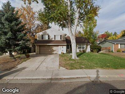
6533 S Vance St Littleton, CO 80123
Dutch Creek Village NeighborhoodEstimated Value: $650,180 - $727,000
4
Beds
5
Baths
2,156
Sq Ft
$321/Sq Ft
Est. Value
About This Home
This home is located at 6533 S Vance St, Littleton, CO 80123 and is currently estimated at $691,795, approximately $320 per square foot. 6533 S Vance St is a home located in Jefferson County with nearby schools including Leawood Elementary School, Ken Caryl Middle School, and Columbine High School.
Ownership History
Date
Name
Owned For
Owner Type
Purchase Details
Closed on
Apr 29, 1996
Sold by
Place Craig Dennis and Place Kathy L
Bought by
Macri Joseph and Macri Cynthia M
Current Estimated Value
Home Financials for this Owner
Home Financials are based on the most recent Mortgage that was taken out on this home.
Original Mortgage
$125,000
Interest Rate
7.8%
Create a Home Valuation Report for This Property
The Home Valuation Report is an in-depth analysis detailing your home's value as well as a comparison with similar homes in the area
Home Values in the Area
Average Home Value in this Area
Purchase History
| Date | Buyer | Sale Price | Title Company |
|---|---|---|---|
| Macri Joseph | $165,000 | -- |
Source: Public Records
Mortgage History
| Date | Status | Borrower | Loan Amount |
|---|---|---|---|
| Open | Macri Joseph | $107,145 | |
| Closed | Macri Joseph | $75,000 | |
| Closed | Macri Joseph | $118,542 | |
| Closed | Macri Joseph | $50,000 | |
| Closed | Macri Cynthia M | $119,553 | |
| Closed | Macri Joseph | $125,000 |
Source: Public Records
Tax History Compared to Growth
Tax History
| Year | Tax Paid | Tax Assessment Tax Assessment Total Assessment is a certain percentage of the fair market value that is determined by local assessors to be the total taxable value of land and additions on the property. | Land | Improvement |
|---|---|---|---|---|
| 2024 | $3,203 | $34,156 | $10,831 | $23,325 |
| 2023 | $3,203 | $34,156 | $10,831 | $23,325 |
| 2022 | $2,887 | $30,198 | $8,784 | $21,414 |
| 2021 | $2,930 | $31,066 | $9,036 | $22,030 |
| 2020 | $2,584 | $27,489 | $7,236 | $20,253 |
| 2019 | $2,549 | $27,489 | $7,236 | $20,253 |
| 2018 | $2,394 | $25,013 | $7,077 | $17,936 |
| 2017 | $2,149 | $25,013 | $7,077 | $17,936 |
| 2016 | $2,151 | $24,152 | $7,404 | $16,748 |
| 2015 | $1,900 | $24,152 | $7,404 | $16,748 |
| 2014 | $1,900 | $19,968 | $4,836 | $15,132 |
Source: Public Records
Map
Nearby Homes
- 6602 S Vance St
- 7314 W Walker Place
- 7825 W Walker Dr
- 7450 W Coal Mine Ave Unit D
- 7906 W Walker Dr
- 7490 W Coal Mine Ave Unit A
- 6924 W Euclid Place Unit A
- 6809 S Webster St Unit F
- 6617 S Reed Way Unit C
- 6606 S Reed Way Unit B
- 7600 W Coal Mine Ave Unit B
- 6819 S Webster St Unit E
- 6825 S Webster St Unit A
- 6845 S Webster St Unit G
- 8150 W Calhoun Dr
- 6336 S Newland Ct
- 7814 W Ontario Place
- 6930 S Yukon Way
- 6975 S Wadsworth Ct
- 7822 W Ottawa Place
- 6533 S Vance St
- 6523 S Vance St
- 6543 S Vance St
- 6558 S Webster St
- 6513 S Vance St
- 6564 S Webster St
- 6554 S Webster St
- 6548 S Webster St
- 6532 S Vance St
- 6544 S Webster St
- 6522 S Vance St
- 6568 S Webster St
- 6553 S Vance St
- 6534 S Webster St
- 6574 S Webster St
- 6542 S Vance St
- 6512 S Vance St
- 6578 S Webster St
- 6562 S Vance St
- 6503 S Vance St