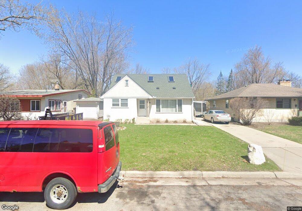
655 Hoyt Ave W Saint Paul, MN 55117
Como Park NeighborhoodEstimated Value: $327,000 - $358,000
3
Beds
2
Baths
718
Sq Ft
$474/Sq Ft
Est. Value
About This Home
This home is located at 655 Hoyt Ave W, Saint Paul, MN 55117 and is currently estimated at $339,993, approximately $473 per square foot. 655 Hoyt Ave W is a home located in Ramsey County with nearby schools including Chelsea Heights Elementary, Murray Middle School, and Como Park Senior High School.
Ownership History
Date
Name
Owned For
Owner Type
Purchase Details
Closed on
Nov 5, 2021
Sold by
Elness Patricia G
Bought by
Elness Patricia G and Bourgoin Randall C
Current Estimated Value
Purchase Details
Closed on
Sep 1, 2015
Sold by
Fleischhacker Frieda Frieda
Bought by
Noonan Noelle Noelle
Home Financials for this Owner
Home Financials are based on the most recent Mortgage that was taken out on this home.
Original Mortgage
$132,000
Interest Rate
3.84%
Create a Home Valuation Report for This Property
The Home Valuation Report is an in-depth analysis detailing your home's value as well as a comparison with similar homes in the area
Home Values in the Area
Average Home Value in this Area
Purchase History
| Date | Buyer | Sale Price | Title Company |
|---|---|---|---|
| Elness Patricia G | -- | None Listed On Document | |
| Noonan Noelle Noelle | $165,000 | -- |
Source: Public Records
Mortgage History
| Date | Status | Borrower | Loan Amount |
|---|---|---|---|
| Previous Owner | Noonan Noelle Noelle | $132,000 |
Source: Public Records
Tax History Compared to Growth
Tax History
| Year | Tax Paid | Tax Assessment Tax Assessment Total Assessment is a certain percentage of the fair market value that is determined by local assessors to be the total taxable value of land and additions on the property. | Land | Improvement |
|---|---|---|---|---|
| 2025 | $5,084 | $362,700 | $60,000 | $302,700 |
| 2023 | $5,084 | $333,100 | $60,000 | $273,100 |
| 2022 | $4,364 | $335,700 | $60,000 | $275,700 |
| 2021 | $4,260 | $278,400 | $60,000 | $218,400 |
| 2020 | $4,122 | $281,600 | $60,000 | $221,600 |
| 2019 | $4,002 | $256,000 | $55,000 | $201,000 |
| 2018 | $3,516 | $246,400 | $55,000 | $191,400 |
| 2017 | $3,450 | $225,700 | $51,900 | $173,800 |
| 2016 | $3,362 | $0 | $0 | $0 |
| 2015 | $3,494 | $217,200 | $51,900 | $165,300 |
| 2014 | $3,366 | $0 | $0 | $0 |
Source: Public Records
Map
Nearby Homes
- 1539 Dale St N
- 1464 Maywood St
- 796 Larpenteur Ave W
- 1342 Dale St N
- 1457 Arundel St
- 1600 Arundel St Unit 204
- 408 Arlington Ave W
- 373 Nebraska Ave W
- 397 Cottage Ave W Unit 3
- 1241 Maywood St
- tbd MacKubin St
- 1801 Western Ave N
- 1222 Como Blvd E
- 766 Maryland Ave W
- 1046 Hoyt Ave W
- 420 McCarrons Blvd S
- 1005 Como Blvd E
- 254 Idaho Ave W
- 1403 Galtier St
- 1176 Norton St
- 649 Hoyt Ave W
- 661 Hoyt Ave W
- 649 649 Hoyt Ave W
- 665 Hoyt Ave W
- 665 665 Hoyt Ave W
- 645 Hoyt Ave W
- 669 Hoyt Ave W
- 639 Hoyt Ave W
- 1543 Maywood St
- 1539 Maywood St
- 1542 Maywood St
- 675 Hoyt Ave W
- 1538 Maywood St
- 646 W Iowa Ave
- 640 640 Iowa-Avenue-w
- 640 640 Iowa Ave W
- 679 Hoyt Ave W
- 1540 Saint Albans St N
- 1553 Dale St N
- 1553 1553 Dale-Street-n