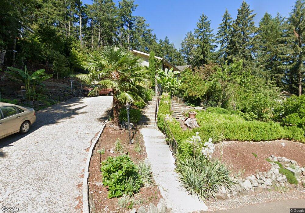
656 Startouch Dr Eugene, OR 97405
Crest Drive NeighborhoodEstimated Value: $633,000 - $696,000
4
Beds
3
Baths
2,537
Sq Ft
$261/Sq Ft
Est. Value
About This Home
This home is located at 656 Startouch Dr, Eugene, OR 97405 and is currently estimated at $661,778, approximately $260 per square foot. 656 Startouch Dr is a home located in Lane County with nearby schools including Edgewood Community Elementary School, Spencer Butte Middle School, and South Eugene High School.
Ownership History
Date
Name
Owned For
Owner Type
Purchase Details
Closed on
Mar 4, 2026
Sold by
Lara Maria Monica and Lara Juventino
Bought by
J M L Revocable Trust and Lara
Current Estimated Value
Purchase Details
Closed on
Jun 9, 2000
Sold by
Lyons William N and Lyons Theresa M
Bought by
Lara Juventino and Lara Maria
Home Financials for this Owner
Home Financials are based on the most recent Mortgage that was taken out on this home.
Original Mortgage
$174,400
Interest Rate
3.95%
Create a Home Valuation Report for This Property
The Home Valuation Report is an in-depth analysis detailing your home's value as well as a comparison with similar homes in the area
Home Values in the Area
Average Home Value in this Area
Purchase History
| Date | Buyer | Sale Price | Title Company |
|---|---|---|---|
| J M L Revocable Trust | -- | None Listed On Document | |
| Lara Juventino | $218,000 | Western Pioneer Title Co |
Source: Public Records
Mortgage History
| Date | Status | Borrower | Loan Amount |
|---|---|---|---|
| Previous Owner | Lara Juventino | $174,400 |
Source: Public Records
Tax History
| Year | Tax Paid | Tax Assessment Tax Assessment Total Assessment is a certain percentage of the fair market value that is determined by local assessors to be the total taxable value of land and additions on the property. | Land | Improvement |
|---|---|---|---|---|
| 2025 | $7,662 | $393,252 | -- | -- |
| 2024 | $7,567 | $381,799 | -- | -- |
| 2023 | $7,567 | $370,679 | $0 | $0 |
| 2022 | $7,089 | $359,883 | $0 | $0 |
| 2021 | $6,658 | $349,401 | $0 | $0 |
| 2020 | $6,682 | $339,225 | $0 | $0 |
| 2019 | $6,453 | $329,345 | $0 | $0 |
| 2018 | $6,074 | $310,440 | $0 | $0 |
| 2017 | $5,683 | $310,440 | $0 | $0 |
| 2016 | $5,463 | $301,398 | $0 | $0 |
| 2015 | $5,331 | $292,619 | $0 | $0 |
| 2014 | $5,239 | $284,096 | $0 | $0 |
Source: Public Records
Map
Nearby Homes
- 653 Brookside Dr
- 784 Brookside Dr
- 0 Pine View Ct Unit 758820410
- 418 Stonewood Dr Unit 418
- 422 Stonewood Dr Unit 422
- 223 Trailside Loop Unit 223
- 151 Treehill Loop Unit 151
- 4040 Southpointe Dr
- 152 Treehill Loop Unit 152
- 143 Treehill Loop Unit 143
- 278 Rockridge Ct
- 126 Treehill Loop Unit 126
- 0 W 40th Ave Unit 3 639571582
- 806 Sundance St
- 36 Westbrook Way
- 21 Westbrook Way
- 17 Westbrook Way
- 3854 Monroe St
- 320 Dellwood Dr
- 4734 Brookwood St
- 648 Startouch Dr
- 662 Startouch Dr
- 657 Startouch Dr
- 652 Startouch Dr
- 645 Startouch Dr
- 650 Startouch Dr
- 670 Startouch Dr
- 668 Startouch Dr
- 671 Startouch Dr
- 664 Startouch Dr
- 644 Startouch Dr
- 642 Startouch Dr
- 643 Startouch Dr
- 659 Brookside Dr
- 667 Kamapheema Place
- 640 Startouch Dr
- 635 Startouch Dr
- 0 Kamapheema Place
- 632 Startouch Dr
- 651 Brookside Dr
Your Personal Tour Guide
Ask me questions while you tour the home.