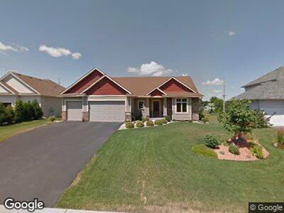
657 Woodland Way Saint Paul, MN 55123
Estimated Value: $592,184 - $749,000
4
Beds
3
Baths
1,745
Sq Ft
$382/Sq Ft
Est. Value
About This Home
This home is located at 657 Woodland Way, Saint Paul, MN 55123 and is currently estimated at $666,796, approximately $382 per square foot. 657 Woodland Way is a home located in Dakota County with nearby schools including Red Pine Elementary School, Dakota Hills Middle School, and Eagan Senior High School.
Ownership History
Date
Name
Owned For
Owner Type
Purchase Details
Closed on
Feb 14, 2008
Sold by
Mittelstaedt Brothers Construction Inc
Bought by
Mcleaney Renee E and Mcleaney Michael B
Current Estimated Value
Home Financials for this Owner
Home Financials are based on the most recent Mortgage that was taken out on this home.
Original Mortgage
$369,653
Interest Rate
5.9%
Mortgage Type
Construction
Create a Home Valuation Report for This Property
The Home Valuation Report is an in-depth analysis detailing your home's value as well as a comparison with similar homes in the area
Home Values in the Area
Average Home Value in this Area
Purchase History
| Date | Buyer | Sale Price | Title Company |
|---|---|---|---|
| Mcleaney Renee E | $410,726 | -- |
Source: Public Records
Mortgage History
| Date | Status | Borrower | Loan Amount |
|---|---|---|---|
| Open | Mcleaney Renee E | $277,000 | |
| Closed | Mcleaney Michael B | $359,220 | |
| Closed | Mcleaney Renee E | $359,200 | |
| Closed | Mcleaney Renee E | $44,800 | |
| Closed | Mcleaney Renee E | $369,653 |
Source: Public Records
Tax History Compared to Growth
Tax History
| Year | Tax Paid | Tax Assessment Tax Assessment Total Assessment is a certain percentage of the fair market value that is determined by local assessors to be the total taxable value of land and additions on the property. | Land | Improvement |
|---|---|---|---|---|
| 2023 | $6,128 | $554,500 | $139,700 | $414,800 |
| 2022 | $5,228 | $527,000 | $139,300 | $387,700 |
| 2021 | $5,364 | $465,000 | $121,100 | $343,900 |
| 2020 | $5,204 | $465,500 | $115,400 | $350,100 |
| 2019 | $4,890 | $439,500 | $109,900 | $329,600 |
| 2018 | $4,503 | $434,900 | $104,700 | $330,200 |
| 2017 | $4,547 | $389,000 | $99,700 | $289,300 |
| 2016 | $4,725 | $375,300 | $94,900 | $280,400 |
| 2015 | $4,677 | $383,282 | $94,281 | $289,001 |
| 2014 | -- | $385,898 | $91,753 | $294,145 |
| 2013 | -- | $326,602 | $81,993 | $244,609 |
Source: Public Records
Map
Nearby Homes
- 644 McFaddens Trail
- 683 Crimson Leaf Trail
- 4532 Alicia Dr
- 675 Farm Rd
- 4884 Avery Ct
- 910 Lakewood Hills Rd
- 4291 Augusta Ln
- 11571 Avery Dr
- 4939 Parkside Cir
- 4943 Parkside Cir
- 4927 Parkside Cir
- 4955 Parkside Cir
- 911 Oakwood Heights Cir Unit 2
- 636 Parkside Ct
- 635 Parkside Ct
- 11560 Ashley Ct
- 4978 Dodd Rd
- 778 Sunset Dr
- 4321 Trenton Trail
- 4281 Rosemary Ct
- 657 Woodland Way
- 653 Woodland Way
- 661 Woodland Way
- 649 Woodland Way
- 658 Woodland Way
- 654 Woodland Way
- 645 Woodland Way
- 650 Woodland Way
- 650 Woodland Cir
- 4625 Dodd Rd
- 63X Parkside Ct
- 4543 S Hay Lake Rd
- 4549 S Hay Lake Rd
- 4539 S Hay Lake Rd
- 641 Woodland Way
- 4537 S Hay Lake Rd
- 681 Shelerud Dr
- 4555 S Hay Lake Rd
- 685 Shelerud Dr
- 4531 S Hay Lake Rd