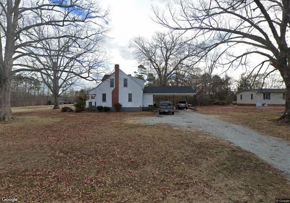
658 Robert Norris Rd Roxboro, NC 27574
Estimated Value: $125,000 - $162,915
3
Beds
2
Baths
1,278
Sq Ft
$110/Sq Ft
Est. Value
About This Home
This home is located at 658 Robert Norris Rd, Roxboro, NC 27574 and is currently estimated at $140,979, approximately $110 per square foot. 658 Robert Norris Rd is a home with nearby schools including Person High School, Roxboro Community School, and Roxboro Christian Academy.
Ownership History
Date
Name
Owned For
Owner Type
Purchase Details
Closed on
Dec 29, 2025
Sold by
Street Jeffer Lee
Bought by
Winstead Donald Ray and Goodman Winstead Thursher
Current Estimated Value
Home Financials for this Owner
Home Financials are based on the most recent Mortgage that was taken out on this home.
Original Mortgage
$106,250
Outstanding Balance
$106,250
Interest Rate
5.33%
Mortgage Type
New Conventional
Estimated Equity
$34,729
Purchase Details
Closed on
Oct 18, 2019
Sold by
Winstead Yvalondra Latriece and Winstead Yvalondra Latrice
Bought by
Street Jeffer Lee
Purchase Details
Closed on
Jul 6, 2018
Sold by
Clay Curtis M
Bought by
Winstead Yvalondra Latrice
Purchase Details
Closed on
Jul 31, 1987
Bought by
Clay Jeanette P
Create a Home Valuation Report for This Property
The Home Valuation Report is an in-depth analysis detailing your home's value as well as a comparison with similar homes in the area
Purchase History
| Date | Buyer | Sale Price | Title Company |
|---|---|---|---|
| Winstead Donald Ray | $125,000 | None Listed On Document | |
| Street Jeffer Lee | $35,000 | None Available | |
| Winstead Yvalondra Latrice | -- | None Available | |
| Clay Jeanette P | -- | -- |
Source: Public Records
Mortgage History
| Date | Status | Borrower | Loan Amount |
|---|---|---|---|
| Open | Winstead Donald Ray | $106,250 |
Source: Public Records
Tax History
| Year | Tax Paid | Tax Assessment Tax Assessment Total Assessment is a certain percentage of the fair market value that is determined by local assessors to be the total taxable value of land and additions on the property. | Land | Improvement |
|---|---|---|---|---|
| 2025 | $540 | $79,688 | $0 | $0 |
| 2024 | $390 | $49,650 | $0 | $0 |
| 2023 | $390 | $49,650 | $0 | $0 |
| 2022 | $388 | $49,650 | $0 | $0 |
| 2021 | $377 | $49,650 | $0 | $0 |
| 2020 | $500 | $66,054 | $0 | $0 |
| 2019 | $471 | $61,123 | $0 | $0 |
| 2018 | $442 | $61,123 | $0 | $0 |
| 2017 | $435 | $61,123 | $0 | $0 |
| 2016 | $435 | $61,123 | $0 | $0 |
| 2015 | $435 | $61,123 | $0 | $0 |
| 2014 | $435 | $61,123 | $0 | $0 |
Source: Public Records
Map
Nearby Homes
- 500 Jones Lester Rd
- 2 Semora Rd
- 40 John D Winstead Rd
- 1.5 Acres Burlington Rd
- 98 Lochridge Dr
- 70 Younger Rd
- 9 Buttonwood Ln
- 209 Reade Dr
- 310 Wesleyan Heights Rd
- 382 Wimbledon Dr
- 213 Hill St
- 515 Reams Ave
- 531 Booth St
- 420 Reams Ave
- 2337 Burlington Rd
- 508 Jones St
- 50 Southern Village Dr
- Lot 3 Hurdle Mills Rd
- 184 Payton Place
- 1739 Hurdle Mills Rd
- 636 Robert Norris Rd
- 614 Robert Norris Rd
- 643 Robert Norris Rd
- 671 Robert Norris Rd
- 1611 Semora Rd
- 594 Robert Norris Rd
- 1579 Semora Rd
- 574 Robert Norris Rd
- 585 Robert Norris Rd
- 1652 Semora Rd
- 548 Robert Norris Rd
- Lot B Semora Rd
- 1535 Semora Rd
- 1564 Semora Rd
- 1507 Semora Rd
- 69 Jones Lester Rd
- 1504 Semora Rd
- 1469 Semora Rd
- 1474 Semora Rd
- 115 Jones Lester Rd
Your Personal Tour Guide
Ask me questions while you tour the home.