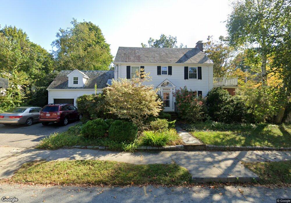
66 Amherst Rd Waban, MA 02468
Waban NeighborhoodEstimated Value: $1,466,291 - $1,730,000
3
Beds
3
Baths
2,202
Sq Ft
$728/Sq Ft
Est. Value
About This Home
This home is located at 66 Amherst Rd, Waban, MA 02468 and is currently estimated at $1,602,823, approximately $727 per square foot. 66 Amherst Rd is a home located in Middlesex County with nearby schools including Angier Elementary School, Charles E Brown Middle School, and Newton South High School.
Ownership History
Date
Name
Owned For
Owner Type
Purchase Details
Closed on
Aug 19, 1993
Sold by
Cook William D and Cook Harriet S
Bought by
Putnam Robt and Putnam Elisabeth
Current Estimated Value
Home Financials for this Owner
Home Financials are based on the most recent Mortgage that was taken out on this home.
Original Mortgage
$296,000
Interest Rate
7.11%
Mortgage Type
Purchase Money Mortgage
Create a Home Valuation Report for This Property
The Home Valuation Report is an in-depth analysis detailing your home's value as well as a comparison with similar homes in the area
Home Values in the Area
Average Home Value in this Area
Purchase History
| Date | Buyer | Sale Price | Title Company |
|---|---|---|---|
| Putnam Robt | $370,000 | -- |
Source: Public Records
Mortgage History
| Date | Status | Borrower | Loan Amount |
|---|---|---|---|
| Closed | Putnam Robt | $296,000 |
Source: Public Records
Tax History
| Year | Tax Paid | Tax Assessment Tax Assessment Total Assessment is a certain percentage of the fair market value that is determined by local assessors to be the total taxable value of land and additions on the property. | Land | Improvement |
|---|---|---|---|---|
| 2025 | $11,055 | $1,128,100 | $948,500 | $179,600 |
| 2024 | $10,689 | $1,095,200 | $920,900 | $174,300 |
| 2023 | $10,235 | $1,005,400 | $703,700 | $301,700 |
| 2022 | $9,793 | $930,900 | $651,600 | $279,300 |
| 2021 | $7,322 | $878,200 | $614,700 | $263,500 |
| 2020 | $9,168 | $878,200 | $614,700 | $263,500 |
| 2019 | $8,832 | $845,200 | $596,800 | $248,400 |
| 2018 | $8,503 | $785,900 | $542,700 | $243,200 |
| 2017 | $5,239 | $741,400 | $512,000 | $229,400 |
| 2016 | $7,885 | $692,900 | $478,500 | $214,400 |
| 2015 | $7,519 | $647,600 | $447,200 | $200,400 |
Source: Public Records
Map
Nearby Homes
- 873 Chestnut St
- 34 Larchmont Ave
- 1003 Chestnut St
- 59 Roundwood Rd
- 1077 Boylston St Unit 1
- 27 Hamilton Place
- 126 Beethoven Ave
- 304 Elliot St Carriage House S Unit 4
- 302 Elliot St Carriage House N Unit 3
- 187 Saint Mary St
- 181 Saint Mary St
- 300 Elliot St Unit 2
- 110 Avalon Rd
- 20 Kinmonth Rd Unit 203
- 20 Kinmonth Rd Unit 306
- 20 Kinmonth Rd Unit 4
- 18 Josselyn Place Unit 18
- 16-18 Josselyn Place Unit 16
- 91 Waban Ave
- 1438 Beacon St
Your Personal Tour Guide
Ask me questions while you tour the home.