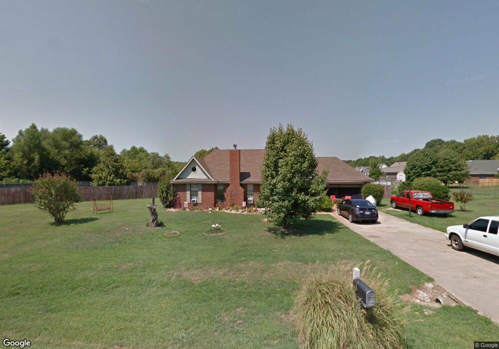
664 Pwr Loop Munford, TN 38058
Estimated Value: $266,000 - $308,000
Studio
2
Baths
1,996
Sq Ft
$146/Sq Ft
Est. Value
About This Home
This home is located at 664 Pwr Loop, Munford, TN 38058 and is currently estimated at $291,613, approximately $146 per square foot. 664 Pwr Loop is a home located in Tipton County with nearby schools including Drummonds Elementary School, Munford Middle School, and Munford High School.
Ownership History
Date
Name
Owned For
Owner Type
Purchase Details
Closed on
Jun 3, 2004
Sold by
Dendy James D
Bought by
Randy Hough
Current Estimated Value
Home Financials for this Owner
Home Financials are based on the most recent Mortgage that was taken out on this home.
Original Mortgage
$123,028
Outstanding Balance
$58,743
Interest Rate
5.98%
Estimated Equity
$232,870
Purchase Details
Closed on
Aug 1, 2000
Sold by
Michael Owen
Bought by
Dendy James D
Purchase Details
Closed on
Feb 23, 1998
Sold by
Welch Lawrence L
Bought by
Lee Owen Michael
Home Financials for this Owner
Home Financials are based on the most recent Mortgage that was taken out on this home.
Original Mortgage
$99,849
Interest Rate
6.95%
Purchase Details
Closed on
Aug 5, 1996
Sold by
Wayne Reed Paul
Bought by
Welch Lawrence L
Purchase Details
Closed on
Feb 26, 1988
Bought by
Reed Paul Wayne
Create a Home Valuation Report for This Property
The Home Valuation Report is an in-depth analysis detailing your home's value as well as a comparison with similar homes in the area
Home Values in the Area
Average Home Value in this Area
Purchase History
| Date | Buyer | Sale Price | Title Company |
|---|---|---|---|
| Randy Hough | $124,000 | -- | |
| Dendy James D | $113,500 | -- | |
| Lee Owen Michael | $99,900 | -- | |
| Welch Lawrence L | $95,000 | -- | |
| Pwr Corp | -- | -- | |
| Reed Paul Wayne | -- | -- |
Source: Public Records
Mortgage History
| Date | Status | Borrower | Loan Amount |
|---|---|---|---|
| Open | Reed Paul Wayne | $123,028 | |
| Previous Owner | Reed Paul Wayne | $99,849 |
Source: Public Records
Tax History
| Year | Tax Paid | Tax Assessment Tax Assessment Total Assessment is a certain percentage of the fair market value that is determined by local assessors to be the total taxable value of land and additions on the property. | Land | Improvement |
|---|---|---|---|---|
| 2025 | $959 | $63,025 | $9,750 | $53,275 |
| 2024 | $954 | $62,700 | $9,750 | $52,950 |
| 2023 | $954 | $62,700 | $9,750 | $52,950 |
| 2022 | $897 | $43,950 | $7,175 | $36,775 |
| 2021 | $897 | $43,950 | $7,175 | $36,775 |
| 2020 | $896 | $43,950 | $7,175 | $36,775 |
| 2019 | $806 | $33,300 | $4,250 | $29,050 |
| 2018 | $762 | $33,300 | $4,250 | $29,050 |
| 2017 | $762 | $31,475 | $4,250 | $27,225 |
| 2016 | $762 | $31,475 | $4,250 | $27,225 |
| 2015 | $761 | $31,475 | $4,250 | $27,225 |
| 2014 | $760 | $31,463 | $0 | $0 |
Source: Public Records
Map
Nearby Homes
- 544 Rachel Shankle Dr
- 37 N Wyatt Shankle Cove
- 447 Abbey Rd Unit D
- 447 Abbey Rd Unit A
- 0 Appleberry Rd
- 52 Green Meadows Blvd
- 59 Rose Bush St
- 21 Rose Bush St
- 53 Rose Bush St
- 47 Rose Bush St
- 27 Rose Bush St
- 33 Rose Bush St
- 1245 Drummonds Rd
- 39 Rose Bush St
- 878 Charles Place
- 632 Cullum Rd
- 595 Charles Place
- 72 Margaret Place
- 43 Tipton Ridge Cove
- 232 Empire Ln
Your Personal Tour Guide
Ask me questions while you tour the home.