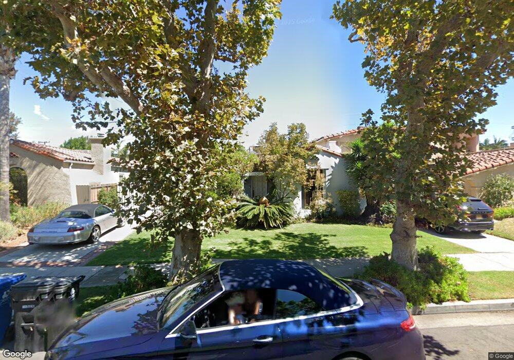
6671 W 5th St Los Angeles, CA 90048
Beverly Grove NeighborhoodEstimated Value: $1,935,846 - $2,352,000
3
Beds
2
Baths
1,947
Sq Ft
$1,112/Sq Ft
Est. Value
About This Home
This home is located at 6671 W 5th St, Los Angeles, CA 90048 and is currently estimated at $2,164,212, approximately $1,111 per square foot. 6671 W 5th St is a home located in Los Angeles County with nearby schools including Hancock Park Elementary, John Burroughs Middle School, and Fairfax High School.
Ownership History
Date
Name
Owned For
Owner Type
Purchase Details
Closed on
Mar 27, 2020
Sold by
Janno
Bought by
Janno
Current Estimated Value
Home Financials for this Owner
Home Financials are based on the most recent Mortgage that was taken out on this home.
Original Mortgage
$600,000
Outstanding Balance
$531,386
Interest Rate
3.5%
Estimated Equity
$1,632,826
Purchase Details
Closed on
Mar 2, 2010
Sold by
Jannol Henry N and Jannol Miryam
Bought by
Jannol Henry N
Create a Home Valuation Report for This Property
The Home Valuation Report is an in-depth analysis detailing your home's value as well as a comparison with similar homes in the area
Home Values in the Area
Average Home Value in this Area
Purchase History
| Date | Buyer | Sale Price | Title Company |
|---|---|---|---|
| Janno | -- | -- | |
| Jannol Henry N | -- | None Available | |
| Jannol Henry N | -- | None Available |
Source: Public Records
Mortgage History
| Date | Status | Borrower | Loan Amount |
|---|---|---|---|
| Open | Janno | $600,000 | |
| Closed | Janno | -- |
Source: Public Records
Tax History Compared to Growth
Tax History
| Year | Tax Paid | Tax Assessment Tax Assessment Total Assessment is a certain percentage of the fair market value that is determined by local assessors to be the total taxable value of land and additions on the property. | Land | Improvement |
|---|---|---|---|---|
| 2025 | $3,641 | $283,080 | $139,498 | $143,582 |
| 2024 | $3,591 | $277,530 | $136,763 | $140,767 |
| 2023 | $3,529 | $272,089 | $134,082 | $138,007 |
| 2022 | $3,375 | $266,754 | $131,453 | $135,301 |
| 2021 | $3,321 | $261,525 | $128,876 | $132,649 |
| 2020 | $3,350 | $258,844 | $127,555 | $131,289 |
| 2019 | $3,225 | $253,769 | $125,054 | $128,715 |
| 2018 | $3,139 | $248,794 | $122,602 | $126,192 |
| 2016 | $2,985 | $239,136 | $117,843 | $121,293 |
| 2015 | $2,942 | $235,545 | $116,073 | $119,472 |
| 2014 | $2,961 | $230,932 | $113,800 | $117,132 |
Source: Public Records
Map
Nearby Homes
- 6657 W 5th St
- 155 N Hamilton Dr Unit 402
- 155 N Hamilton Dr Unit 102
- 6733 Colgate Ave
- 8356 W 4th St
- 6607 Maryland Dr
- 6638 Lindenhurst Ave
- 6511 Maryland Dr
- 6571 Colgate Ave
- 6526 Lindenhurst Ave
- 112 N Hamilton Dr Unit 305
- 6451 Maryland Dr
- 155 N Le Doux Rd
- 6546 Colgate Ave
- 160 N Stanley Dr
- 6531 Orange St
- 6410 Drexel Ave
- 6509 Colgate Ave
- 486 S Sherbourne Dr
- 8206 W 4th St
- 6667 W 5th St
- 6677 W 5th St
- 6661 W 5th St
- 6681 W 5th St
- 6670 Drexel Ave
- 6666 Drexel Ave
- 6676 Drexel Ave
- 6685 W 5th St
- 6660 Drexel Ave
- 6680 Drexel Ave
- 6680 - 6682 Drexel Ave
- 6682 Drexel Ave
- 6670 W 5th St
- 6676 W 5th St
- 6666 W 5th St
- 6656 Drexel Ave
- 6686 Drexel Ave Unit 2
- 6686 Drexel Ave Unit 1
- 6686 Drexel Ave
- 6651 W 5th St