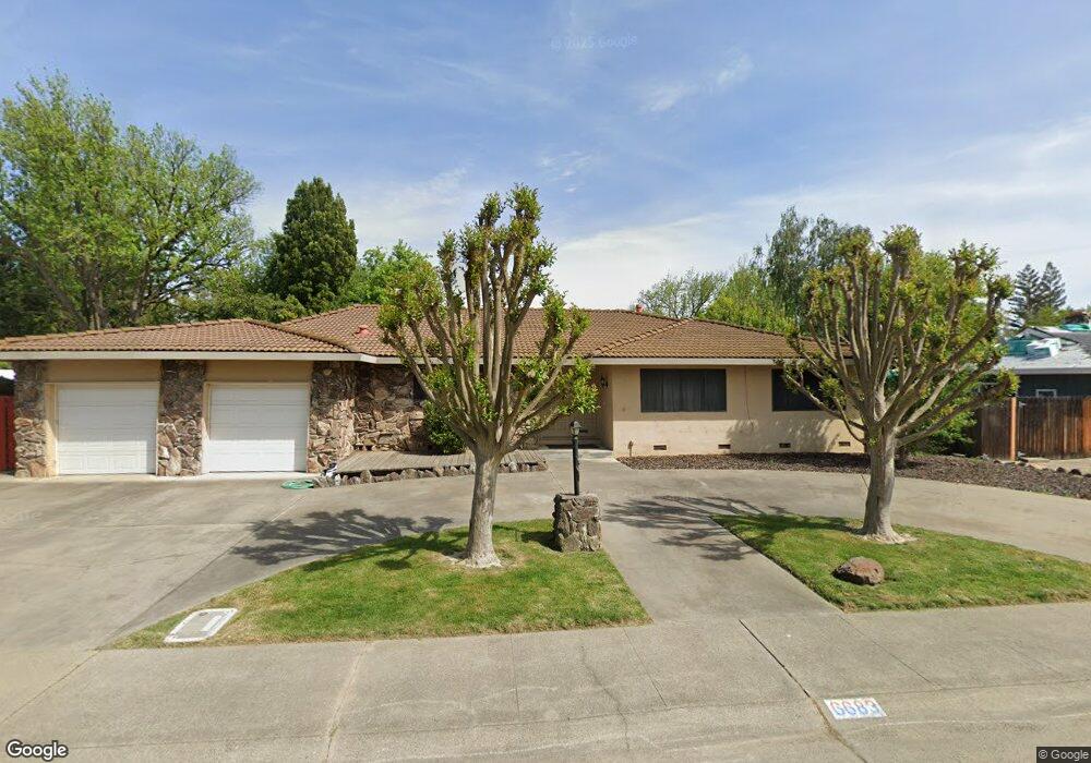
6683 Benham Way Sacramento, CA 95831
Pocket-Greenhaven NeighborhoodEstimated Value: $536,000 - $715,000
3
Beds
3
Baths
2,067
Sq Ft
$321/Sq Ft
Est. Value
About This Home
This home is located at 6683 Benham Way, Sacramento, CA 95831 and is currently estimated at $662,583, approximately $320 per square foot. 6683 Benham Way is a home located in Sacramento County with nearby schools including Genevieve Didion School, Sam Brannan Middle School, and John F. Kennedy High School.
Ownership History
Date
Name
Owned For
Owner Type
Purchase Details
Closed on
Apr 15, 2010
Sold by
Foey Stanley D
Bought by
Foey Stanley D and Stanley D Foey Family Trust
Current Estimated Value
Purchase Details
Closed on
Sep 26, 2006
Sold by
Foey Stanley David and Foey Revocable Living Trust
Bought by
Foey Stanley David
Purchase Details
Closed on
Jul 26, 1996
Sold by
Va
Bought by
Foey David W and Foey Helen
Create a Home Valuation Report for This Property
The Home Valuation Report is an in-depth analysis detailing your home's value as well as a comparison with similar homes in the area
Home Values in the Area
Average Home Value in this Area
Purchase History
| Date | Buyer | Sale Price | Title Company |
|---|---|---|---|
| Foey Stanley D | -- | None Available | |
| Foey Stanley D | -- | None Available | |
| Foey Stanley David | -- | None Available | |
| Foey David W | -- | -- |
Source: Public Records
Tax History Compared to Growth
Tax History
| Year | Tax Paid | Tax Assessment Tax Assessment Total Assessment is a certain percentage of the fair market value that is determined by local assessors to be the total taxable value of land and additions on the property. | Land | Improvement |
|---|---|---|---|---|
| 2025 | $1,790 | $124,968 | $26,933 | $98,035 |
| 2024 | $1,790 | $122,518 | $26,405 | $96,113 |
| 2023 | $1,742 | $120,117 | $25,888 | $94,229 |
| 2022 | $1,727 | $117,763 | $25,381 | $92,382 |
| 2021 | $1,646 | $115,455 | $24,884 | $90,571 |
| 2020 | $1,650 | $114,272 | $24,629 | $89,643 |
| 2019 | $1,617 | $112,033 | $24,147 | $87,886 |
| 2018 | $1,577 | $109,837 | $23,674 | $86,163 |
| 2017 | $1,551 | $107,684 | $23,210 | $84,474 |
| 2016 | $1,542 | $105,573 | $22,755 | $82,818 |
| 2015 | $1,515 | $103,988 | $22,414 | $81,574 |
| 2014 | $1,488 | $101,958 | $21,976 | $79,982 |
Source: Public Records
Map
Nearby Homes
- 9 Sandhill Ct
- 6980 Riverside Blvd
- 0 Riverside Blvd
- 26 Marina Grande Ct
- 487 Twin River Way
- 10 Fleet Ct
- 7262 Harbor Light Way
- 506 Roundtree Ct
- 657 Brickyard Dr
- 14 Westlite Ct
- 792 Parklin Ave
- 763 La Contenta Way
- 4074 Southampton St
- 4057 Southampton St
- 3236 Boston Rd
- 462 de Mar Dr
- 4029 Dover St
- 4009 Martis St
- 37 Starlit Cir
- 4025 Shaver Ct
- 6707 Benham Way
- 6669 Benham Way
- 6701 Harmon Dr
- 6685 Harmon Dr
- 6725 Harmon Dr
- 6655 Benham Way
- 6678 Benham Way
- 6700 Benham Way
- 6671 Harmon Dr
- 6664 Benham Way
- 6714 Benham Way
- 6745 Harmon Dr
- 6720 Harmon Dr
- 6641 Benham Way
- 6700 Harmon Dr
- 6745 Benham Way
- 6730 Harmon Dr
- 6650 Benham Way
- 6657 Harmon Dr
- 6680 Harmon Dr