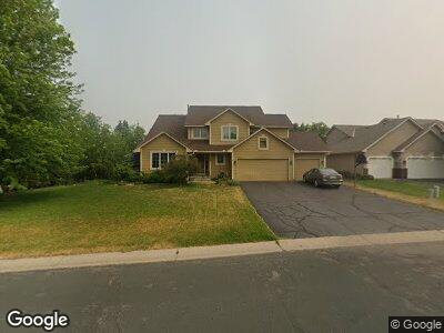
669 McFaddens Trail Saint Paul, MN 55123
Estimated Value: $510,622 - $595,000
4
Beds
4
Baths
2,079
Sq Ft
$271/Sq Ft
Est. Value
About This Home
This home is located at 669 McFaddens Trail, Saint Paul, MN 55123 and is currently estimated at $562,656, approximately $270 per square foot. 669 McFaddens Trail is a home located in Dakota County with nearby schools including Red Pine Elementary School, Dakota Hills Middle School, and Eagan Senior High School.
Ownership History
Date
Name
Owned For
Owner Type
Purchase Details
Closed on
Apr 16, 2018
Sold by
Anderson William H and Anderson Julie A
Bought by
Anderson Julie A and Anderson William H
Current Estimated Value
Purchase Details
Closed on
Jun 13, 2000
Sold by
Johnson Thomas J and Johnson Michelle L
Bought by
Anderson William H and Anderson Julie A
Purchase Details
Closed on
Jan 28, 1996
Sold by
Frank Guy D and Frank Di
Bought by
Johnson Thomas J and Johnson Michelle L
Create a Home Valuation Report for This Property
The Home Valuation Report is an in-depth analysis detailing your home's value as well as a comparison with similar homes in the area
Home Values in the Area
Average Home Value in this Area
Purchase History
| Date | Buyer | Sale Price | Title Company |
|---|---|---|---|
| Anderson Julie A | -- | None Available | |
| Anderson William H | $265,500 | -- | |
| Johnson Thomas J | $188,000 | -- |
Source: Public Records
Mortgage History
| Date | Status | Borrower | Loan Amount |
|---|---|---|---|
| Previous Owner | Anderson William H | $67,803 |
Source: Public Records
Tax History Compared to Growth
Tax History
| Year | Tax Paid | Tax Assessment Tax Assessment Total Assessment is a certain percentage of the fair market value that is determined by local assessors to be the total taxable value of land and additions on the property. | Land | Improvement |
|---|---|---|---|---|
| 2023 | $5,018 | $462,100 | $101,700 | $360,400 |
| 2022 | $4,392 | $453,900 | $101,400 | $352,500 |
| 2021 | $4,446 | $392,000 | $88,200 | $303,800 |
| 2020 | $4,364 | $387,600 | $84,000 | $303,600 |
| 2019 | $3,923 | $371,200 | $80,000 | $291,200 |
| 2018 | $3,636 | $353,000 | $76,200 | $276,800 |
| 2017 | $3,716 | $319,200 | $72,600 | $246,600 |
| 2016 | $3,762 | $311,600 | $69,100 | $242,500 |
| 2015 | $3,504 | $303,494 | $67,087 | $236,407 |
| 2014 | -- | $287,144 | $64,839 | $222,305 |
| 2013 | -- | $251,174 | $57,905 | $193,269 |
Source: Public Records
Map
Nearby Homes
- 644 McFaddens Trail
- 675 Farm Rd
- 4884 Avery Ct
- 4939 Parkside Cir
- 4943 Parkside Cir
- 4927 Parkside Cir
- 4955 Parkside Cir
- 636 Parkside Ct
- 635 Parkside Ct
- 4978 Dodd Rd
- 11571 Avery Dr
- 4902 Brooklyn Ln
- 625 Remington Ct
- 11635 Aileron Ct
- 4532 Alicia Dr
- 11700 Azure Ln
- 11735 Azure Cir
- 683 Crimson Leaf Trail
- 910 Lakewood Hills Rd
- 11798 Azure Ln
- 669 McFaddens Trail
- 665 McFaddens Trail
- 4668 Pine Cone Cir
- 673 McFaddens Trail
- 661 McFaddens Trail
- 668 McFaddens Trail
- 664 McFaddens Trail
- 4667 Pine Cone Cir
- 4662 Pine Cone Cir
- 677 McFaddens Trail
- 657 McFaddens Trail
- 672 McFaddens Trail
- 4663 Pine Cone Cir
- 4675 Dodd Rd
- 686 Pine Cone Trail
- 681 McFaddens Trail
- 653 McFaddens Trail
- 691 McFaddens Trail
- 676 McFaddens Trail
- 690 Rosa Ct