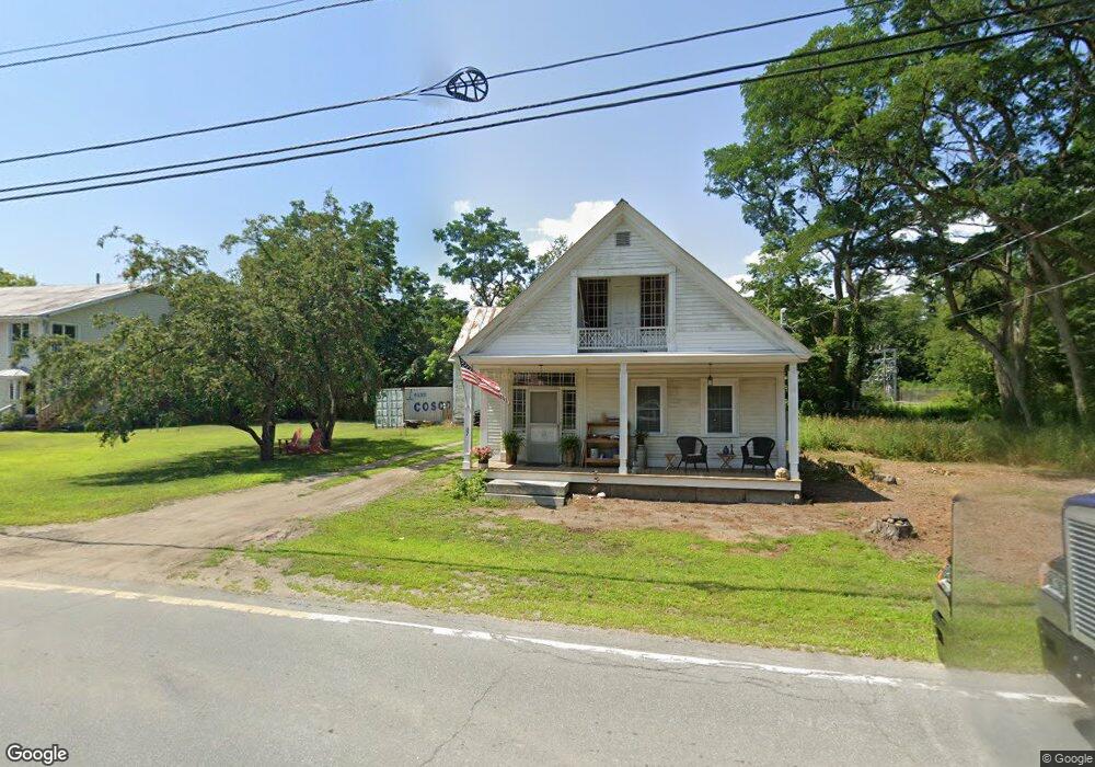
67 Main St Monroe, NH 03771
Estimated Value: $294,000 - $533,000
3
Beds
2
Baths
1,525
Sq Ft
$243/Sq Ft
Est. Value
About This Home
This home is located at 67 Main St, Monroe, NH 03771 and is currently estimated at $369,915, approximately $242 per square foot. 67 Main St is a home with nearby schools including Monroe Consolidated School.
Ownership History
Date
Name
Owned For
Owner Type
Purchase Details
Closed on
May 24, 2018
Sold by
Gibson Karen S
Bought by
Gibson Karen S
Current Estimated Value
Create a Home Valuation Report for This Property
The Home Valuation Report is an in-depth analysis detailing your home's value as well as a comparison with similar homes in the area
Home Values in the Area
Average Home Value in this Area
Purchase History
| Date | Buyer | Sale Price | Title Company |
|---|---|---|---|
| Gibson Karen S | $35,000 | -- |
Source: Public Records
Tax History Compared to Growth
Tax History
| Year | Tax Paid | Tax Assessment Tax Assessment Total Assessment is a certain percentage of the fair market value that is determined by local assessors to be the total taxable value of land and additions on the property. | Land | Improvement |
|---|---|---|---|---|
| 2024 | $2,306 | $216,300 | $23,500 | $192,800 |
| 2023 | $2,105 | $216,300 | $23,500 | $192,800 |
| 2022 | $1,435 | $117,700 | $23,500 | $94,200 |
| 2020 | $1,410 | $117,700 | $23,500 | $94,200 |
| 2019 | $890 | $78,500 | $23,500 | $55,000 |
| 2018 | $839 | $78,500 | $23,500 | $55,000 |
| 2016 | $846 | $74,600 | $21,200 | $53,400 |
| 2015 | $785 | $74,600 | $21,200 | $53,400 |
| 2014 | $894 | $74,600 | $21,200 | $53,400 |
| 2012 | $1,272 | $112,300 | $21,200 | $91,100 |
Source: Public Records
Map
Nearby Homes
- 4706 Us Route 5 S
- 4615 U S 5
- 630 Plains Rd
- 433 Grange Hall Rd
- 342 Grange Hall Rd
- 00 Woodsville Rd
- 00 Coppermine Rd Unit 59
- 1291 Littleton Rd
- 286 Carter St
- 88 Mill Hill
- 396 Nelson Rd
- 391 Bimson Dr
- 1573 Us Route 5 S
- 182 Symes Pond Rd
- 201 Under the Mountain Rd
- 663 Ferguson Rd
- 225 Witherspoon Rd
- 0 Denio Rd Unit 5059200
- 0 Denio Rd Unit 5059211
- 0 Denio Rd Unit 5059215