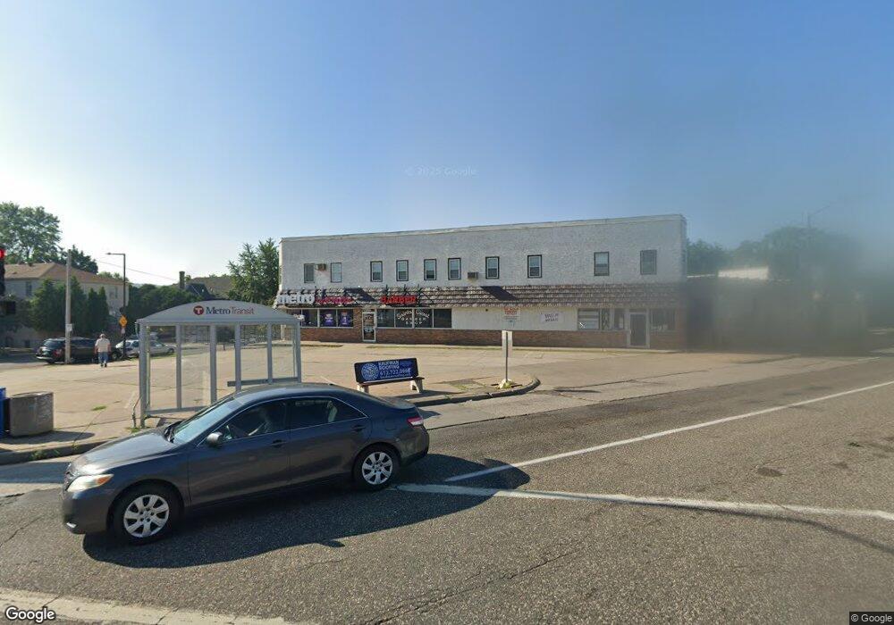
670 7th St W Saint Paul, MN 55102
West Seventh NeighborhoodEstimated Value: $1,033,728
5
Beds
--
Bath
8,190
Sq Ft
$126/Sq Ft
Est. Value
About This Home
This home is located at 670 7th St W, Saint Paul, MN 55102 and is currently estimated at $1,033,728, approximately $126 per square foot. 670 7th St W is a home located in Ramsey County with nearby schools including Expo for Excellence Elementary School, Hidden River Middle School, and Central Senior High School.
Ownership History
Date
Name
Owned For
Owner Type
Purchase Details
Closed on
Feb 10, 2021
Sold by
Sorrento Development Llc
Bought by
Alfex Commercial Llc
Current Estimated Value
Purchase Details
Closed on
Jul 28, 2017
Sold by
Sorrento Development Llc
Bought by
Alfex Commercial Llc
Purchase Details
Closed on
Jul 20, 2017
Sold by
Sorrento Development Llc
Bought by
Alfex Commerical Llc
Create a Home Valuation Report for This Property
The Home Valuation Report is an in-depth analysis detailing your home's value as well as a comparison with similar homes in the area
Home Values in the Area
Average Home Value in this Area
Purchase History
| Date | Buyer | Sale Price | Title Company |
|---|---|---|---|
| Alfex Commercial Llc | $860,000 | Servion Commercial Title | |
| Alfex Commercial Lcl | $860,000 | Servion Commercial Title | |
| Alfex Commercial Llc | $335,000 | C U Commercial Title Svcs | |
| Alfex Commerical Llc | $335,000 | None Available |
Source: Public Records
Mortgage History
| Date | Status | Borrower | Loan Amount |
|---|---|---|---|
| Closed | Alfex Commerical Llc | $0 |
Source: Public Records
Tax History Compared to Growth
Tax History
| Year | Tax Paid | Tax Assessment Tax Assessment Total Assessment is a certain percentage of the fair market value that is determined by local assessors to be the total taxable value of land and additions on the property. | Land | Improvement |
|---|---|---|---|---|
| 2025 | $17,488 | $705,500 | $223,500 | $482,000 |
| 2023 | $17,488 | $748,100 | $223,500 | $524,600 |
| 2022 | $15,394 | $764,500 | $223,500 | $541,000 |
| 2021 | $15,092 | $612,100 | $223,500 | $388,600 |
| 2020 | $17,988 | $612,100 | $223,500 | $388,600 |
| 2019 | $16,232 | $677,400 | $223,500 | $453,900 |
| 2018 | $11,356 | $604,800 | $223,500 | $381,300 |
| 2017 | $12,286 | $435,900 | $223,500 | $212,400 |
| 2016 | $12,394 | $0 | $0 | $0 |
| 2015 | $12,654 | $357,300 | $223,500 | $133,800 |
| 2014 | $14,418 | $0 | $0 | $0 |
Source: Public Records
Map
Nearby Homes
- 398 Banfil St
- 270 7th St W
- 275 Cliff St
- 195 Oneida St
- 391 Duke St
- 89 Douglas St
- 391 Grand Ave Unit 304
- 383 Grand Ave Unit 9
- 383 Grand Ave Unit 1
- 506 Grand Hill
- 380 Ramsey St Unit 1B
- 11 Summit Ct Unit 11
- 442 Summit Ave Unit 4
- 442 Summit Ave Unit 6
- 94 Crocus Place
- 212 McBoal St
- 506 Summit Ave
- 385 Toronto St
- 421 Summit Ave Unit 2
- 421 Summit Ave Unit 3
- 259 Nugent St
- 246 Nugent St
- 242 Nugent St
- 258 Nugent St
- 265 Nugent St
- 264 Nugent St
- 696 7th St W
- 427 Saint Clair Ave
- 251 Western Ave S
- 270 Nugent St
- 253 Western Ave S
- 271 Nugent St
- 255 Western Ave S
- 263 Western Ave S
- 263 263 Western-Avenue-s
- 272 Nugent St
- 275 Nugent St
- 267 Western Ave S
- 267 267 Western Ave S
- 272 Richmond St