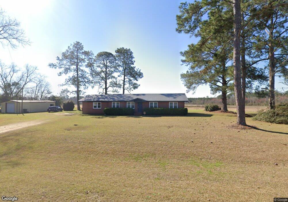
670 Gibbs Rd Moultrie, GA 31788
Estimated Value: $93,000 - $205,000
--
Bed
2
Baths
1,620
Sq Ft
$97/Sq Ft
Est. Value
About This Home
This home is located at 670 Gibbs Rd, Moultrie, GA 31788 and is currently estimated at $156,785, approximately $96 per square foot. 670 Gibbs Rd is a home located in Colquitt County with nearby schools including Odom Elementary School, Willie J. Williams Middle School, and C.A. Gray Junior High School.
Ownership History
Date
Name
Owned For
Owner Type
Purchase Details
Closed on
Feb 4, 2000
Sold by
Commonwealth Mortgage
Bought by
Copeland Michael
Current Estimated Value
Purchase Details
Closed on
Apr 29, 1999
Bought by
Commonwealth Mortgage
Purchase Details
Closed on
Oct 6, 1998
Bought by
Barnett Bank N A
Purchase Details
Closed on
Aug 29, 1996
Bought by
Peacock Doyle
Purchase Details
Closed on
Jan 20, 1993
Bought by
Bay David
Purchase Details
Closed on
Dec 21, 1976
Bought by
Carter Carl V
Create a Home Valuation Report for This Property
The Home Valuation Report is an in-depth analysis detailing your home's value as well as a comparison with similar homes in the area
Home Values in the Area
Average Home Value in this Area
Purchase History
| Date | Buyer | Sale Price | Title Company |
|---|---|---|---|
| Copeland Michael | $47,900 | -- | |
| Commonwealth Mortgage | -- | -- | |
| Barnett Bank N A | -- | -- | |
| Peacock Doyle | $53,500 | -- | |
| Bay David | $46,000 | -- | |
| Carter Carl V | $28,000 | -- |
Source: Public Records
Tax History Compared to Growth
Tax History
| Year | Tax Paid | Tax Assessment Tax Assessment Total Assessment is a certain percentage of the fair market value that is determined by local assessors to be the total taxable value of land and additions on the property. | Land | Improvement |
|---|---|---|---|---|
| 2024 | $1,090 | $48,208 | $1,958 | $46,250 |
| 2023 | $861 | $38,104 | $1,958 | $36,146 |
| 2022 | $814 | $34,179 | $1,740 | $32,439 |
| 2021 | $719 | $29,600 | $1,740 | $27,860 |
| 2020 | $683 | $27,639 | $1,740 | $25,899 |
| 2019 | $724 | $26,332 | $1,740 | $24,592 |
| 2018 | $674 | $26,332 | $1,740 | $24,592 |
| 2017 | $744 | $27,346 | $2,754 | $24,592 |
| 2016 | $699 | $27,346 | $2,754 | $24,592 |
| 2015 | -- | $27,346 | $2,754 | $24,592 |
| 2014 | -- | $27,346 | $2,754 | $24,592 |
| 2013 | -- | $0 | $0 | $0 |
Source: Public Records
Map
Nearby Homes
- 2262 Sardis Church Rd
- 277 Indian Creek Subdivision
- 0 Upper Trail Unit 913421
- 0 Upper Trail Unit 913422
- 1114 Cannon Rd
- 0 Sardis Church Rd
- 182 Horseshoe Dr
- 5808 Georgia 133
- 5940 Georgia 37
- 313 Langford St
- 410 Railroad St
- 124 Flint Dr
- 0 Southerland Ave
- 1113 Georgia 133
- 132 Tallokas Trail
- 270 Old Timey Trail
- 292 Robin Ln
- 410 Indian Trail
- 0 Old Timey Trail
- 157 Quail Ridge
- 797 Gibbs Rd
- 2764 Sardis Church Rd
- 877 Gibbs Rd
- 2790 Sardis Church Rd
- 2915 Sardis Church Rd
- 2851 Sardis Church Rd
- 2887 Sardis Church Rd
- 2791 Sardis Church Rd
- 447 Gibbs Rd
- 3035 Sardis Church Rd
- 2963 Sardis Church Rd
- 2708 Sardis Church Rd
- 2971 Sardis Church Rd
- 220 Gibbs Rd
- 3945 Ga Highway 133 S
- 149 Gopher Ridge Ln
- 150 Gopher Ridge Ln
- 2478 Sardis Church Rd
- 221 Stripling Rd