Estimated Value: $361,000 - $411,000
4
Beds
2
Baths
2,093
Sq Ft
$182/Sq Ft
Est. Value
About This Home
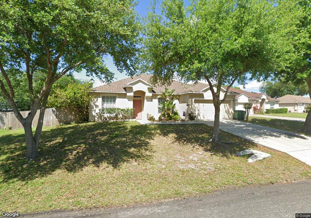
This home is located at 6700 Cairo Rd, Cocoa, FL 32927 and is currently estimated at $379,930, approximately $181 per square foot. 6700 Cairo Rd is a home located in Brevard County with nearby schools including Enterprise Elementary School, Space Coast Junior/Senior High School, and Sculptor Charter School.
Ownership History
Date
Name
Owned For
Owner Type
Purchase Details
Closed on
Jun 15, 2018
Sold by
Germain Michael St and Lessey Jo Ella
Bought by
Germain Michael St and Germain Crystal St
Current Estimated Value
Purchase Details
Closed on
Feb 14, 2012
Sold by
St German Michael J and Riley Sarah Theresa
Bought by
St Germain Michael J
Purchase Details
Closed on
Sep 28, 2009
Sold by
Suntrust Mortgage Inc
Bought by
Lessey Joseph A and Lessey Jo Ella
Home Financials for this Owner
Home Financials are based on the most recent Mortgage that was taken out on this home.
Original Mortgage
$138,430
Interest Rate
5.1%
Purchase Details
Closed on
Feb 12, 2009
Sold by
Despain Brenda
Bought by
Suntrust Mortgage Inc
Purchase Details
Closed on
Feb 20, 2007
Sold by
Sine Gerald
Bought by
Despain Brenda
Purchase Details
Closed on
Feb 22, 2006
Sold by
Mercedes Homes Inc
Bought by
Despain Brenda
Home Financials for this Owner
Home Financials are based on the most recent Mortgage that was taken out on this home.
Original Mortgage
$194,350
Interest Rate
7.87%
Purchase Details
Closed on
May 3, 2005
Sold by
Duke Properties & Investments Inc
Bought by
Mercedes Homes Inc
Home Financials for this Owner
Home Financials are based on the most recent Mortgage that was taken out on this home.
Original Mortgage
$31,200
Interest Rate
5.54%
Purchase Details
Closed on
Mar 15, 2005
Sold by
Bridges Steven D and Diversified Trust
Bought by
Duke Properties & Investments Inc
Home Financials for this Owner
Home Financials are based on the most recent Mortgage that was taken out on this home.
Original Mortgage
$31,200
Interest Rate
5.54%
Create a Home Valuation Report for This Property
The Home Valuation Report is an in-depth analysis detailing your home's value as well as a comparison with similar homes in the area
Home Values in the Area
Average Home Value in this Area
Purchase History
| Date | Buyer | Sale Price | Title Company |
|---|---|---|---|
| Germain Michael St | $128,000 | Attorney | |
| St Germain Michael J | -- | Attorney | |
| Lessey Joseph A | $141,000 | Attorney | |
| Suntrust Mortgage Inc | $231,900 | Attorney | |
| Despain Brenda | -- | Attorney | |
| Despain Brenda | $243,000 | B D R Title | |
| Mercedes Homes Inc | $64,500 | B D R Title | |
| Duke Properties & Investments Inc | $39,000 | Liberty Title |
Source: Public Records
Mortgage History
| Date | Status | Borrower | Loan Amount |
|---|---|---|---|
| Previous Owner | Lessey Joseph A | $138,430 | |
| Previous Owner | Despain Brenda | $194,350 | |
| Previous Owner | Duke Properties & Investments Inc | $31,200 |
Source: Public Records
Tax History
| Year | Tax Paid | Tax Assessment Tax Assessment Total Assessment is a certain percentage of the fair market value that is determined by local assessors to be the total taxable value of land and additions on the property. | Land | Improvement |
|---|---|---|---|---|
| 2025 | $3,051 | $231,830 | -- | -- |
| 2024 | $3,006 | $225,300 | -- | -- |
| 2023 | $3,006 | $218,740 | -- | -- |
| 2022 | $2,819 | $212,370 | $0 | $0 |
| 2021 | $2,880 | $206,190 | $0 | $0 |
| 2020 | $2,821 | $203,350 | $0 | $0 |
| 2019 | $2,771 | $198,780 | $35,000 | $163,780 |
| 2018 | $3,085 | $186,820 | $27,000 | $159,820 |
| 2017 | $2,968 | $173,490 | $24,000 | $149,490 |
| 2016 | $2,790 | $150,450 | $18,000 | $132,450 |
| 2015 | $2,668 | $126,810 | $15,000 | $111,810 |
| 2014 | $2,433 | $115,290 | $11,000 | $104,290 |
Source: Public Records
Map
Nearby Homes
- 6760 Cairo Rd
- 6815 Bryant Rd
- 6615 Dock Ave
- 00 Unknown
- 7065 Hundred Acre Dr
- 6450 Ember Ave
- 5555 Brandon St
- 5155 Mayflower St
- 6990 Bryant Rd
- 6581 Bancroft Ave
- 6620 Grissom Pkwy
- 5075 Carter St
- 5165 Patricia St
- 5080 Mayflower St
- 6481 La Brea Ave
- 0000 Grissom Pkwy
- 6398 Cable Ave
- 6438 Hudson Rd
- 5680 Brandon St
- 6375 Cable Ave
Your Personal Tour Guide
Ask me questions while you tour the home.