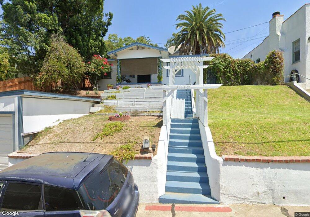
6738 Stanford Way Whittier, CA 90601
Whittier College NeighborhoodEstimated Value: $614,000 - $754,000
3
Beds
1
Bath
963
Sq Ft
$718/Sq Ft
Est. Value
About This Home
This home is located at 6738 Stanford Way, Whittier, CA 90601 and is currently estimated at $691,686, approximately $718 per square foot. 6738 Stanford Way is a home located in Los Angeles County with nearby schools including Lou Henry Hoover Elementary School, Walter F. Dexter Middle School, and Whittier High School.
Ownership History
Date
Name
Owned For
Owner Type
Purchase Details
Closed on
Jun 1, 2018
Sold by
Lucero Lisa Marie
Bought by
Lucero Barney Dismas and Lisa Marie Lucero Individual Trust
Current Estimated Value
Purchase Details
Closed on
Dec 22, 2017
Sold by
Lucer
Bought by
Lucer
Home Financials for this Owner
Home Financials are based on the most recent Mortgage that was taken out on this home.
Interest Rate
3.94%
Create a Home Valuation Report for This Property
The Home Valuation Report is an in-depth analysis detailing your home's value as well as a comparison with similar homes in the area
Home Values in the Area
Average Home Value in this Area
Purchase History
| Date | Buyer | Sale Price | Title Company |
|---|---|---|---|
| Lucero Barney Dismas | -- | None Available | |
| Lucer | -- | -- |
Source: Public Records
Mortgage History
| Date | Status | Borrower | Loan Amount |
|---|---|---|---|
| Closed | Lucer | -- |
Source: Public Records
Tax History Compared to Growth
Tax History
| Year | Tax Paid | Tax Assessment Tax Assessment Total Assessment is a certain percentage of the fair market value that is determined by local assessors to be the total taxable value of land and additions on the property. | Land | Improvement |
|---|---|---|---|---|
| 2025 | $2,266 | $156,150 | $114,193 | $41,957 |
| 2024 | $2,266 | $153,089 | $111,954 | $41,135 |
| 2023 | $2,509 | $150,088 | $109,759 | $40,329 |
| 2022 | $2,326 | $147,146 | $107,607 | $39,539 |
| 2021 | $2,345 | $144,262 | $105,498 | $38,764 |
| 2019 | $2,142 | $139,985 | $102,370 | $37,615 |
| 2018 | $2,228 | $137,241 | $100,363 | $36,878 |
| 2016 | $2,095 | $131,914 | $96,467 | $35,447 |
| 2015 | $2,043 | $129,933 | $95,018 | $34,915 |
| 2014 | $2,045 | $127,389 | $93,157 | $34,232 |
Source: Public Records
Map
Nearby Homes
- 13707 Philadelphia St
- 7013 Hillside Ln
- 6769 Hillside Ln
- 6723 Hillside Ln
- 13664 Earlham Dr
- 13751 Penn St
- 13513 Penn St
- 7032 Washington Ave
- 6233 Haviland Ave
- 13733 Franklin St
- 6256 Friends Ave
- 7251 Painter Ave Unit 7255
- 13517 Franklin St
- 6231 Painter Ave
- 7052 Bright Ave
- 7339 College Ave
- 13867 Philadelphia St
- 6226 Washington Ave
- 13702 Mar Vista St
- 13570 Turnbull Canyon Rd
- 6742 Stanford Place
- 6732 Stanford Way
- 6741 Stanford Way
- 6728 Stanford Way
- 6736 Stanford Place
- 6744 Stanford Place
- 13536 Olive Dr Unit A-D
- 13536 Olive Dr
- 6724 Stanford Way
- 13611 Philadelphia St
- 13607 Philadelphia St
- 13530 Olive Dr
- 13601 Philadelphia St
- 6720 Stanford Way
- 6728 Stanford Place
- 13526 Olive Dr
- 13701 Glen Ct
- 13522 Olive Dr
- 13541 Olive Dr
- 13545 Olive Dr