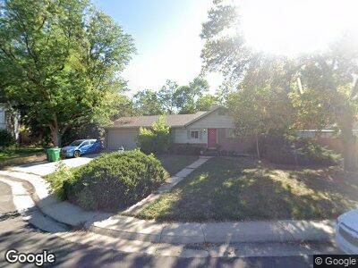
675 W Davies Ct Littleton, CO 80120
Heritage NeighborhoodEstimated Value: $586,000 - $619,000
3
Beds
4
Baths
828
Sq Ft
$731/Sq Ft
Est. Value
About This Home
This home is located at 675 W Davies Ct, Littleton, CO 80120 and is currently estimated at $605,588, approximately $731 per square foot. 675 W Davies Ct is a home located in Arapahoe County with nearby schools including Runyon Elementary School, Euclid Middle School, and Heritage High School.
Ownership History
Date
Name
Owned For
Owner Type
Purchase Details
Closed on
Jun 2, 2014
Sold by
Kancir Paul A
Bought by
Ozbun Kathleen R
Current Estimated Value
Purchase Details
Closed on
Apr 29, 1997
Sold by
Kancir John W & Joy A Living Trust
Bought by
Kancir Paul A
Home Financials for this Owner
Home Financials are based on the most recent Mortgage that was taken out on this home.
Original Mortgage
$114,900
Interest Rate
7.92%
Purchase Details
Closed on
Nov 26, 1996
Sold by
Kancir John W
Bought by
John W & Joy A Kancir Living Trust
Purchase Details
Closed on
Jul 4, 1776
Bought by
Conversion Arapco
Create a Home Valuation Report for This Property
The Home Valuation Report is an in-depth analysis detailing your home's value as well as a comparison with similar homes in the area
Home Values in the Area
Average Home Value in this Area
Purchase History
| Date | Buyer | Sale Price | Title Company |
|---|---|---|---|
| Ozbun Kathleen R | $285,000 | Capital Title | |
| Kancir Paul A | $118,500 | North American Title | |
| John W & Joy A Kancir Living Trust | -- | -- | |
| Conversion Arapco | -- | -- |
Source: Public Records
Mortgage History
| Date | Status | Borrower | Loan Amount |
|---|---|---|---|
| Previous Owner | Kancir Paul A | $98,000 | |
| Previous Owner | Kancir Paul A | $98,379 | |
| Previous Owner | Kancir Paul A | $41,400 | |
| Previous Owner | Kancir Paul A | $30,000 | |
| Previous Owner | Kancir Paul A | $119,200 | |
| Previous Owner | Kancir Paul A | $114,900 |
Source: Public Records
Tax History Compared to Growth
Tax History
| Year | Tax Paid | Tax Assessment Tax Assessment Total Assessment is a certain percentage of the fair market value that is determined by local assessors to be the total taxable value of land and additions on the property. | Land | Improvement |
|---|---|---|---|---|
| 2024 | $3,518 | $36,790 | -- | -- |
| 2023 | $3,518 | $36,790 | $0 | $0 |
| 2022 | $3,136 | $30,886 | $0 | $0 |
| 2021 | $3,127 | $30,886 | $0 | $0 |
| 2020 | $3,333 | $29,737 | $0 | $0 |
| 2019 | $3,133 | $29,737 | $0 | $0 |
| 2018 | $2,575 | $25,330 | $0 | $0 |
| 2017 | $2,412 | $25,330 | $0 | $0 |
| 2016 | $2,152 | $21,333 | $0 | $0 |
| 2015 | $2,149 | $21,333 | $0 | $0 |
| 2014 | -- | $15,856 | $0 | $0 |
| 2013 | -- | $16,970 | $0 | $0 |
Source: Public Records
Map
Nearby Homes
- 7406 S Elati St
- 7167 S Acoma St
- 6930 S Delaware St
- 8 Lindenwood Dr
- 7256 S Broadway
- 1275 W Hinsdale Dr
- 794 W Elati Cir
- 824 W Geddes Cir
- 112 W Sterne Pkwy Unit 112
- 6930 S Broadway
- 6838 S Broadway
- 164 W Acoma Dr
- 6844 S Broadway
- 784 W Sterne Pkwy
- 50 E Highline Cir Unit 101
- 50 E Highline Cir Unit 102
- 1540 W Briarwood Ave
- 7019 S Windermere St
- 100 E Highline Cir Unit 105
- 100 E Highline Cir Unit 307
- 675 W Davies Ct
- 695 W Davies Ct
- 655 W Davies Ct
- 615 W Davies Way
- 635 W Davies Way
- 605 W Davies Way
- 705 W Davies Ct
- 707 W Davies Way
- 7250 S Sundown Cir
- 703 W Davies Ct
- 7248 S Sundown Cir
- 7255 S Sundown Cir
- 737 W Davies Way
- 595 W Davies Way
- 7257 S Sundown Cir
- 606 W Davies Way
- 686 W Davies Way
- 676 W Davies Way
- 586 W Davies Way
- 706 W Davies Way