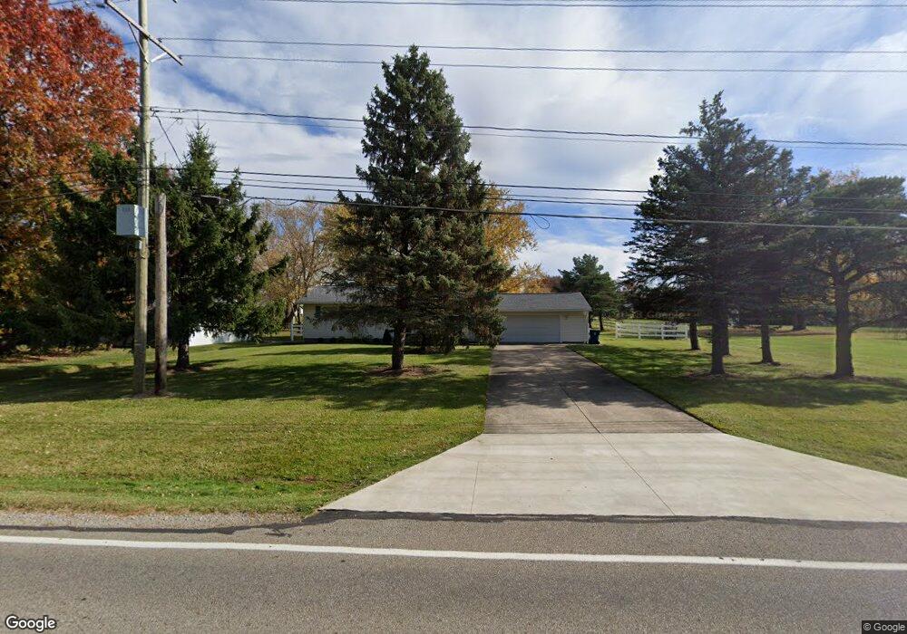
679 Substation Rd Brunswick, OH 44212
Estimated Value: $244,000 - $285,544
3
Beds
1
Bath
1,565
Sq Ft
$170/Sq Ft
Est. Value
About This Home
This home is located at 679 Substation Rd, Brunswick, OH 44212 and is currently estimated at $266,636, approximately $170 per square foot. 679 Substation Rd is a home located in Medina County with nearby schools including Hickory Ridge Elementary School, Willets Middle School, and Brunswick High School.
Ownership History
Date
Name
Owned For
Owner Type
Purchase Details
Closed on
May 16, 2024
Sold by
Millam Samuel Dean and Millam Seth Daniel
Bought by
Dolores M Taylor Family Trust and Kuchta
Current Estimated Value
Purchase Details
Closed on
Aug 28, 2003
Sold by
Clark Linda J
Bought by
Millam Samuel D
Home Financials for this Owner
Home Financials are based on the most recent Mortgage that was taken out on this home.
Original Mortgage
$135,950
Interest Rate
5.69%
Mortgage Type
VA
Create a Home Valuation Report for This Property
The Home Valuation Report is an in-depth analysis detailing your home's value as well as a comparison with similar homes in the area
Home Values in the Area
Average Home Value in this Area
Purchase History
| Date | Buyer | Sale Price | Title Company |
|---|---|---|---|
| Dolores M Taylor Family Trust | $245,000 | Ohio First Land Title | |
| Millam Samuel D | -- | Executive Title |
Source: Public Records
Mortgage History
| Date | Status | Borrower | Loan Amount |
|---|---|---|---|
| Previous Owner | Millam Samuel D | $135,950 |
Source: Public Records
Tax History Compared to Growth
Tax History
| Year | Tax Paid | Tax Assessment Tax Assessment Total Assessment is a certain percentage of the fair market value that is determined by local assessors to be the total taxable value of land and additions on the property. | Land | Improvement |
|---|---|---|---|---|
| 2024 | $3,385 | $60,000 | $25,090 | $34,910 |
| 2023 | $3,385 | $60,000 | $25,090 | $34,910 |
| 2022 | $3,215 | $60,000 | $25,090 | $34,910 |
| 2021 | $2,855 | $46,880 | $19,600 | $27,280 |
| 2020 | $2,593 | $46,880 | $19,600 | $27,280 |
| 2019 | $2,594 | $46,880 | $19,600 | $27,280 |
| 2018 | $2,424 | $42,160 | $17,810 | $24,350 |
| 2017 | $2,427 | $42,160 | $17,810 | $24,350 |
| 2016 | $2,426 | $42,160 | $17,810 | $24,350 |
| 2015 | $2,279 | $39,770 | $16,800 | $22,970 |
| 2014 | $2,274 | $39,770 | $16,800 | $22,970 |
| 2013 | $2,278 | $39,770 | $16,800 | $22,970 |
Source: Public Records
Map
Nearby Homes
- 4949 Orchard Dr
- 4723 Baywood Dr
- 4893 Grafton Rd
- 4913 Fallen Leaf Trail
- 4910 Fallen Leaf Trail
- 642 Topaz Ln
- 833 Substation Rd
- 841 Substation Rd
- 573 Oakhurst Dr
- 786 Pepperwood Dr
- 5045 Grafton Rd
- 892 Crabapple Dr
- 5046 Forestland Ct
- 4928 Treeline Dr
- 660 Marsh Way
- 626 Juniper Ln
- 4647 Boxwood Dr
- 4626 Ruby Ln
- 4597 Brushwood Cir
- 959 Overton Dr
- 669 Substation Rd
- 699 Substation Rd
- 659 Substation Rd
- 709 Substation Rd
- 651 Substation Rd
- 4816 Aldersyde Cir
- 4810 Aldersyde Cir
- 678 Substation Rd
- 4804 Aldersyde Cir
- 719 Substation Rd
- 668 Substation Rd
- 4819 Aldersyde Cir
- 696 Substation Rd
- 4873 Cabernet Dr
- 641 Substation Rd
- 4813 Baywood Dr
- 4819 Baywood Dr
- 644 Substation Rd
- 4796 Aldersyde Cir
- 4883 Cabernet Dr