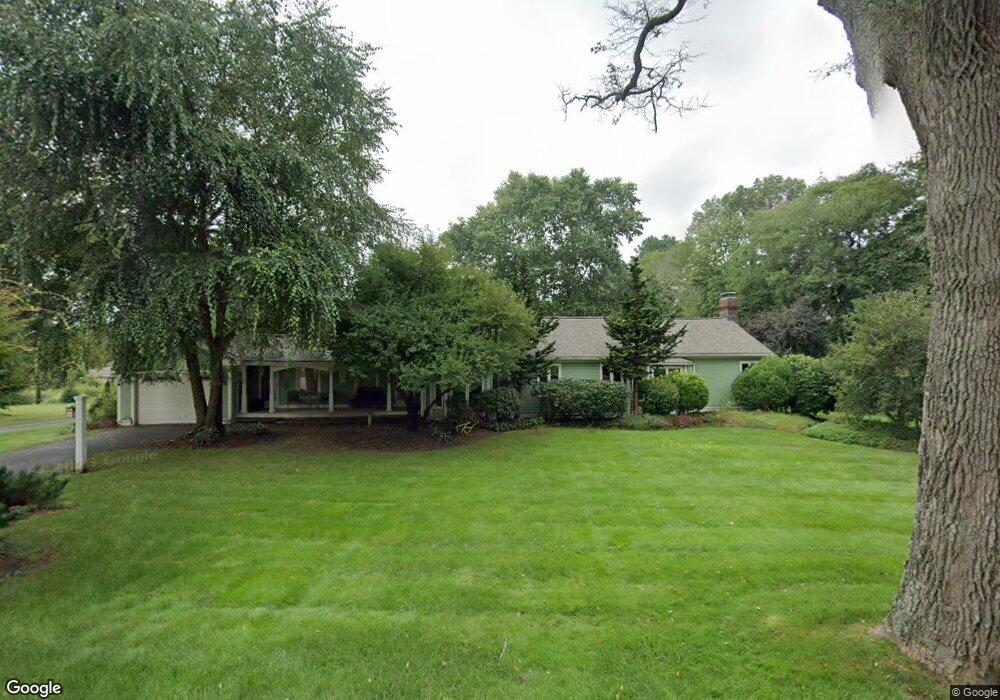
68 Daniels St Franklin, MA 02038
Estimated Value: $838,805 - $890,000
3
Beds
2
Baths
2,736
Sq Ft
$316/Sq Ft
Est. Value
About This Home
This home is located at 68 Daniels St, Franklin, MA 02038 and is currently estimated at $865,451, approximately $316 per square foot. 68 Daniels St is a home located in Norfolk County with nearby schools including Helen Keller Elementary School, Annie Sullivan Middle School, and Franklin High School.
Ownership History
Date
Name
Owned For
Owner Type
Purchase Details
Closed on
Mar 19, 2021
Sold by
Livingstone Jeffrey R
Bought by
Livingstone Ft and Livingstone
Current Estimated Value
Home Financials for this Owner
Home Financials are based on the most recent Mortgage that was taken out on this home.
Original Mortgage
$374,474
Outstanding Balance
$333,988
Interest Rate
2.8%
Mortgage Type
New Conventional
Estimated Equity
$531,463
Purchase Details
Closed on
Sep 23, 2014
Sold by
Livingstone Jeffrey R
Bought by
Livingstone Ft and Livingstone
Home Financials for this Owner
Home Financials are based on the most recent Mortgage that was taken out on this home.
Original Mortgage
$360,000
Interest Rate
4.14%
Mortgage Type
New Conventional
Purchase Details
Closed on
Sep 12, 2011
Sold by
Livingstone Jeff R
Bought by
Livingstone Ft and Livingstone
Purchase Details
Closed on
Apr 30, 2009
Sold by
Mccarthy Paul and Mccarthy Susan
Bought by
Livingstone Jeffrey R
Home Financials for this Owner
Home Financials are based on the most recent Mortgage that was taken out on this home.
Original Mortgage
$348,000
Interest Rate
4.86%
Mortgage Type
Purchase Money Mortgage
Purchase Details
Closed on
Jun 28, 2005
Sold by
Bianchi Janine M and Ray Janine M
Bought by
Mccarthy Paul and Mccarthy Susan
Purchase Details
Closed on
Nov 14, 2002
Sold by
Lerner Nelson M and Lerner Laurie I
Bought by
Ray Janine M
Purchase Details
Closed on
Jul 30, 1998
Sold by
Richardson Marc A and Richardson Samantha A
Bought by
Rhodes Laurie I
Create a Home Valuation Report for This Property
The Home Valuation Report is an in-depth analysis detailing your home's value as well as a comparison with similar homes in the area
Purchase History
| Date | Buyer | Sale Price | Title Company |
|---|---|---|---|
| Livingstone Ft | -- | None Available | |
| Livingstone Jeffrey R | -- | None Available | |
| Livingstone Ft | -- | -- | |
| Livingstone Jeffrey R | -- | -- | |
| Livingstone Ft | -- | -- | |
| Livingstone Jeffrey R | -- | -- | |
| Livingstone Ft | -- | -- | |
| Livingstone Ft | -- | -- | |
| Livingstone Jeffrey R | $435,000 | -- | |
| Livingstone Jeffrey R | $435,000 | -- | |
| Mccarthy Paul | $400,000 | -- | |
| Mccarthy Paul | $400,000 | -- | |
| Ray Janine M | $330,000 | -- | |
| Ray Janine M | $330,000 | -- | |
| Rhodes Laurie I | $178,000 | -- | |
| Rhodes Laurie I | $178,000 | -- |
Source: Public Records
Mortgage History
| Date | Status | Borrower | Loan Amount |
|---|---|---|---|
| Open | Livingstone Ft | $374,474 | |
| Previous Owner | Livingstone Ft | $360,000 | |
| Previous Owner | Livingstone Jeffrey R | $348,000 |
Source: Public Records
Tax History
| Year | Tax Paid | Tax Assessment Tax Assessment Total Assessment is a certain percentage of the fair market value that is determined by local assessors to be the total taxable value of land and additions on the property. | Land | Improvement |
|---|---|---|---|---|
| 2025 | $8,679 | $746,900 | $333,000 | $413,900 |
| 2024 | $8,627 | $731,700 | $333,000 | $398,700 |
| 2023 | $8,351 | $663,800 | $283,900 | $379,900 |
| 2022 | $7,570 | $538,800 | $223,500 | $315,300 |
| 2021 | $7,562 | $516,200 | $251,000 | $265,200 |
| 2020 | $7,158 | $493,300 | $240,700 | $252,600 |
| 2019 | $7,079 | $482,900 | $230,400 | $252,500 |
| 2018 | $6,587 | $449,600 | $222,200 | $227,400 |
| 2017 | $6,315 | $433,100 | $205,700 | $227,400 |
| 2016 | $6,165 | $425,200 | $220,600 | $204,600 |
| 2015 | $6,147 | $414,200 | $209,600 | $204,600 |
| 2014 | $5,612 | $388,400 | $183,800 | $204,600 |
Source: Public Records
Map
Nearby Homes
- 100 Daniels St
- 91 Oliver Pond Cir Unit 3
- 83 Oliver Pond Cir Unit 7
- 24 Leanne Way Unit 24
- 99 Leland Rd
- 72 Skyline Dr
- 10 Populatic Street Extension
- 254 Daniels St
- 27 Dover Cir
- 41 Kimberlee Ave
- 29 Elm St
- 204 Lincoln St
- 40 Lakeshore Dr
- 48 Dover Cir
- 839 Lincoln St
- 12 Ariana Ln
- 29 Hancock Rd
- 12 Harborwood Dr
- 6 Lydia Ln
- 17 Longhill Rd
Your Personal Tour Guide
Ask me questions while you tour the home.