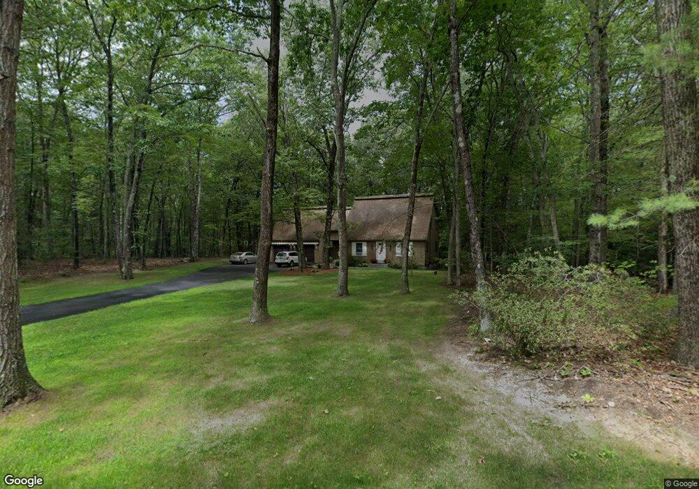
68 Truell Rd Hollis, NH 03049
Hollis NeighborhoodEstimated Value: $694,598 - $831,000
4
Beds
3
Baths
2,500
Sq Ft
$296/Sq Ft
Est. Value
About This Home
This home is located at 68 Truell Rd, Hollis, NH 03049 and is currently estimated at $739,400, approximately $295 per square foot. 68 Truell Rd is a home located in Hillsborough County with nearby schools including Hollis Primary School, Hollis Upper Elementary School, and Hollis-Brookline Middle School.
Ownership History
Date
Name
Owned For
Owner Type
Purchase Details
Closed on
May 29, 2009
Sold by
Crabtree William C
Bought by
Gillis Kyle D and Gillis Shelly K
Current Estimated Value
Home Financials for this Owner
Home Financials are based on the most recent Mortgage that was taken out on this home.
Original Mortgage
$355,352
Interest Rate
4.87%
Mortgage Type
Purchase Money Mortgage
Create a Home Valuation Report for This Property
The Home Valuation Report is an in-depth analysis detailing your home's value as well as a comparison with similar homes in the area
Home Values in the Area
Average Home Value in this Area
Purchase History
| Date | Buyer | Sale Price | Title Company |
|---|---|---|---|
| Gillis Kyle D | $345,300 | -- |
Source: Public Records
Mortgage History
| Date | Status | Borrower | Loan Amount |
|---|---|---|---|
| Open | Gillis Kyle D | $345,987 | |
| Closed | Gillis Kyle D | $355,352 | |
| Previous Owner | Gillis Kyle D | $74,500 |
Source: Public Records
Tax History Compared to Growth
Tax History
| Year | Tax Paid | Tax Assessment Tax Assessment Total Assessment is a certain percentage of the fair market value that is determined by local assessors to be the total taxable value of land and additions on the property. | Land | Improvement |
|---|---|---|---|---|
| 2024 | $10,014 | $564,800 | $276,900 | $287,900 |
| 2023 | $9,410 | $564,800 | $276,900 | $287,900 |
| 2022 | $12,748 | $564,800 | $276,900 | $287,900 |
| 2021 | $7,670 | $337,900 | $164,600 | $173,300 |
| 2020 | $7,833 | $337,900 | $164,600 | $173,300 |
| 2019 | $9,071 | $337,900 | $164,600 | $173,300 |
| 2018 | $7,322 | $337,900 | $164,600 | $173,300 |
| 2017 | $7,237 | $312,600 | $144,600 | $168,000 |
| 2016 | $8,537 | $312,600 | $144,600 | $168,000 |
| 2015 | $7,196 | $312,600 | $144,600 | $168,000 |
| 2014 | $7,230 | $312,600 | $144,600 | $168,000 |
| 2013 | $7,134 | $312,600 | $144,600 | $168,000 |
Source: Public Records
Map
Nearby Homes
- 77 Mooar Hill Rd
- 4-13 Woodmont Dr
- 25 Eastern Ave
- 16 Captain Danforth Ln
- 172 Hayden Rd
- 6 Veterans Rd Unit 15
- 102 Silver Lake Rd
- 3 Wood Ln
- 8 Carriage Ln
- 40-40A Pine Hill Rd
- 77 Broad St
- 12 Fairway Dr
- 36 Berkeley Place
- 118 Broad St
- 686 Route 13 S
- 199 Pine Hill Rd
- 3 Roedean Dr Unit C-207
- 15 Four Winds Rd
- 201 Millwright Dr
- 75 Deerwood Dr Unit B