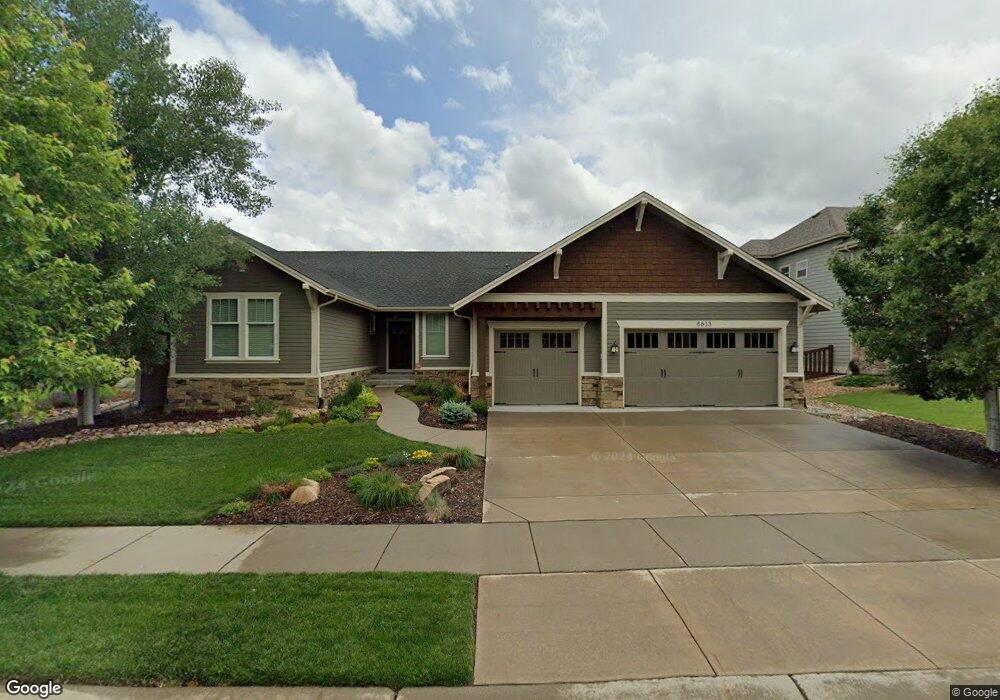
6813 Silver Dollar Ct Timnath, CO 80547
Estimated Value: $816,000 - $1,132,000
3
Beds
4
Baths
4,673
Sq Ft
$205/Sq Ft
Est. Value
About This Home
This home is located at 6813 Silver Dollar Ct, Timnath, CO 80547 and is currently estimated at $960,243, approximately $205 per square foot. 6813 Silver Dollar Ct is a home located in Larimer County with nearby schools including Bethke Elementary School.
Ownership History
Date
Name
Owned For
Owner Type
Purchase Details
Closed on
Jan 26, 2015
Sold by
Matson James G and Matson Joanne E
Bought by
Matson James G and Matson Joanne E
Current Estimated Value
Purchase Details
Closed on
Mar 26, 2013
Sold by
Matson James G and Matson Joanne E
Bought by
Matson James G and Matson Joanne E
Purchase Details
Closed on
Mar 31, 2011
Sold by
Stonefield Homes Llc
Bought by
Matson James G and Matson Joanne E
Home Financials for this Owner
Home Financials are based on the most recent Mortgage that was taken out on this home.
Original Mortgage
$370,000
Outstanding Balance
$243,889
Interest Rate
3.87%
Mortgage Type
New Conventional
Estimated Equity
$716,354
Create a Home Valuation Report for This Property
The Home Valuation Report is an in-depth analysis detailing your home's value as well as a comparison with similar homes in the area
Home Values in the Area
Average Home Value in this Area
Purchase History
| Date | Buyer | Sale Price | Title Company |
|---|---|---|---|
| Matson James G | -- | None Available | |
| Matson James G | -- | None Available | |
| Matson James G | $519,900 | Land Title Guarantee Company |
Source: Public Records
Mortgage History
| Date | Status | Borrower | Loan Amount |
|---|---|---|---|
| Open | Matson James G | $370,000 |
Source: Public Records
Tax History Compared to Growth
Tax History
| Year | Tax Paid | Tax Assessment Tax Assessment Total Assessment is a certain percentage of the fair market value that is determined by local assessors to be the total taxable value of land and additions on the property. | Land | Improvement |
|---|---|---|---|---|
| 2025 | $8,238 | $66,337 | $16,750 | $49,587 |
| 2024 | $7,981 | $66,337 | $16,750 | $49,587 |
| 2022 | $6,271 | $50,770 | $14,560 | $36,210 |
| 2021 | $7,378 | $52,231 | $14,979 | $37,252 |
| 2020 | $6,970 | $49,063 | $13,013 | $36,050 |
| 2019 | $6,990 | $49,063 | $13,013 | $36,050 |
| 2018 | $6,035 | $44,496 | $6,264 | $38,232 |
| 2017 | $6,021 | $44,496 | $6,264 | $38,232 |
| 2016 | $6,160 | $45,372 | $6,925 | $38,447 |
| 2015 | $6,132 | $47,840 | $6,930 | $40,910 |
| 2014 | $5,619 | $41,390 | $7,400 | $33,990 |
Source: Public Records
Map
Nearby Homes
- 6750 Rock River Rd
- 6748 Rainier Rd
- 6794 Spring Rain Rd
- 6770 Spring Rain Rd
- 5865 Quarry St
- 5793 Quarry St
- 5606 Calgary St
- 5543 Calgary St
- 5536 Long Dr
- 6747 Grainery Rd
- 6816 Covenant Ct
- 5622 Foxfire St
- 5894 Graphite St
- 6604 Neota Creek Ct
- 6420 Tuxedo Park Rd
- 6504 Zimmerman Lake Rd
- 6117 Gold Dust Rd
- 5801 Dressage St
- 5317 School House Dr
- 5267 School House Dr
- 6833 Silver Dollar Ct
- 6793 Silver Dollar Ct
- 6832 Silver Dollar Ct
- 6812 Silver Dollar Ct
- 6853 Silver Dollar Ct
- 6792 Silver Dollar Ct
- 6773 Silver Dollar Ct
- 6872 Silver Dollar Ct
- 6852 Silver Dollar Ct
- 6702 Rock River Rd
- 6810 Rock River Rd
- 6772 Silver Dollar Ct
- 6822 Rock River Rd
- 6798 Rock River Rd
- 6834 Rock River Rd
- 6791 Duncan Ct
- 6846 Rock River Rd
- 6774 Rock River Rd
- 6786 Rock River Rd
- 6771 Duncan Ct