Estimated Value: $304,000 - $341,000
3
Beds
2
Baths
1,600
Sq Ft
$200/Sq Ft
Est. Value
About This Home
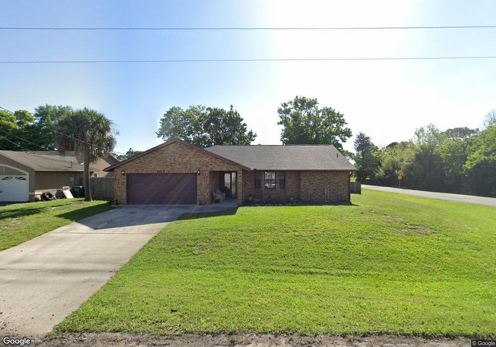
This home is located at 6815 Cairo Rd, Cocoa, FL 32927 and is currently estimated at $319,944, approximately $199 per square foot. 6815 Cairo Rd is a home located in Brevard County with nearby schools including Enterprise Elementary School, Space Coast Junior/Senior High School, and Sculptor Charter School.
Ownership History
Date
Name
Owned For
Owner Type
Purchase Details
Closed on
Sep 21, 2006
Sold by
King Matthew A and King Betsy A
Bought by
King Betsy A
Current Estimated Value
Home Financials for this Owner
Home Financials are based on the most recent Mortgage that was taken out on this home.
Original Mortgage
$100,000
Outstanding Balance
$59,430
Interest Rate
6.48%
Estimated Equity
$260,514
Create a Home Valuation Report for This Property
The Home Valuation Report is an in-depth analysis detailing your home's value as well as a comparison with similar homes in the area
Home Values in the Area
Average Home Value in this Area
Purchase History
| Date | Buyer | Sale Price | Title Company |
|---|---|---|---|
| King Betsy A | -- | Countywide Title & Escrow Co |
Source: Public Records
Mortgage History
| Date | Status | Borrower | Loan Amount |
|---|---|---|---|
| Open | King Betsy A | $100,000 |
Source: Public Records
Tax History
| Year | Tax Paid | Tax Assessment Tax Assessment Total Assessment is a certain percentage of the fair market value that is determined by local assessors to be the total taxable value of land and additions on the property. | Land | Improvement |
|---|---|---|---|---|
| 2025 | $1,257 | $90,010 | -- | -- |
| 2024 | $1,220 | $87,480 | -- | -- |
| 2023 | $1,220 | $84,940 | $0 | $0 |
| 2022 | $1,135 | $82,470 | $0 | $0 |
| 2021 | $1,124 | $80,070 | $0 | $0 |
| 2020 | $1,059 | $78,970 | $0 | $0 |
| 2019 | $993 | $77,200 | $0 | $0 |
| 2018 | $983 | $75,770 | $0 | $0 |
| 2017 | $977 | $74,220 | $0 | $0 |
| 2016 | $986 | $72,700 | $18,000 | $54,700 |
| 2015 | $996 | $72,200 | $15,000 | $57,200 |
| 2014 | $1,001 | $71,630 | $11,000 | $60,630 |
Source: Public Records
Map
Nearby Homes
- 6815 Bryant Rd
- 6760 Cairo Rd
- 5155 Mayflower St
- 7065 Hundred Acre Dr
- 5075 Carter St
- 6615 Dock Ave
- 6990 Bryant Rd
- 5165 Patricia St
- 00 Unknown
- 5555 Brandon St
- 5080 Mayflower St
- 6620 Grissom Pkwy
- 6450 Ember Ave
- 6581 Bancroft Ave
- 7045 Grissom Pkwy
- 0000 Grissom Pkwy
- 5200 Frisco St
- 7155 Export Ave
- 7230 Venus Ave
- 6398 Cable Ave
Your Personal Tour Guide
Ask me questions while you tour the home.