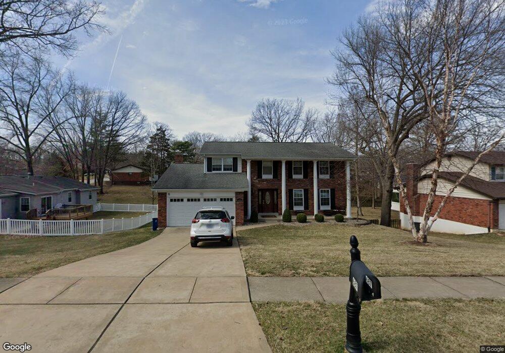
687 Crowsnest Dr Ballwin, MO 63021
Estimated Value: $395,688 - $423,000
4
Beds
3
Baths
2,232
Sq Ft
$184/Sq Ft
Est. Value
About This Home
This home is located at 687 Crowsnest Dr, Ballwin, MO 63021 and is currently estimated at $410,922, approximately $184 per square foot. 687 Crowsnest Dr is a home located in St. Louis County with nearby schools including Ballwin Elementary School, Selvidge Middle School, and Marquette Sr. High School.
Ownership History
Date
Name
Owned For
Owner Type
Purchase Details
Closed on
Mar 27, 2012
Sold by
Brimer Fletcher S and Brimer Jennifer M
Bought by
Brimer Fletcher S and Brimer Jennifer M
Current Estimated Value
Home Financials for this Owner
Home Financials are based on the most recent Mortgage that was taken out on this home.
Original Mortgage
$200,500
Outstanding Balance
$83,191
Interest Rate
3.97%
Mortgage Type
New Conventional
Estimated Equity
$327,731
Purchase Details
Closed on
Apr 14, 2005
Sold by
Vines Johnny J and Vines Linda Kay
Bought by
Brimer Fletcher S
Home Financials for this Owner
Home Financials are based on the most recent Mortgage that was taken out on this home.
Original Mortgage
$199,500
Interest Rate
5.88%
Mortgage Type
Fannie Mae Freddie Mac
Create a Home Valuation Report for This Property
The Home Valuation Report is an in-depth analysis detailing your home's value as well as a comparison with similar homes in the area
Home Values in the Area
Average Home Value in this Area
Purchase History
| Date | Buyer | Sale Price | Title Company |
|---|---|---|---|
| Brimer Fletcher S | -- | Ort | |
| Brimer Fletcher S | $210,000 | -- |
Source: Public Records
Mortgage History
| Date | Status | Borrower | Loan Amount |
|---|---|---|---|
| Open | Brimer Fletcher S | $200,500 | |
| Previous Owner | Brimer Fletcher S | $199,500 |
Source: Public Records
Tax History
| Year | Tax Paid | Tax Assessment Tax Assessment Total Assessment is a certain percentage of the fair market value that is determined by local assessors to be the total taxable value of land and additions on the property. | Land | Improvement |
|---|---|---|---|---|
| 2025 | $4,476 | $64,960 | $22,970 | $41,990 |
| 2024 | $4,476 | $63,970 | $19,150 | $44,820 |
| 2023 | $4,473 | $63,970 | $19,150 | $44,820 |
| 2022 | $4,093 | $54,340 | $19,150 | $35,190 |
| 2021 | $4,063 | $54,340 | $19,150 | $35,190 |
| 2020 | $4,004 | $51,050 | $17,420 | $33,630 |
| 2019 | $4,020 | $51,050 | $17,420 | $33,630 |
| 2018 | $3,738 | $44,740 | $13,600 | $31,140 |
| 2017 | $3,649 | $44,740 | $13,600 | $31,140 |
| 2016 | $3,411 | $40,200 | $9,690 | $30,510 |
Source: Public Records
Map
Nearby Homes
- 756 Alexander Mark Way
- 899 Oklahoma Ave
- 3 Chappel Ct
- 798 Canary Dr
- 429 Fairview Ct
- 729 Tuscan Valley Ct
- 313 Brightfield Dr
- 947 Bellestri Dr
- 313 Saint Lawrence Dr
- 846 Pheasant Woods Dr
- 275 Essen Ct Unit TBB
- 408 Saint Lawrence Dr
- 332 Remington Way Dr
- 401 Hillcrest Blvd
- 237 Ballwin Ave
- 212 Lakeside Dr
- 312 Ballwin Ave
- 215 Straightoak Ct
- 805 Phaeton Dr
- 804 Joyceann Dr
- 679 Crowsnest Dr
- 73 Breezeview Dr
- 682 Amber Jack Dr
- 667 Crowsnest Dr
- 670 Amber Jack Dr
- 85 Breezeview Dr
- 684 Crowsnest Dr
- 688 Crowsnest Dr
- 680 Crowsnest Dr
- 658 Amber Jack Dr
- 655 Crowsnest Dr
- 668 Crowsnest Dr
- 78 Breezeview Dr
- 74 Breezeview Dr
- 696 Crowsnest Dr
- 644 Amber Jack Dr
- 82 Breezeview Dr
- 70 Breezeview Dr
- 855 Reindeer Dr
- 643 Crowsnest Dr
Your Personal Tour Guide
Ask me questions while you tour the home.