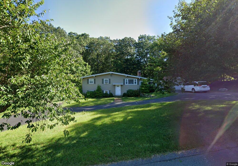
69 Crocker Ave Unit 1 Franklin, MA 02038
Downtown Franklin NeighborhoodEstimated Value: $582,000 - $612,000
3
Beds
2
Baths
1,200
Sq Ft
$495/Sq Ft
Est. Value
About This Home
This home is located at 69 Crocker Ave Unit 1, Franklin, MA 02038 and is currently estimated at $594,197, approximately $495 per square foot. 69 Crocker Ave Unit 1 is a home located in Norfolk County with nearby schools including Remington Middle School, Franklin High School, and Benjamin Franklin Classical Charter Public School.
Ownership History
Date
Name
Owned For
Owner Type
Purchase Details
Closed on
Jul 31, 2017
Sold by
Oloughlin Kevin
Bought by
Chwalek Michael and Chwalek Bridie
Current Estimated Value
Home Financials for this Owner
Home Financials are based on the most recent Mortgage that was taken out on this home.
Original Mortgage
$288,000
Outstanding Balance
$223,044
Interest Rate
3.91%
Mortgage Type
New Conventional
Estimated Equity
$371,153
Purchase Details
Closed on
Sep 3, 2015
Sold by
Bussaglia Susan M and Bussaglia Gerard Sandra
Bought by
Oloughlin Kevin
Home Financials for this Owner
Home Financials are based on the most recent Mortgage that was taken out on this home.
Original Mortgage
$235,400
Interest Rate
4.07%
Mortgage Type
Commercial
Create a Home Valuation Report for This Property
The Home Valuation Report is an in-depth analysis detailing your home's value as well as a comparison with similar homes in the area
Home Values in the Area
Average Home Value in this Area
Purchase History
| Date | Buyer | Sale Price | Title Company |
|---|---|---|---|
| Chwalek Michael | $360,000 | -- | |
| Oloughlin Kevin | $263,000 | -- |
Source: Public Records
Mortgage History
| Date | Status | Borrower | Loan Amount |
|---|---|---|---|
| Open | Chwalek Michael | $288,000 | |
| Previous Owner | Oloughlin Kevin | $235,400 |
Source: Public Records
Tax History Compared to Growth
Tax History
| Year | Tax Paid | Tax Assessment Tax Assessment Total Assessment is a certain percentage of the fair market value that is determined by local assessors to be the total taxable value of land and additions on the property. | Land | Improvement |
|---|---|---|---|---|
| 2025 | $6,596 | $567,600 | $237,000 | $330,600 |
| 2024 | $6,297 | $534,100 | $237,000 | $297,100 |
| 2023 | $6,506 | $517,200 | $258,700 | $258,500 |
| 2022 | $6,019 | $428,400 | $197,500 | $230,900 |
| 2021 | $5,598 | $382,100 | $205,600 | $176,500 |
| 2020 | $5,460 | $376,300 | $207,500 | $168,800 |
| 2019 | $5,140 | $350,600 | $182,000 | $168,600 |
| 2018 | $5,002 | $341,400 | $185,900 | $155,500 |
| 2017 | $4,924 | $337,700 | $182,200 | $155,500 |
| 2016 | $4,708 | $324,700 | $189,200 | $135,500 |
| 2015 | $4,547 | $306,400 | $170,900 | $135,500 |
| 2014 | $4,355 | $301,400 | $165,900 | $135,500 |
Source: Public Records
Map
Nearby Homes
- 82 Uncas Ave Unit 1
- 70 Uncas Ave
- 64 Uncas Ave
- 1 Uncas Ave
- 40 Cross St
- 159 E Central St
- 99 Summer St
- 32 Dale St
- 90 E Central St Unit 103
- 90 E Central St Unit 106
- 90 E Central St Unit 304
- 90 E Central St Unit 202
- 90 E Central St Unit 105
- 90 E Central St Unit 301
- 67 Milliken Ave Unit 22
- 29 Lawrence Dr
- 55 Lawrence Dr Unit 55
- 67 Cottage St
- 76 Dean Ave
- 7 Howard Place