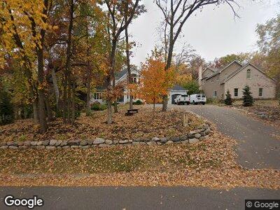
69 Locust St Saint Paul, MN 55115
Estimated Value: $937,000 - $1,240,000
5
Beds
4
Baths
3,169
Sq Ft
$361/Sq Ft
Est. Value
About This Home
This home is located at 69 Locust St, Saint Paul, MN 55115 and is currently estimated at $1,145,188, approximately $361 per square foot. 69 Locust St is a home located in Washington County with nearby schools including O.H. Anderson Elementary School, Wildwood Elementary School, and Mahtomedi Middle School.
Ownership History
Date
Name
Owned For
Owner Type
Purchase Details
Closed on
May 18, 2018
Sold by
Weigel Andrew and Weigel Tami
Bought by
Lallak Daniel Gene and Kresl York Julie Lynn
Current Estimated Value
Home Financials for this Owner
Home Financials are based on the most recent Mortgage that was taken out on this home.
Original Mortgage
$595,200
Interest Rate
4.4%
Mortgage Type
New Conventional
Purchase Details
Closed on
May 15, 2015
Sold by
Reichuber Melvin A and Reichuber Carolyn S
Bought by
Weigel Andrew
Create a Home Valuation Report for This Property
The Home Valuation Report is an in-depth analysis detailing your home's value as well as a comparison with similar homes in the area
Home Values in the Area
Average Home Value in this Area
Purchase History
| Date | Buyer | Sale Price | Title Company |
|---|---|---|---|
| Lallak Daniel Gene | $744,000 | Titlesmart Inc | |
| Weigel Andrew | $647,500 | Partners Title Of North Subu |
Source: Public Records
Mortgage History
| Date | Status | Borrower | Loan Amount |
|---|---|---|---|
| Open | Lallak Daniel Gene | $726,500 | |
| Closed | Kresl Lallak Daniel Gene | $718,000 | |
| Closed | Lallak Daniel Gene | $595,200 | |
| Previous Owner | Reichuber Melvin A | $121,296 |
Source: Public Records
Tax History Compared to Growth
Tax History
| Year | Tax Paid | Tax Assessment Tax Assessment Total Assessment is a certain percentage of the fair market value that is determined by local assessors to be the total taxable value of land and additions on the property. | Land | Improvement |
|---|---|---|---|---|
| 2023 | $10,024 | $841,200 | $244,000 | $597,200 |
| 2022 | $10,398 | $930,900 | $410,400 | $520,500 |
| 2021 | $10,532 | $751,000 | $335,000 | $416,000 |
| 2020 | $10,428 | $782,700 | $348,800 | $433,900 |
| 2019 | $10,186 | $766,400 | $315,500 | $450,900 |
| 2018 | $9,214 | $716,300 | $274,000 | $442,300 |
| 2017 | $8,906 | $689,400 | $254,000 | $435,400 |
| 2016 | $9,208 | $635,400 | $302,000 | $333,400 |
| 2015 | $8,596 | $599,800 | $249,800 | $350,000 |
| 2013 | -- | $589,800 | $225,900 | $363,900 |
Source: Public Records
Map
Nearby Homes
- 69 Locust St
- 84 Kale St
- 150 Locust St
- 33X Park Ave
- 47 Juniper St Unit 47
- 130 Wildwood Bay Dr
- 1918 Mahtomedi Ave
- 153 Wildwood Bay Dr
- 188 Hanson Rd
- 209 Quail St
- xx Iris St
- 230 Wildwood Bay Dr
- 66 Hickory St
- 231 Kenwood St
- 361 Maple St
- xxx Bryant Ave
- 331 Park Ave
- 324 Forest Ave
- XXX 89th St N
- 115 Wildwood Beach Rd