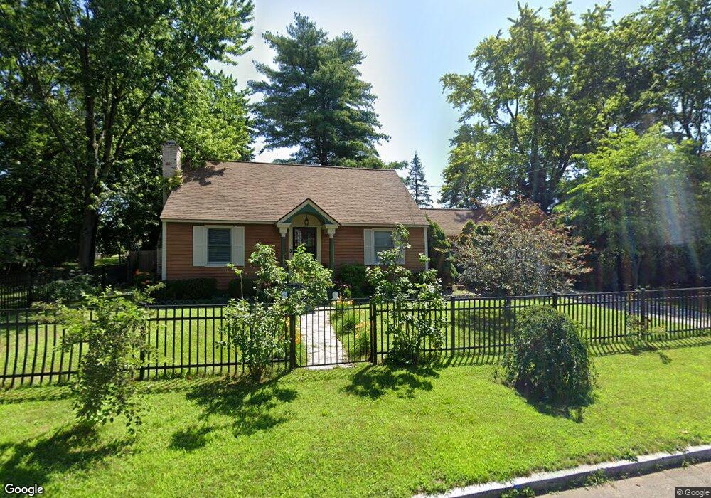
69 Lucerne Rd Springfield, MA 01119
Boston Road NeighborhoodEstimated Value: $296,953 - $339,000
3
Beds
1
Bath
1,434
Sq Ft
$221/Sq Ft
Est. Value
About This Home
This home is located at 69 Lucerne Rd, Springfield, MA 01119 and is currently estimated at $316,488, approximately $220 per square foot. 69 Lucerne Rd is a home located in Hampden County with nearby schools including Warner, M Marcus Kiley Middle, and Springfield Central High School.
Ownership History
Date
Name
Owned For
Owner Type
Purchase Details
Closed on
Jul 9, 1999
Sold by
Robinson Peter C and Robinson Debra M
Bought by
Duncanson Latina D and Duncanson Arlington G
Current Estimated Value
Home Financials for this Owner
Home Financials are based on the most recent Mortgage that was taken out on this home.
Original Mortgage
$84,456
Outstanding Balance
$22,966
Interest Rate
7.19%
Mortgage Type
Purchase Money Mortgage
Estimated Equity
$293,522
Purchase Details
Closed on
Jun 12, 1987
Sold by
Reyes Roberto
Bought by
Robinson Peter C
Home Financials for this Owner
Home Financials are based on the most recent Mortgage that was taken out on this home.
Original Mortgage
$77,800
Interest Rate
10.47%
Mortgage Type
Purchase Money Mortgage
Create a Home Valuation Report for This Property
The Home Valuation Report is an in-depth analysis detailing your home's value as well as a comparison with similar homes in the area
Home Values in the Area
Average Home Value in this Area
Purchase History
| Date | Buyer | Sale Price | Title Company |
|---|---|---|---|
| Duncanson Latina D | $84,500 | -- | |
| Robinson Peter C | $82,500 | -- |
Source: Public Records
Mortgage History
| Date | Status | Borrower | Loan Amount |
|---|---|---|---|
| Open | Robinson Peter C | $84,456 | |
| Previous Owner | Robinson Peter C | $77,800 |
Source: Public Records
Tax History
| Year | Tax Paid | Tax Assessment Tax Assessment Total Assessment is a certain percentage of the fair market value that is determined by local assessors to be the total taxable value of land and additions on the property. | Land | Improvement |
|---|---|---|---|---|
| 2025 | $4,436 | $282,900 | $44,200 | $238,700 |
| 2024 | $4,108 | $255,800 | $41,300 | $214,500 |
| 2023 | $4,349 | $255,100 | $39,300 | $215,800 |
| 2022 | $3,613 | $192,000 | $39,300 | $152,700 |
| 2021 | $3,481 | $184,200 | $35,800 | $148,400 |
| 2020 | $3,304 | $169,200 | $35,800 | $133,400 |
| 2019 | $3,261 | $165,700 | $35,800 | $129,900 |
| 2018 | $3,253 | $162,200 | $35,800 | $126,400 |
| 2017 | $3,124 | $158,900 | $35,800 | $123,100 |
| 2016 | $3,043 | $154,800 | $35,800 | $119,000 |
| 2015 | $2,970 | $151,000 | $35,800 | $115,200 |
Source: Public Records
Map
Nearby Homes
Your Personal Tour Guide
Ask me questions while you tour the home.