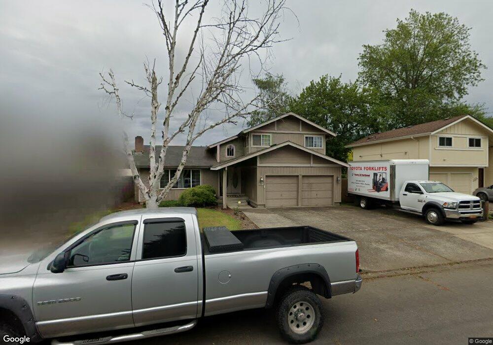
697 N 71st St Springfield, OR 97478
Thurston NeighborhoodEstimated Value: $441,170 - $457,000
3
Beds
2
Baths
1,616
Sq Ft
$278/Sq Ft
Est. Value
About This Home
This home is located at 697 N 71st St, Springfield, OR 97478 and is currently estimated at $449,543, approximately $278 per square foot. 697 N 71st St is a home located in Lane County with nearby schools including Thurston Elementary School, Thurston Middle School, and Thurston High School.
Ownership History
Date
Name
Owned For
Owner Type
Purchase Details
Closed on
Jan 15, 2025
Sold by
Dyson Daniel
Bought by
Bowerman Cody Sage and Stumph Katie Lynn
Current Estimated Value
Home Financials for this Owner
Home Financials are based on the most recent Mortgage that was taken out on this home.
Original Mortgage
$432,030
Outstanding Balance
$428,193
Interest Rate
6.72%
Mortgage Type
FHA
Estimated Equity
$21,350
Purchase Details
Closed on
Dec 11, 2024
Sold by
Dyson Megan Elizabeth
Bought by
Dyson Daniel
Home Financials for this Owner
Home Financials are based on the most recent Mortgage that was taken out on this home.
Original Mortgage
$432,030
Outstanding Balance
$428,193
Interest Rate
6.72%
Mortgage Type
FHA
Estimated Equity
$21,350
Purchase Details
Closed on
Apr 22, 2021
Sold by
Dyson Megan
Bought by
Dyson Daniel
Purchase Details
Closed on
Dec 22, 2020
Sold by
Dyson Megan
Bought by
Dyson Daniel
Purchase Details
Closed on
Apr 5, 2012
Sold by
Dyson Daniel Jonathan and Dyson Megan Elizabeth
Bought by
Dyson Megan Elizabeth
Purchase Details
Closed on
May 12, 2010
Sold by
Culp Michael W and Culp Jennifer R
Bought by
Dyson Daniel J and Dyson Megan E
Home Financials for this Owner
Home Financials are based on the most recent Mortgage that was taken out on this home.
Original Mortgage
$207,209
Interest Rate
5.25%
Mortgage Type
FHA
Purchase Details
Closed on
Sep 26, 2003
Sold by
Matthews Daniel R and Matthews Amy B
Bought by
Culp Michael W and Culp Jennifer R
Home Financials for this Owner
Home Financials are based on the most recent Mortgage that was taken out on this home.
Original Mortgage
$151,757
Interest Rate
6.17%
Mortgage Type
Purchase Money Mortgage
Purchase Details
Closed on
Jan 15, 1998
Sold by
Hiebenthal Douglas D
Bought by
Matthews Daniel R and Matthews Amy B
Home Financials for this Owner
Home Financials are based on the most recent Mortgage that was taken out on this home.
Original Mortgage
$145,656
Interest Rate
7.14%
Mortgage Type
VA
Create a Home Valuation Report for This Property
The Home Valuation Report is an in-depth analysis detailing your home's value as well as a comparison with similar homes in the area
Home Values in the Area
Average Home Value in this Area
Purchase History
| Date | Buyer | Sale Price | Title Company |
|---|---|---|---|
| Bowerman Cody Sage | $440,000 | Cascade Title | |
| Dyson Daniel | -- | Cascade Title | |
| Dyson Daniel | -- | None Listed On Document | |
| Dyson Daniel | -- | None Available | |
| Dyson Megan Elizabeth | -- | None Available | |
| Dyson Daniel J | $210,000 | Fidelity National Title Insu | |
| Culp Michael W | $154,140 | Evergreen Land Title Company | |
| Matthews Daniel R | $142,800 | Evergreen Land Title Co |
Source: Public Records
Mortgage History
| Date | Status | Borrower | Loan Amount |
|---|---|---|---|
| Open | Bowerman Cody Sage | $432,030 | |
| Previous Owner | Dyson Daniel J | $207,209 | |
| Previous Owner | Culp Michael W | $151,757 | |
| Previous Owner | Matthews Daniel R | $145,656 |
Source: Public Records
Tax History
| Year | Tax Paid | Tax Assessment Tax Assessment Total Assessment is a certain percentage of the fair market value that is determined by local assessors to be the total taxable value of land and additions on the property. | Land | Improvement |
|---|---|---|---|---|
| 2025 | $4,381 | $238,898 | -- | -- |
| 2024 | $4,310 | $231,940 | -- | -- |
| 2023 | $4,310 | $225,185 | -- | -- |
| 2022 | $3,992 | $218,627 | $0 | $0 |
| 2021 | $3,920 | $212,260 | $0 | $0 |
| 2020 | $3,806 | $206,078 | $0 | $0 |
| 2019 | $3,691 | $200,076 | $0 | $0 |
| 2018 | $3,479 | $188,591 | $0 | $0 |
| 2017 | $3,346 | $188,591 | $0 | $0 |
| 2016 | $3,275 | $183,098 | $0 | $0 |
| 2015 | $3,182 | $177,765 | $0 | $0 |
| 2014 | $3,134 | $172,587 | $0 | $0 |
Source: Public Records
Map
Nearby Homes
- 0 71st St
- 0 Omlid Dr Unit 1 706471345
- 0 Omlid Dr Unit 27 796722689
- 0 Omlid Dr Unit 26 256458253
- 0 Omlid Dr Unit 3 154724851
- 0 Omlid Dr Unit 2 312357104
- 689 68th Place
- 353 71st St
- 353 72nd St
- 6887 B St
- 6808 Moses Pass
- 250 68th St
- 6981 Main St
- 6964 Bluebelle Way
- 296 S 68th Ct
- 7027 S E St
- 595 S 68th Place
- 0 S 69th Place
- 0 S 73rd St Unit 24191573
- 320 Mountaingate Dr
Your Personal Tour Guide
Ask me questions while you tour the home.