Estimated Value: $232,000 - $283,000
3
Beds
2
Baths
1,092
Sq Ft
$229/Sq Ft
Est. Value
About This Home
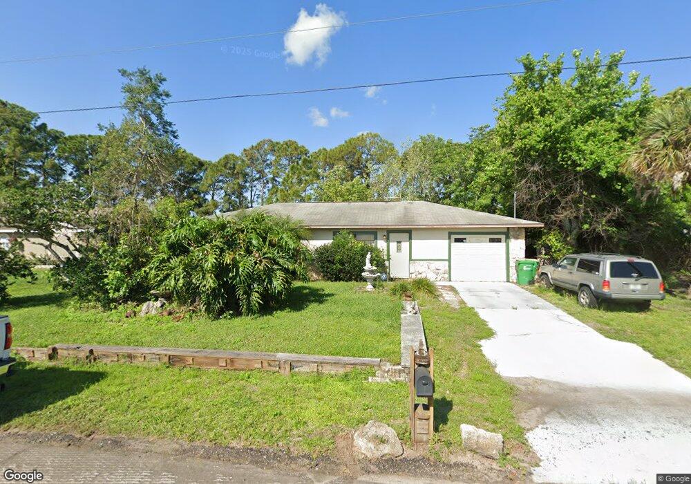
This home is located at 6980 Marvin Ave, Cocoa, FL 32927 and is currently estimated at $250,550, approximately $229 per square foot. 6980 Marvin Ave is a home located in Brevard County with nearby schools including Enterprise Elementary School, Space Coast Junior/Senior High School, and East Atlantic Prep of Brevard County.
Ownership History
Date
Name
Owned For
Owner Type
Purchase Details
Closed on
Sep 26, 2013
Sold by
Mcdonald James Louis and Smith Donna C
Bought by
Mcdonald James Louis
Current Estimated Value
Purchase Details
Closed on
Mar 10, 2009
Sold by
Mcdonald James Louis
Bought by
Mcdonald James Louis and Smith Donna C
Purchase Details
Closed on
Jan 20, 2004
Sold by
Mcdonald James Louis and Mcdonald Margaret Susan
Bought by
Mcdonald James Louis
Create a Home Valuation Report for This Property
The Home Valuation Report is an in-depth analysis detailing your home's value as well as a comparison with similar homes in the area
Home Values in the Area
Average Home Value in this Area
Purchase History
| Date | Buyer | Sale Price | Title Company |
|---|---|---|---|
| Mcdonald James Louis | -- | Attorney | |
| Mcdonald James Louis | -- | None Available | |
| Mcdonald James Louis | -- | -- |
Source: Public Records
Tax History
| Year | Tax Paid | Tax Assessment Tax Assessment Total Assessment is a certain percentage of the fair market value that is determined by local assessors to be the total taxable value of land and additions on the property. | Land | Improvement |
|---|---|---|---|---|
| 2025 | $1,596 | $127,890 | -- | -- |
| 2024 | $1,561 | $124,290 | -- | -- |
| 2023 | $1,561 | $120,670 | $0 | $0 |
| 2022 | $1,452 | $117,160 | $0 | $0 |
| 2021 | $1,465 | $113,750 | $0 | $0 |
| 2020 | $1,430 | $112,180 | $0 | $0 |
| 2019 | $1,370 | $109,660 | $0 | $0 |
| 2018 | $1,367 | $107,620 | $0 | $0 |
| 2017 | $2,029 | $108,920 | $24,000 | $84,920 |
| 2016 | $943 | $76,220 | $18,000 | $58,220 |
| 2015 | $1,067 | $66,280 | $15,000 | $51,280 |
| 2014 | $993 | $62,720 | $11,000 | $51,720 |
Source: Public Records
Map
Nearby Homes
- 5680 Brandon St
- TBD Freeport Rd
- 5555 Brandon St
- 7200 Oakwood Ave
- 7065 Hundred Acre Dr
- 6665 Addie Ave
- 7230 Venus Ave
- 6990 Bryant Rd
- 6581 Bancroft Ave
- 7368 Crepe Myrtle Ct
- 6105 Banyan St
- 6574 Bamboo Ave
- 6615 Dock Ave
- 6815 Bryant Rd
- 7419 Hackberry Rd
- 6135 Allmont St
- 7429 Hackberry Rd
- 6760 Cairo Rd
- 6545 Addie Ave
- 7635 Fringe Place
- 6970 Marvin Ave
- 6960 Marvin Ave
- 6960 Marvin Ave Unit 7
- 7000 Marvin Ave
- 5710 Hemsing St
- 7005 Marvin Ave
- 6965 Marvin Ave
- 6950 Marvin Ave
- 7010 Marvin Ave
- 6955 Marvin Ave
- 5700 Hemsing St
- 7020 Marvin Ave
- 6940 Marvin Ave
- 6945 Marvin Ave
- 7000 Amesbury Ave
- 5690 Hemsing St
- 5695 Graham St
- 5700 Brandon St
- 7030 Marvin Ave
- 7025 Marvin Ave
Your Personal Tour Guide
Ask me questions while you tour the home.