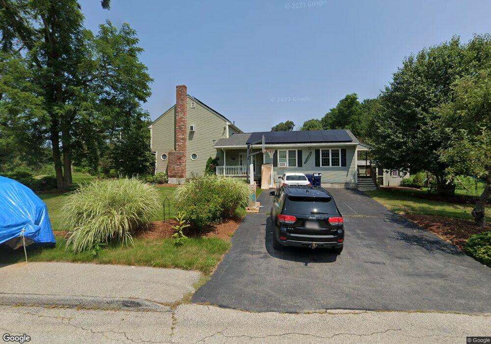
7 Barnett Rd Sutton, MA 01590
Estimated Value: $706,360 - $883,000
4
Beds
4
Baths
2,742
Sq Ft
$283/Sq Ft
Est. Value
About This Home
This home is located at 7 Barnett Rd, Sutton, MA 01590 and is currently estimated at $775,340, approximately $282 per square foot. 7 Barnett Rd is a home located in Worcester County with nearby schools including Sutton Elementary School, Sutton Middle School, and Sutton High School.
Create a Home Valuation Report for This Property
The Home Valuation Report is an in-depth analysis detailing your home's value as well as a comparison with similar homes in the area
Home Values in the Area
Average Home Value in this Area
Tax History
| Year | Tax Paid | Tax Assessment Tax Assessment Total Assessment is a certain percentage of the fair market value that is determined by local assessors to be the total taxable value of land and additions on the property. | Land | Improvement |
|---|---|---|---|---|
| 2025 | $7,878 | $655,400 | $152,200 | $503,200 |
| 2024 | $7,675 | $605,300 | $145,600 | $459,700 |
| 2023 | $7,353 | $530,900 | $131,500 | $399,400 |
| 2022 | $7,122 | $469,200 | $105,300 | $363,900 |
| 2021 | $6,763 | $422,700 | $105,300 | $317,400 |
| 2020 | $6,704 | $422,700 | $105,300 | $317,400 |
| 2019 | $6,454 | $390,700 | $101,500 | $289,200 |
| 2018 | $5,938 | $358,800 | $86,200 | $272,600 |
| 2017 | $5,851 | $354,600 | $75,400 | $279,200 |
| 2016 | $5,748 | $344,600 | $75,400 | $269,200 |
| 2015 | $5,494 | $329,400 | $75,400 | $254,000 |
| 2014 | $4,843 | $286,900 | $73,200 | $213,700 |
Source: Public Records
Map
Nearby Homes
- 8 Virginia Ave
- 28 Johnson Rd
- 923 Main St
- 16 Hough Rd
- 201 Prescott Rd
- 2 D St
- 14 C St
- 20 Wunschel Dr
- 578 Carpenter Rd
- 33 Nautical Way Unit 107
- 36 Compass Point Dr Unit 36
- 37 Bayliss Way
- 22 Bayliss Way
- 198 Uxbridge Rd
- 51 Lincoln Rd
- 1 Spring St
- 81 Rebecca Rd
- 711 Samuel Dr
- 86 Kingsnorth St
- 192 Rebecca Rd
Your Personal Tour Guide
Ask me questions while you tour the home.