Estimated Value: $534,079 - $611,000
3
Beds
2
Baths
1,646
Sq Ft
$344/Sq Ft
Est. Value
About This Home
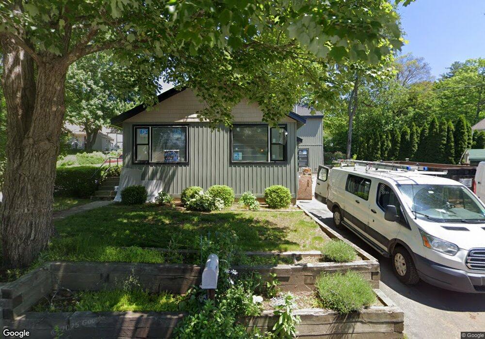
This home is located at 7 Coles Grove Rd, Derry, NH 03038 and is currently estimated at $565,770, approximately $343 per square foot. 7 Coles Grove Rd is a home located in Rockingham County with nearby schools including Derry Village School, West Running Brook Middle School, and Pinkerton Academy.
Ownership History
Date
Name
Owned For
Owner Type
Purchase Details
Closed on
Oct 20, 2023
Sold by
Whiter Matthew W and Whiter Linda
Bought by
7 Coles Grove Rt and Kilduff
Current Estimated Value
Purchase Details
Closed on
Jul 9, 2012
Sold by
Whiter William C and Whiter Margaret E
Bought by
Whiter Matthew W and Whiter Linda
Create a Home Valuation Report for This Property
The Home Valuation Report is an in-depth analysis detailing your home's value as well as a comparison with similar homes in the area
Home Values in the Area
Average Home Value in this Area
Purchase History
| Date | Buyer | Sale Price | Title Company |
|---|---|---|---|
| 7 Coles Grove Rt | $480,000 | None Available | |
| 7 Coles Grove Rt | $480,000 | None Available | |
| Whiter Matthew W | $200,000 | -- | |
| Whiter Matthew W | $200,000 | -- |
Source: Public Records
Mortgage History
| Date | Status | Borrower | Loan Amount |
|---|---|---|---|
| Closed | Whiter Matthew W | $0 |
Source: Public Records
Tax History Compared to Growth
Tax History
| Year | Tax Paid | Tax Assessment Tax Assessment Total Assessment is a certain percentage of the fair market value that is determined by local assessors to be the total taxable value of land and additions on the property. | Land | Improvement |
|---|---|---|---|---|
| 2024 | $8,898 | $476,100 | $234,500 | $241,600 |
| 2023 | $8,524 | $412,200 | $199,300 | $212,900 |
| 2022 | $7,848 | $412,200 | $199,300 | $212,900 |
| 2021 | $7,609 | $307,300 | $148,800 | $158,500 |
| 2020 | $7,480 | $307,300 | $148,800 | $158,500 |
| 2019 | $6,603 | $252,800 | $115,300 | $137,500 |
| 2018 | $6,580 | $252,800 | $115,300 | $137,500 |
| 2017 | $5,994 | $207,700 | $91,200 | $116,500 |
| 2016 | $5,620 | $207,700 | $91,200 | $116,500 |
| 2015 | $5,662 | $193,700 | $91,200 | $102,500 |
| 2014 | $5,699 | $193,700 | $91,200 | $102,500 |
| 2013 | $5,577 | $177,100 | $82,000 | $95,100 |
Source: Public Records
Map
Nearby Homes
- 51 Chester Rd
- 3 Pembroke Dr Unit 20
- 2 Pembroke Dr Unit 21
- 2 Silvestri Cir Unit 6
- 1 Barkland Dr
- 4C Pine Isle Dr Unit B
- 12 Orchard Dr
- 7 Chester Rd Unit 211
- 7 Chester Rd Unit 212
- 12 Beaver Lake Rd
- 5 Nesmith St
- 7 Dexter St
- 5 Tsienneto Rd Unit 10
- 5 Tsienneto Rd Unit 127
- 5 Tsienneto Rd Unit 170
- 5 Tsienneto Rd Unit 41
- 5 Tsienneto Rd Unit 151
- 12 Perley Rd Unit 21
- 80 Bypass 28
- 27 Mount Pleasant St Unit R
- 2 Beaver Lake Ave
- 1 Beaver Lake Ave
- 10 Coles Grove Rd
- 12 Coles Grove Rd
- 8 Coles Grove Rd
- 8 Coles Grove Rd Unit RR 490
- 3 Zames Rd
- 9 Coles Grove Rd
- 16 Coles Grove Rd
- 3 Zames St
- 6 Coles Grove Rd Unit R
- 6 Coles Grove Rd Unit L
- 1 Zames Rd
- 4 Zames Rd
- 3 Beaver Lake Ave
- 4 Beaver Lake Ave
- 4 Coles Grove Rd
- 6 Beaver Lake Ave
- 11 Coles Grove Rd
- 20 Coles Grove Rd