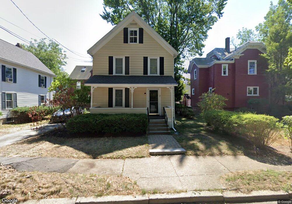
7 Henshaw Place West Newton, MA 02465
West Newton NeighborhoodEstimated Value: $893,000 - $1,071,000
3
Beds
2
Baths
1,516
Sq Ft
$654/Sq Ft
Est. Value
About This Home
This home is located at 7 Henshaw Place, West Newton, MA 02465 and is currently estimated at $991,143, approximately $653 per square foot. 7 Henshaw Place is a home located in Middlesex County with nearby schools including Franklin Elementary School, C.C. Burr, and F.A. Day Middle School.
Ownership History
Date
Name
Owned For
Owner Type
Purchase Details
Closed on
Aug 16, 2004
Sold by
Pirello Candace A and Mcdonough Matthew G
Bought by
Mcdonough Candace Pirello and Mcdonough Matthew G
Current Estimated Value
Purchase Details
Closed on
Jan 20, 2004
Sold by
Sin Suet Yim and Leung Wing King
Bought by
Pirello Candace A and Mcdonough Matthew G
Purchase Details
Closed on
Sep 30, 1993
Sold by
Paret Alan and Paret Helen
Bought by
Sin Suet Yim and Leung Wing King
Create a Home Valuation Report for This Property
The Home Valuation Report is an in-depth analysis detailing your home's value as well as a comparison with similar homes in the area
Home Values in the Area
Average Home Value in this Area
Purchase History
| Date | Buyer | Sale Price | Title Company |
|---|---|---|---|
| Mcdonough Candace Pirello | -- | -- | |
| Pirello Candace A | $420,000 | -- | |
| Sin Suet Yim | $181,000 | -- |
Source: Public Records
Mortgage History
| Date | Status | Borrower | Loan Amount |
|---|---|---|---|
| Open | Sin Suet Yim | $330,000 | |
| Closed | Sin Suet Yim | $340,000 | |
| Closed | Sin Suet Yim | $340,000 |
Source: Public Records
Tax History Compared to Growth
Tax History
| Year | Tax Paid | Tax Assessment Tax Assessment Total Assessment is a certain percentage of the fair market value that is determined by local assessors to be the total taxable value of land and additions on the property. | Land | Improvement |
|---|---|---|---|---|
| 2025 | $6,953 | $709,500 | $704,500 | $5,000 |
| 2024 | $6,723 | $688,800 | $684,000 | $4,800 |
| 2023 | $6,335 | $622,300 | $508,900 | $113,400 |
| 2022 | $6,062 | $576,200 | $471,200 | $105,000 |
| 2021 | $5,849 | $543,600 | $444,500 | $99,100 |
| 2020 | $5,675 | $543,600 | $444,500 | $99,100 |
| 2019 | $5,516 | $527,800 | $431,600 | $96,200 |
| 2018 | $5,236 | $483,900 | $393,000 | $90,900 |
| 2017 | $5,076 | $456,500 | $370,800 | $85,700 |
| 2016 | $4,855 | $426,600 | $346,500 | $80,100 |
| 2015 | $4,629 | $398,700 | $323,800 | $74,900 |
Source: Public Records
Map
Nearby Homes
- 41 Kilburn Rd
- 371 Cherry St
- 287 Cherry St Unit 2
- 2 Elm St Unit 6
- 2 Elm St Unit 8
- 106 River St Unit 18
- 106 River St Unit 2
- 106 River St Unit 14
- 429 Cherry St Unit 11
- 66 Webster St
- 53-55 N Gate Park
- 44 Westland Ave
- 56 Dearborn St
- 79 Chestnut St Unit 2
- 42 Evergreen Cir
- 27 Cross St Unit 27
- 12 Inis Cir
- 212 River St Unit 2
- 318 Austin St Unit A
- 90 Auburndale Ave
- 33 Henshaw St
- 11 Jepsen Ct Unit 2
- 11 Jepsen Ct
- 11 Henshaw Place
- 8 Jepsen Ct
- 4 Henshaw Place
- 12 Henshaw Place
- 39 Henshaw St
- 39 Henshaw St Unit 2
- 7 Henshaw Terrace
- 36 Henshaw St Unit 3
- 36 Henshaw St Unit 2
- 36 Henshaw St Unit 1
- 36 Henshaw St Unit 2,36
- 38 Henshaw St
- 38 Henshaw St Unit 1
- 38 Lindbergh Ave
- 13 Henshaw Terrace Unit 15
- 13 Henshaw Terrace Unit 13
- 42 Henshaw St