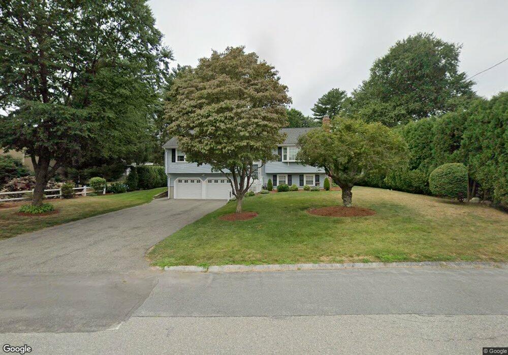
7 Larson Rd Milford, MA 01757
Estimated Value: $597,926 - $670,000
3
Beds
3
Baths
1,950
Sq Ft
$328/Sq Ft
Est. Value
About This Home
This home is located at 7 Larson Rd, Milford, MA 01757 and is currently estimated at $639,232, approximately $327 per square foot. 7 Larson Rd is a home located in Worcester County with nearby schools including Milford High School and Bethany Christian Academy.
Ownership History
Date
Name
Owned For
Owner Type
Purchase Details
Closed on
Apr 5, 2005
Sold by
Ruggiero Gloria M
Bought by
Ruggiero Joseph L and Bollan Karen M
Current Estimated Value
Purchase Details
Closed on
Dec 16, 1996
Sold by
Laporte Keith B and Laporte Suzanne
Bought by
Ruggiero Joseph and Ruggiero Gloria
Home Financials for this Owner
Home Financials are based on the most recent Mortgage that was taken out on this home.
Original Mortgage
$67,000
Interest Rate
7.75%
Mortgage Type
Purchase Money Mortgage
Purchase Details
Closed on
Jan 5, 1994
Sold by
Winer Michael K
Bought by
Laporte Keith B and Kida Suzanne
Home Financials for this Owner
Home Financials are based on the most recent Mortgage that was taken out on this home.
Original Mortgage
$125,100
Interest Rate
7.23%
Mortgage Type
Purchase Money Mortgage
Create a Home Valuation Report for This Property
The Home Valuation Report is an in-depth analysis detailing your home's value as well as a comparison with similar homes in the area
Home Values in the Area
Average Home Value in this Area
Purchase History
| Date | Buyer | Sale Price | Title Company |
|---|---|---|---|
| Ruggiero Joseph L | -- | -- | |
| Ruggiero Joseph | $168,500 | -- | |
| Laporte Keith B | $158,400 | -- |
Source: Public Records
Mortgage History
| Date | Status | Borrower | Loan Amount |
|---|---|---|---|
| Previous Owner | Ruggiero Joseph | $67,000 | |
| Previous Owner | Laporte Keith B | $125,100 |
Source: Public Records
Tax History
| Year | Tax Paid | Tax Assessment Tax Assessment Total Assessment is a certain percentage of the fair market value that is determined by local assessors to be the total taxable value of land and additions on the property. | Land | Improvement |
|---|---|---|---|---|
| 2025 | $6,940 | $542,200 | $191,700 | $350,500 |
| 2024 | $6,775 | $509,800 | $184,100 | $325,700 |
| 2023 | $6,404 | $443,200 | $159,100 | $284,100 |
| 2022 | $6,124 | $397,900 | $145,700 | $252,200 |
| 2021 | $6,092 | $381,200 | $145,700 | $235,500 |
| 2020 | $5,988 | $375,200 | $145,700 | $229,500 |
| 2019 | $5,663 | $342,400 | $145,700 | $196,700 |
| 2018 | $5,453 | $329,300 | $141,900 | $187,400 |
| 2017 | $5,285 | $314,800 | $141,900 | $172,900 |
| 2016 | $5,090 | $296,300 | $141,900 | $154,400 |
| 2015 | $4,930 | $280,900 | $134,200 | $146,700 |
Source: Public Records
Map
Nearby Homes
- 130 Purchase St
- 37 Godfrey Ln
- 4 Kennedy Ln Unit 47
- 9 Packard Rd
- 8 Shadowbrook Ln Unit 39
- 8 Shadowbrook Ln Unit 41
- 9 Shadowbrook Ln Unit 29
- 21 Shadowbrook Ln Unit 13
- 14 Shadowbrook Ln Unit 30
- 85 Congress St
- 20 Cornell Dr
- 38 Walker Avenue Extension
- 10 Yale Dr
- 8 Bandy Ln
- 9 Robin Rd
- 44 Silver Hill Rd
- 3 Fordham Dr
- 3 Columbus Ave
- 9 Granite St
- 14 C Country Club Ln
Your Personal Tour Guide
Ask me questions while you tour the home.