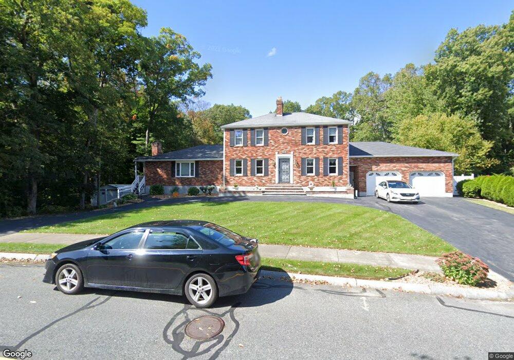
7 Rayburn Dr Millbury, MA 01527
Estimated Value: $608,000 - $783,000
4
Beds
3
Baths
2,508
Sq Ft
$284/Sq Ft
Est. Value
About This Home
This home is located at 7 Rayburn Dr, Millbury, MA 01527 and is currently estimated at $713,095, approximately $284 per square foot. 7 Rayburn Dr is a home located in Worcester County with nearby schools including Elmwood Street Elementary School, Raymond E. Shaw Elementary School, and Millbury Junior/Senior High School.
Create a Home Valuation Report for This Property
The Home Valuation Report is an in-depth analysis detailing your home's value as well as a comparison with similar homes in the area
Home Values in the Area
Average Home Value in this Area
Tax History Compared to Growth
Tax History
| Year | Tax Paid | Tax Assessment Tax Assessment Total Assessment is a certain percentage of the fair market value that is determined by local assessors to be the total taxable value of land and additions on the property. | Land | Improvement |
|---|---|---|---|---|
| 2025 | $9,449 | $705,700 | $152,300 | $553,400 |
| 2024 | $8,683 | $656,300 | $140,900 | $515,400 |
| 2023 | $7,851 | $543,300 | $98,500 | $444,800 |
| 2022 | $6,914 | $460,900 | $94,600 | $366,300 |
| 2021 | $6,829 | $442,600 | $94,600 | $348,000 |
| 2020 | $6,692 | $436,500 | $94,600 | $341,900 |
| 2019 | $12,418 | $408,000 | $82,400 | $325,600 |
| 2018 | $0 | $407,200 | $96,800 | $310,400 |
| 2017 | $6,240 | $379,800 | $96,800 | $283,000 |
| 2016 | $6,166 | $374,600 | $96,800 | $277,800 |
| 2015 | $6,067 | $368,600 | $103,200 | $265,400 |
| 2014 | $5,588 | $326,800 | $99,400 | $227,400 |
Source: Public Records
Map
Nearby Homes
- 15 Rayburn Dr
- 123 Riverlin St
- 64 Millbury Ave
- 20 Woodridge Rd
- Lot 1 Cooper Rd
- 8 Autumn Gate Cir
- 17 Atwood Ave
- 16 Jackie Dr
- 19 Rice Rd
- 90 Macarthur Dr
- 4 Thomas Hill Rd
- 40 River St
- 10 Leslie Ln
- 16 Elm Ct
- 255 Riverlin St
- 52 Clearview Terrace Unit 39
- 73 Potter Hill Rd
- 2 Jessica j Dr
- 19 Cortland Way
- 12 Alstead Path