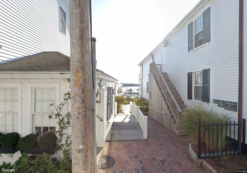
7 S Water St Edgartown, MA 02539
Edgartown Neighborhood
1
Bed
1
Bath
284
Sq Ft
1.3
Acres
About This Home
This home is located at 7 S Water St, Edgartown, MA 02539. 7 S Water St is a home located in Dukes County with nearby schools including Edgartown Elementary School and Martha's Vineyard Regional High School.
Ownership History
Date
Name
Owned For
Owner Type
Purchase Details
Closed on
Oct 22, 2021
Sold by
Murphy Joseph G and Murphy Marta A
Bought by
Mercier Margaret H
Purchase Details
Closed on
Jul 13, 2017
Sold by
Nancy Young T 2007
Bought by
Young 3Rd Arthur W
Purchase Details
Closed on
Jan 28, 2013
Sold by
Webster Raey W
Bought by
Webster R W Sondgrass
Purchase Details
Closed on
Dec 14, 2012
Sold by
Harborside Inn Condo T
Bought by
Reid Anita
Purchase Details
Closed on
Oct 22, 2012
Sold by
Coverdale Carolyn A
Bought by
Harborside Inn Condo T
Create a Home Valuation Report for This Property
The Home Valuation Report is an in-depth analysis detailing your home's value as well as a comparison with similar homes in the area
Home Values in the Area
Average Home Value in this Area
Purchase History
| Date | Buyer | Sale Price | Title Company |
|---|---|---|---|
| Mercier Margaret H | $170,000 | None Available | |
| Young 3Rd Arthur W | -- | -- | |
| Webster R W Sondgrass | -- | -- | |
| Webster R W Sondgrass | -- | -- | |
| Reid Anita | -- | -- | |
| Oliveros Armando | -- | -- | |
| Delgado Odalys | -- | -- | |
| Alston Alberta | $125 | -- | |
| Giunta F S | -- | -- | |
| Harborside Inn Condo T | -- | -- | |
| Harborside Inn Condo T | -- | -- |
Source: Public Records
Tax History Compared to Growth
Tax History
| Year | Tax Paid | Tax Assessment Tax Assessment Total Assessment is a certain percentage of the fair market value that is determined by local assessors to be the total taxable value of land and additions on the property. | Land | Improvement |
|---|---|---|---|---|
| 2025 | $67,961 | $25,645,800 | $9,870,000 | $15,775,800 |
| 2024 | $65,397 | $25,645,800 | $9,870,000 | $15,775,800 |
| 2023 | $64,627 | $25,645,800 | $9,870,000 | $15,775,800 |
| 2022 | $49,037 | $16,183,700 | $9,870,000 | $6,313,700 |
| 2021 | $53,083 | $16,183,700 | $9,870,000 | $6,313,700 |
| 2020 | $54,215 | $16,183,700 | $9,870,000 | $6,313,700 |
| 2019 | $62,631 | $16,183,700 | $9,870,000 | $6,313,700 |
| 2018 | $62,631 | $16,183,700 | $9,870,000 | $6,313,700 |
| 2017 | $57,165 | $16,102,800 | $9,870,000 | $6,232,800 |
| 2016 | $58,292 | $16,102,800 | $9,870,000 | $6,232,800 |
| 2015 | $55,877 | $16,102,800 | $9,870,000 | $6,232,800 |
Source: Public Records
Map
Nearby Homes
- 52 S Summer St
- 25 Dock St
- 62 N Summer St
- 68 N Water St
- 69 School St
- 8 High St
- 11 Norton St
- 43 Peases Point Way S
- 10 Peases Point Way N
- 10 Tilton Way
- 43 Cottage St
- 117 N Water St
- 54 Fuller St
- 48 W Tisbury Rd
- 48 Edgartown - West Tisbury Rd
- 23 Pinehurst Rd
- 26 Curtis Ln
- 76 Norton Orchard Rd
- 7 Clark Dr
- 2 Orchard Ln
- 3 S Water St Unit 6
- 3 S Water St Unit WK29
- 3 S Water St Unit 310,wk29
- 3 S Water St Unit 429/432 w30
- 3 S Water St
- 3 S Water St Unit 206
- 3 S Water St Unit 205
- 20 Main St
- 8 Main St
- 22 S Water St
- 10 Main St
- 29 S Water St
- 1 S Water St
- 2 Main St
- 4-6, 8-10 Main St
- 24 Main St
- 6 S Water St
- 24 S Water St
- 314 Edgartown Vh Rd
- 19 Main St