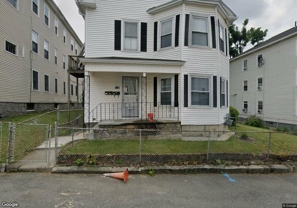
70 Seymour St Worcester, MA 01610
Vernon Hill NeighborhoodEstimated Value: $555,968 - $680,000
6
Beds
3
Baths
3,198
Sq Ft
$185/Sq Ft
Est. Value
About This Home
This apartment is in a two story recently renovated property with just 2 units, each with its own private entrance. Convenience of off street parking included and laundry in the unit. Centrally located in Worcester with hospitals, schools, churches, shopping, restaurants, entertainment, parks, and highways all close by.
Ownership History
Date
Name
Owned For
Owner Type
Purchase Details
Closed on
Nov 24, 2020
Sold by
Mary T Ogrady 2008 Irt
Bought by
Mary T Ogrady 2008 Irt
Current Estimated Value
Purchase Details
Closed on
Jul 10, 2008
Sold by
Ogrady Mary T
Bought by
Mary T Ogrady Irt and Ogrady Mary T
Create a Home Valuation Report for This Property
The Home Valuation Report is an in-depth analysis detailing your home's value as well as a comparison with similar homes in the area
Home Values in the Area
Average Home Value in this Area
Purchase History
| Date | Buyer | Sale Price | Title Company |
|---|---|---|---|
| Mary T Ogrady 2008 Irt | -- | None Available | |
| Mary T Ogrady Irt | -- | -- |
Source: Public Records
Property History
| Date | Event | Price | List to Sale | Price per Sq Ft |
|---|---|---|---|---|
| 02/10/2025 02/10/25 | Off Market | $2,650 | -- | -- |
| 01/20/2025 01/20/25 | For Rent | -- | -- | -- |
| 10/12/2024 10/12/24 | For Rent | $2,650 | 0.0% | -- |
| 10/08/2024 10/08/24 | Off Market | $2,650 | -- | -- |
Tax History Compared to Growth
Tax History
| Year | Tax Paid | Tax Assessment Tax Assessment Total Assessment is a certain percentage of the fair market value that is determined by local assessors to be the total taxable value of land and additions on the property. | Land | Improvement |
|---|---|---|---|---|
| 2025 | $6,438 | $488,100 | $98,500 | $389,600 |
| 2024 | $6,130 | $445,800 | $98,500 | $347,300 |
| 2023 | $5,739 | $400,200 | $85,600 | $314,600 |
| 2022 | $5,302 | $348,600 | $68,500 | $280,100 |
| 2021 | $4,848 | $297,800 | $54,800 | $243,000 |
| 2020 | $4,549 | $267,600 | $54,400 | $213,200 |
| 2019 | $4,552 | $252,900 | $47,600 | $205,300 |
| 2018 | $4,457 | $235,700 | $47,600 | $188,100 |
| 2017 | $4,251 | $221,200 | $47,600 | $173,600 |
| 2016 | $4,219 | $204,700 | $33,900 | $170,800 |
| 2015 | $4,108 | $204,700 | $33,900 | $170,800 |
| 2014 | $4,000 | $204,700 | $33,900 | $170,800 |
Source: Public Records
Map
Nearby Homes
- 70 Seymour St Unit 70 Seymour Street Un
- 70 Seymour St Unit 1
- 70 Seymour St Unit 2
- 72 Seymour St Unit 2
- 72 Seymour St Unit 1
- 72 Seymour St
- 66 Seymour St
- 17 Alpine St
- 5 Sterling St
- 5 Sterling St Unit 2
- 5 Sterling St Unit 3
- 74 Seymour St
- 19 Alpine St
- 69 Seymour St
- 73 Seymour St
- 73 Seymour St Unit 2
- 73 Seymour St Unit 1
- 73 Seymour St Unit 3
- 63 Seymour St
- 76 Seymour St