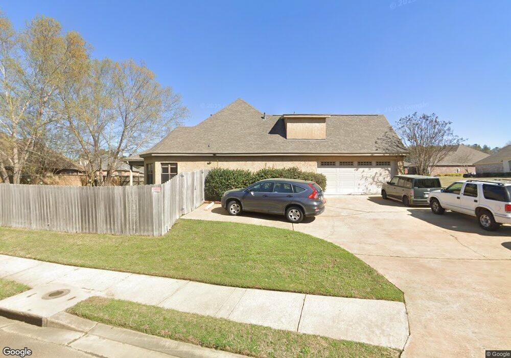
701 Brookwood Cir Brandon, MS 39042
Estimated Value: $391,000 - $404,000
4
Beds
4
Baths
2,414
Sq Ft
$165/Sq Ft
Est. Value
About This Home
This home is located at 701 Brookwood Cir, Brandon, MS 39042 and is currently estimated at $399,080, approximately $165 per square foot. 701 Brookwood Cir is a home located in Rankin County with nearby schools including Rouse Elementary School, Brandon Elementary School, and Stonebridge Elementary School.
Ownership History
Date
Name
Owned For
Owner Type
Purchase Details
Closed on
Jan 4, 2007
Sold by
Lakepointe Properties Inc
Bought by
Gillis Michael B and Ferrell Jamie L
Current Estimated Value
Home Financials for this Owner
Home Financials are based on the most recent Mortgage that was taken out on this home.
Original Mortgage
$225,500
Outstanding Balance
$133,555
Interest Rate
6.05%
Estimated Equity
$265,525
Purchase Details
Closed on
Nov 18, 2005
Sold by
Thornton Construction Co Inc A Missi
Bought by
Lakepointe Properties Inc and A Mississip ,
Create a Home Valuation Report for This Property
The Home Valuation Report is an in-depth analysis detailing your home's value as well as a comparison with similar homes in the area
Home Values in the Area
Average Home Value in this Area
Purchase History
| Date | Buyer | Sale Price | Title Company |
|---|---|---|---|
| Gillis Michael B | -- | M-Tec, Miller Title & Escrow | |
| Lakepointe Properties Inc | -- | M-Tec, Miller Title & Escrow |
Source: Public Records
Mortgage History
| Date | Status | Borrower | Loan Amount |
|---|---|---|---|
| Open | Gillis Michael B | $225,500 |
Source: Public Records
Tax History Compared to Growth
Tax History
| Year | Tax Paid | Tax Assessment Tax Assessment Total Assessment is a certain percentage of the fair market value that is determined by local assessors to be the total taxable value of land and additions on the property. | Land | Improvement |
|---|---|---|---|---|
| 2024 | $3,453 | $28,752 | $0 | $0 |
| 2023 | $3,013 | $28,462 | $0 | $0 |
| 2022 | $2,978 | $28,462 | $0 | $0 |
| 2021 | $2,978 | $28,462 | $0 | $0 |
| 2020 | $2,978 | $28,462 | $0 | $0 |
| 2019 | $2,828 | $25,207 | $0 | $0 |
| 2018 | $2,785 | $25,207 | $0 | $0 |
| 2017 | $2,785 | $25,207 | $0 | $0 |
| 2016 | $2,523 | $24,641 | $0 | $0 |
| 2015 | $2,523 | $24,641 | $0 | $0 |
| 2014 | $2,774 | $24,641 | $0 | $0 |
| 2013 | -- | $24,641 | $0 | $0 |
Source: Public Records
Map
Nearby Homes
- 705 Brookwood Cir
- 444 Edgewood Crossing
- 2008 Brookstone Place
- 104 Meadowcreek Dr
- 2701 Highway 80 E
- 230 Eastwood Dr
- 0 Shiloh Rd Unit 4106044
- 148 W Legacy Dr
- 100 City Limits Rd
- 0 Trickhambridge Rd
- 1518 Arcadia Ln
- 103 Pimlico Dr
- 200 Evelyn Ln
- 202 Evelyn Ln
- 526 E Jasper St
- 1 E Government St
- 1106 Pointe Cove
- 103 Copperridge Dr
- 117 Busick Well Rd
- 313 Busick Well Rd
- 500 Edgewood Ln
- 4021 Brookwood Cir
- 702 Brookwood Cir
- 704 Brookwood Cir
- 502 Edgewood Ln
- 707 Brookwood Cir
- 706 Brookwood Cir
- 432 Edgewood Crossing
- 504 Edgewood Ln
- 421 Edgewood Crossing
- 728 Brookwood Cir
- 730 Brookwood Cir
- 726 Brookwood Cir
- 709 Brookwood Cir
- 434 Edgewood Crossing
- 506 Edgewood Ln Unit 176
- 712 Brookwood Cir
- 503 Edgewood Ln
- 506 Edgewood Ln
- 422 Edgewood Crossing