Estimated Value: $270,000 - $294,000
3
Beds
2
Baths
1,240
Sq Ft
$226/Sq Ft
Est. Value
About This Home
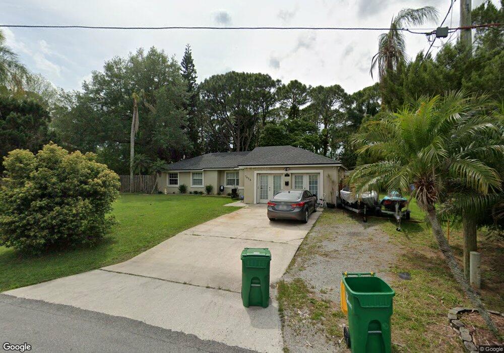
This home is located at 7016 Holly Ave, Cocoa, FL 32927 and is currently estimated at $280,606, approximately $226 per square foot. 7016 Holly Ave is a home located in Brevard County with nearby schools including Atlantis Elementary School, Space Coast Junior/Senior High School, and Sculptor Charter School.
Ownership History
Date
Name
Owned For
Owner Type
Purchase Details
Closed on
Feb 10, 2005
Sold by
Tindall John W and Tindall Susan G
Bought by
Tindall Susan G
Current Estimated Value
Home Financials for this Owner
Home Financials are based on the most recent Mortgage that was taken out on this home.
Original Mortgage
$75,000
Interest Rate
5.61%
Create a Home Valuation Report for This Property
The Home Valuation Report is an in-depth analysis detailing your home's value as well as a comparison with similar homes in the area
Home Values in the Area
Average Home Value in this Area
Purchase History
| Date | Buyer | Sale Price | Title Company |
|---|---|---|---|
| Tindall Susan G | -- | American Title Inc |
Source: Public Records
Mortgage History
| Date | Status | Borrower | Loan Amount |
|---|---|---|---|
| Closed | Tindall Susan G | $75,000 |
Source: Public Records
Tax History Compared to Growth
Tax History
| Year | Tax Paid | Tax Assessment Tax Assessment Total Assessment is a certain percentage of the fair market value that is determined by local assessors to be the total taxable value of land and additions on the property. | Land | Improvement |
|---|---|---|---|---|
| 2025 | $5,059 | $240,550 | -- | -- |
| 2024 | $2,380 | $244,980 | -- | -- |
| 2023 | $2,380 | $72,740 | $0 | $0 |
| 2022 | $2,350 | $70,630 | $0 | $0 |
| 2021 | $869 | $68,580 | $0 | $0 |
| 2020 | $820 | $67,640 | $0 | $0 |
| 2019 | $764 | $66,120 | $0 | $0 |
| 2018 | $762 | $64,890 | $0 | $0 |
| 2017 | $758 | $63,560 | $0 | $0 |
| 2016 | $760 | $62,260 | $18,000 | $44,260 |
| 2015 | $762 | $61,830 | $15,000 | $46,830 |
| 2014 | $878 | $61,340 | $11,000 | $50,340 |
Source: Public Records
Map
Nearby Homes
- 5155 Mayflower St
- 5090 Market St
- 7065 Hundred Acre Dr
- 7155 Export Ave
- 7230 Venus Ave
- 6840 Anecia Ave
- 5170 Everett St
- 6735 Grissom Pkwy
- 7635 Fringe Place
- 7275 Durban Ave
- 6615 Dock Ave
- 7545 Fringe Place
- 7302 Bumelia Dr
- 5149 Arlington Rd Unit 104
- 7310 Joshua Place
- 00 Unknown
- 4859 Horton St
- 6643 Emil Ave
- 6581 Bancroft Ave
- 0000 Grissom Pkwy