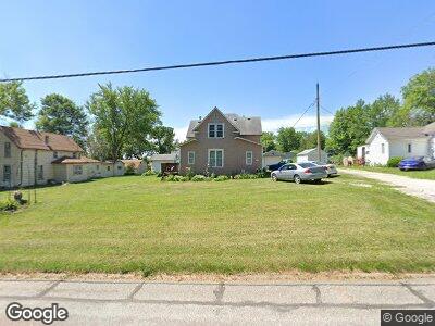
702 Station St Shelby, IA 51570
Estimated Value: $128,045 - $218,000
4
Beds
2
Baths
1,420
Sq Ft
$129/Sq Ft
Est. Value
About This Home
This home is located at 702 Station St, Shelby, IA 51570 and is currently estimated at $182,761, approximately $128 per square foot. 702 Station St is a home located in Shelby County with nearby schools including AHST Elementary School and AHST High School.
Ownership History
Date
Name
Owned For
Owner Type
Purchase Details
Closed on
Dec 19, 2005
Sold by
Lodes Scott A and Lodes Stephanie
Bought by
Rivera Todd P and Rivera Tammy M
Current Estimated Value
Home Financials for this Owner
Home Financials are based on the most recent Mortgage that was taken out on this home.
Original Mortgage
$64,800
Interest Rate
7.87%
Mortgage Type
Adjustable Rate Mortgage/ARM
Create a Home Valuation Report for This Property
The Home Valuation Report is an in-depth analysis detailing your home's value as well as a comparison with similar homes in the area
Home Values in the Area
Average Home Value in this Area
Purchase History
| Date | Buyer | Sale Price | Title Company |
|---|---|---|---|
| Rivera Todd P | $802,875 | None Available |
Source: Public Records
Mortgage History
| Date | Status | Borrower | Loan Amount |
|---|---|---|---|
| Open | Rivera Todd P | $82,925 | |
| Closed | Rivera Todd P | $64,800 |
Source: Public Records
Tax History Compared to Growth
Tax History
| Year | Tax Paid | Tax Assessment Tax Assessment Total Assessment is a certain percentage of the fair market value that is determined by local assessors to be the total taxable value of land and additions on the property. | Land | Improvement |
|---|---|---|---|---|
| 2024 | $1,380 | $101,636 | $12,938 | $88,698 |
| 2023 | $1,060 | $101,636 | $12,938 | $88,698 |
| 2022 | $1,060 | $70,921 | $10,781 | $60,140 |
| 2021 | $1,034 | $70,921 | $10,781 | $60,140 |
| 2020 | $910 | $65,618 | $10,781 | $54,837 |
| 2019 | $880 | $62,732 | $0 | $0 |
| 2018 | $806 | $62,732 | $0 | $0 |
| 2017 | $806 | $62,732 | $0 | $0 |
| 2016 | $986 | $71,589 | $0 | $0 |
| 2015 | $986 | $66,920 | $0 | $0 |
| 2014 | $916 | $66,920 | $0 | $0 |
Source: Public Records
Map
Nearby Homes
- 203 Western Ave
- 505 Des Moines St
- 805 Spring St
- 506 West St
- 405 Davenport St
- 16.36 AC East St
- 113 Circle Dr
- 521 Patton Loop
- 513 Patton Loop
- 424 Patton Loop
- 608 Patton Loop
- 500 Patton Loop
- 509 Patton Loop
- 505 Patton Loop
- 516 Patton
- 211 W Baker St
- 409 N Elm St
- 610 N Chestnut St
- 805 N Chestnut St
- 606 N Chestnut St